In Wile E Canyon near the southern apex of the loop. Photos and trail review by Bruce on June 7, 2022.
Looney Tunes and Wile E Canyon
Plus What's Up Doc and Sufferin SuccotashThe Cutthroat riding area lies south of Jordanelle and Highway 32, at
the northern end of the Jordanelle Ridge riding area. Wile E Canyon is a
popular stand-alone loop ride, and has two ways of
connecting uphill to the Coyote
Loop -- Sufferin Succotash and What's Up
Doc. The
Looney Tunes trail joins two limbs of the Coyote Loop, and can be used for
a shorter version of Coyote, or as a destination trail by looping two
sections of the Coyote Loop.
Newer trails in the northern Jordanelle Ridge area -- Beep Beep, Road
Runner, Puddy Tat, and Tweety Bird -- are discussed on the north
Jordanelle Ridge trail page.
The Wile E Canyon trailhead is located 4 miles east of US 40 on SR 32. Go
through the deep rock road-cut, then pass the road to the golf course -- where
the old Cutthroat trailhead was located. (There's still an access trail there,
but no cyclist parking as of summer 2025.) One-tenth mile later, watch for a strip of
gravel parking along the fence with
room for 8 to 10 cars. An access trail takes you to the Wile E Canyon loop.
You can also ride into the area from other trailheads.
See the trailhead information at the bottom of the page.

Parking near the northeastern corner of the Wile E Canyon loop.

Looking north toward the Jordanelle Reservoir.
The riding starts at 6600 feet elevation. The top of Looney Tunes is at 7350, and the
Coyote Loop
tops out at 7600. Because this area lies on a north-facing slope, the riding season at this
elevation will be June through October.
Wile E Canyon is groomed for fat biking during the winter. It may be closed during the early
spring from the time the snow begins melting until the riding surface
is dry.
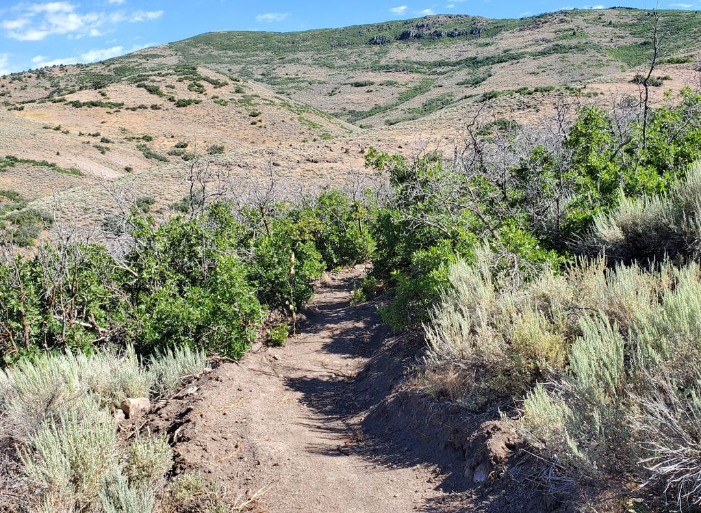
The terrain is dirt with an occasional outcrop of igneous rock. On the lower slopes, sage brush
is punctuated by groves of gambel oak. As you pedal higher in elevation,
this gives way to
maple forest, then aspens. In this area, much of your ride will be in
the shade.

Climbing up to Looney Tunes on Coyote.

Cruising through the aspen and maple forest on the eastern side of the Wile E Canyon loop.
Wile E Canyon is a lariat loop ride that starts on the Cutthroat connector trail just uphill
from the trailhead. It has a cutoff trail that can be used to bypass much
of the climbing when
doing the ride clockwise. Wile E Canyon is 3.7 miles with 400 vertical
feet of overall climbing.
It can be done in either direction, and there seems to be an equal number
of riders each way.
It's quick enough that you can do the loop twice, once each way, and decide
for yourself.
The Wile E Canyon loop has two connector trails: one goes to the Wile E
Canyon trailhead, and the other goes to the old Cutthroat access trail, Beep Beep, and the Coyote
Loop (Cutthroat Switchbacks and westbound East Riverview). If you stay downhill and westbound near Highway
32, you'll arrive at the Cutthroat connector trail 1/10th mile later. Turn left
to stay on the connector to Beep Beep and the Cutthroat Switchbacks.

Arriving at the trail fork to Wile E Canyon when coming uphill from the Cutthroat trailhead.

Traversing around the hill, heading for Wile E Canyon on a clockwise ride.
If you're a beginning rider and intend to skip the tougher climbing, go to the left at this
trail fork rather than starting uphill. You'll traverse around the hill.
When done clockwise, you'll enter the canyon heading gently downhill. You'll cross some areas
of open rock, which provides the only roughness on this ride. The rock
appears to be an igneous
breccia composed of ash and broken granite. You'll then drop through the
bottom of the canyon
and begin climbing south uphill.

Cruising into the area of open rock.

Looking downhill at a table jump on the eastern side of the loop. To hit this, you'd be riding the loop counterclockwise.
There really aren't any technical areas on the trail. The volcanic rock is a bit bumpy if you're
determined to keep your butt on the saddle. There are a couple of optional
stunts. But overall,
the trail is simply smooth XC riding.
You'll now cross the bottom of the canyon and begin climbing uphill.

There's a bit of sage and grass meadow on the eastern side of the loop.

Shady forest near the southern tip of the loop.
At mile 1.1 of the clockwise loop, keep left as you pass the Leghorn (as in, Foghorn Leghorn)
bypass trail.
As the loop hits its apex on the southern end and heads back downhill, the Sufferin Succotash
trail forks to your left uphill (mile 1.6). You'll reach the western side
of the Leghorn bypass
at mile 2.2. If your plan is to bypass the harder climbing, you can fork
to the right and take
the bypass for 0.1 mile and return to the eastern side of the loop for
the return back to the
trailhead.
On the western side of the loop at mile 2.4, you'll stop descending to cross the ravine and
climb through a series of turns. You'll gain 100 feet in 0.2 mile. The
trail levels out between
the turns, so it's an easier uphill than you'd think when you look at
the topo map.

Rolling a turn on the slope of the western side of the loop.

Looking downhill through a turn on this "wiggles" section.
(When riding counterclockwise and using these turns as a downhill, it's a fairly controlled
descent. The tightness of the turns, with flatter sections between the
turns, forces you to
keep your speed in check. It's not a "bomber downhill.")
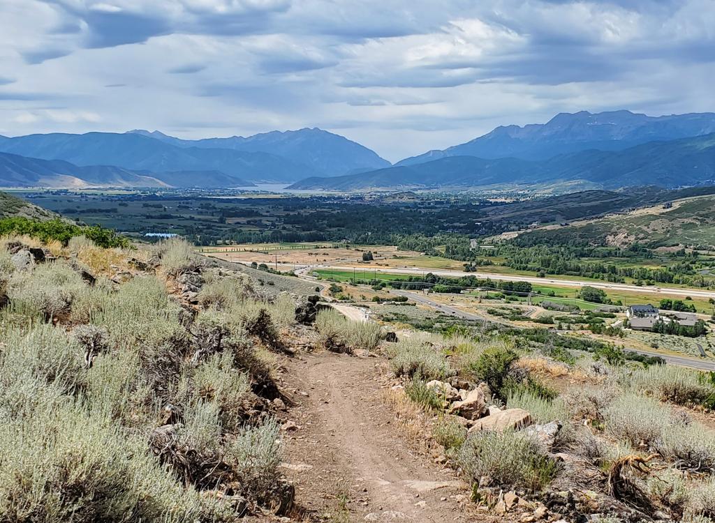
After climbing through the wiggles, you'll reach a traverse near the top of the ridge. The
trail will head back to the north, with some nice views over Jordanelle
and the valley below
you to the right.
At mile 2.9, the What's Up Doc trail is on your left. Many riders turn here to head further
uphill to the Coyote Loop. Keep straight if you're going back to the trailhead.

Looking north toweard Highway 32 and Jordanelle.

Descending through the swoops toward the loop fork on the clockwise ride.
At mile 3.1 you'll drop through a series of swooping turns to arrive back at the loop fork.
Now turn around and do the loop in reverse!

Looking south from the Wile E Canyon trail. The trail on the left is Wile E Canyon, and the right trail is What's Up Doc.
The What's Up Doc trail connects the highest elevation on the eastern side of the Wile E Canyon
Loop to the Coyote Loop. The combination of Wile E Canyon and What's Up
Doc offers an alternative
route for the first part of the climb when doing the Coyote Loop clockwise
from the Cutthroat
area.
The trail is 0.8 miles long with a bit over 150 feet of climbing when done from east to west
-- Wile E Canyon to Coyote.

Climbing uphill through gambel oak forest.

After crossing the ridgeline on the climb from Wile E Canyon, we're heading south. To the west is the Jordanelle Reservoir.
The trail is a bench cut with a generous riding surface, new in 2022. The terrain is scrub
oak, sage brush and maple.
The What's Up Doc trail opens up additional loop ride opportunities. My favorite is Wile E
Canyon clockwise, then What's Up Doc to Coyote, uphill to the top of Looney
Tunes, downhill
to Coyote and back to the Cutthroat trailhead.

Almost to the Coyote Loop.

Looking down the slope toward Jordanelle Reservoir. We're still a mile away from the Wile E Canyon loop.
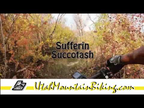
The Sufferin Succotash trail joins the southern tip of the Wile E Canyon loop trail to the
Coyote Loop on the ridgeline above. The trail was finished in fall 2022.
Sufferin Succotash is 1.4 miles long, with 500 feet of elevation change. It lies on a north-facing
slope, so it's shaded by a forest of aspen, maple, and oak. The trail
is an engineered bench
cut with rollers and banked turns.
The pitch is OK for early-intermediate riders. Sufferin Succotash makes a fine climber, and
is great fun to descend.

Bruce rolls through a turn on Sufferin Succotash.

A sample turn as seen over the handlebars.
Sufferin Succotash's upper end is on the
Coyote
Loop,
just 100 yards north from the junction of
Chop'd
Coyote
with the loop. A left turn takes you to Chop'd Coyote and the southern side of the Coyote Loop.
Right will take you towards the top of Looney Tunes and the descent back
to the Cutthroat trailhead.
If you're descending Sufferin Succotash, make a left turn at the bottom if your goal is to
climb to What's Up Doc or to hit Wile E Canyon in the clockwise direction.
To get to the Cutthroat
trailhead, the easiest route is to turn right.

Flying through an aspen grove as we approach the Wile E Canyon loop.

We're now on Wile E Canyon, headed for What's Up Doc. The trail will descend, then climb back uphill through a series of climbing turns.
As a variation on the counterclockwise Coyote Loop -- with more climbing -- consider dropping
down Sufferin Succotash to Wile E Canyon, taking a left turn, then taking
What's Up Doc to
Coyote and climbing back almost to the ridgeline. Drop off Coyote to descend
Looney Tunes,
then turn left to resume riding Coyote counterclockwise.

Rolling through a banked turn as Looney Tunes breaks out of the forest.
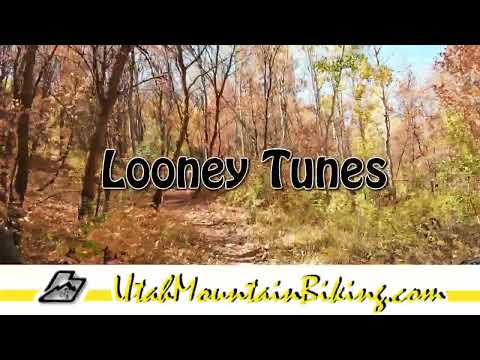
Looney Tunes is 1.7 miles long. It's a two-way trail but most riders will prefer to ride it
downhill. There is a bit more than 350 feet of elevation change over the
course of Looney Tunes.
Of course, there's additional climbing required for any ride that includes
this trail.
The photos will follow a clockwise loop from the Cutthroat trailhead up
eastern
Coyote
southbound to Looney Tunes, then returning east on northern
Coyote. Note that in 2023, upper Looney Tunes has been affected by
construction and requires re-routing. You can still ride up-and-back from the bottom.
In the downhill direction, Looney Tunes is used either as a short-cut on the Coyote Loop, or
as part of a loop from the Cutthroat trailhead consisting of eastern Coyote
uphill, Looney
Tunes, then the Riverview section of Coyote back downhill to the trailhead.
As an uphill, Looney Tunes "short-circuits" a bit of the climbing on the clockwise Coyote Loop,
bypassing the descent down to the Cutthroat trailhead and the climb back
up. You'll skip around
500 vertical feet of climbing.

Climbing a zigzag course uphill on Coyote.

Getting close to the top of Coyote as the slope mellows.
When riding the
Coyote Loop
counterclockwise, the top of Looney Tunes is 14.3 miles from the UVU trailhead, 10.4 miles
from the junction of southern Riverview with Coyote. You'll find Looney
Tunes shortly after
the loop reaches the north slope of the mountain above Jordanelle. It
will be on your right.
If you're using Looney Tunes to bypass part of the Coyote Loop -- see
the map -- you save a
couple of miles (3.6 on Coyote vs 1.7 on Looney Tunes). You'll also skip
around 250 vertical
feet of climbing and descending.
When riding the Coyote Loop clockwise, the bottom of Looney Tunes is at mile 3.5 from the Riverview
trailhead. The junction with the Cutthroat connector trail comes 1.1 miles
later (keep straight).
The top of Looney Tunes is 2.4 miles uphill from here, at mile 6.9 from
the
Riverview
trailhead.

Trail fork to Looney Tunes, seen as though climbing up Coyote.

Swooshing downhill through tall trees.
To reach the top of Looney Tunes from Cutthroat, pedal up the connector trail to mile 0.4 then
turn to the left at the T trail fork to begin climbing Coyote southbound.
At 2.8 miles from
the trailhead, Looney Tunes will be on your right heading downhill.
As a lariat loop from the Cutthroat trailhead, it's 5.3 miles with 650 vertical feet of climbing.
The trail is non-technical, but recommended for intermediates (or better)
due to the amount
of climbing and the nature of the many turns.

A section of traversing trail with gentle uphill takes us across a ridge into another canyon before resuming the descent.

An S turn in the aspens.
Looney Tunes is a machine-cut trail, engineered with swooping banked turns that ride well either
direction. When riding downhill, there will be short sections of gentle
climbing or traversing.
The trail is well-built and a blast to ride.

View to the west as the trail breaks onto a ridge.

View north as we swoop down toward Coyote's north side.
The bottom can be found 1.1 miles from the junction of the trailhead connector with the Coyote
Loop if you're going to do the little loop counterclockwise. The bottom
of Looney Tunes is
on a wide ridgeline, so this northern side of the Coyote Loop is downhill
in both directions.

Bottom of Looney Tunes on the right, looking west as if we'd climbed the Riverview section of Coyote from Cutthroat.

And after many miles of sheep tracks on the trail, here they are.
This area is a grazing area for sheep during late spring and summer. The herd is moved daily,
so you never know where you'll encounter them. Slow down to walking speed
as you pass through.
Sheep are not known for their intelligence, and they'll bolt from 40 feet
off the trail to
directly in front of your tires in a second.
When completing a loop ride from Cutthroat it's 0.4 miles from trailhead to Coyote Loop (turn
left), then 2.4 on eastern Coyote (with 650 feet of climbing), then 1.7
miles on Looney Tunes
downhill, then 1.1 miles downhill on Coyote back to the Cutthroat connector
trail fork.
From the Highway 32 trailhead, the Looney Tunes loop will be 5.3 miles with 650 vertical feet
of climbing.

Rolling through an igneous boulder field eastbound as we complete the loop ride.
Getting there!
UVU Wasatch Campus Trailhead: One mile south of the junction of
Highway 40 and 32 (a couple of miles north of Heber), turn east (toward the
mountain) at the UVU campus. Go to the uppermost level of parking behind the UVU
buildings. Look for the duck-under and kiosk A singletrack trail climbs 1.5
miles to the Riverview Trail.
Wile E Canyon trailhead: The Wile E Canyon trailhead is located on the
southern side of Highway 32, just over 4 miles from US-40. It's 1/10th mile east
of the old Cutthroat trailhead (see below). There's room for about 8 cars here.
From the parking lot, a connector trail takes you 120 yards uphill to the Wile E
Canyon loop. To get to Beep Beep (or the Coyote Switchbacks or East Riverview),
turn right at the trail fork, keep right at the next fork, then turn left onto
the Coyote Riverview Connector trail as you approach the gravel road.
Coyote Riverview Connector trail (old Cutthroat): You can still
connect through the old Cutthroat trailhead, although there's no longer a
parking area here. For example, if the crowds have forced you to park where
construction workers leave their vehicles along Highway 32, you can pedal to the
gravel road to the new golf course leaves the highway, four miles east of US-40
and just east of the big rock-wall road-cut.
Puddy Tat parking: On Highway 3 around three miles from US-40, watch
for a dirt road turning to the right in a huge sage meadow. There are a couple
of buildings across Highway 32 at this spot. The parking spot is just through
the fence, with a connection to Puddy Tat on the eastern side of parking. (This
spot was still being worked on at the time of my review.)
Riverview trailhead: From US-40 just south of the Jordanelle reservoir,
turn east at the traffic light onto Highwat 32 (at mile 14.2 from I-80 if you're
coming from the north). On Highway 32, climb 1.1 miles. When you see the second
entry into Riverview on your left and a road under construction to your right,
the Riverview Connector trail starts on the uphill side of that road just after
it leaves Highway 32. (In 2025, there's no longer protected parking here. It's
unclear whether the trailhead will be restored when construction is complete.)
Coyote Trailhead: The southern Coyote trailhead has been lost to
subdivision construction. Access to the southern side the trail system is in
limbo, but some riders find their way through the construction zone by pedaling
up the gravel Coyote Canyon road.
Canal DT trailhead: Just uphill from the light on highway 32, watch
for the canal crossing. Park along the road. Start riding south on the
doubletrack just uphill from the canal.
Bathrooms: No public restrooms nearby.
Water: Gas stations in Heber, campgrounds.
Camping:
Hailstone campground at Jordanelle on US-40, about 6 miles away.
Bike services: Slim and Knobby's
bike shop, Heber