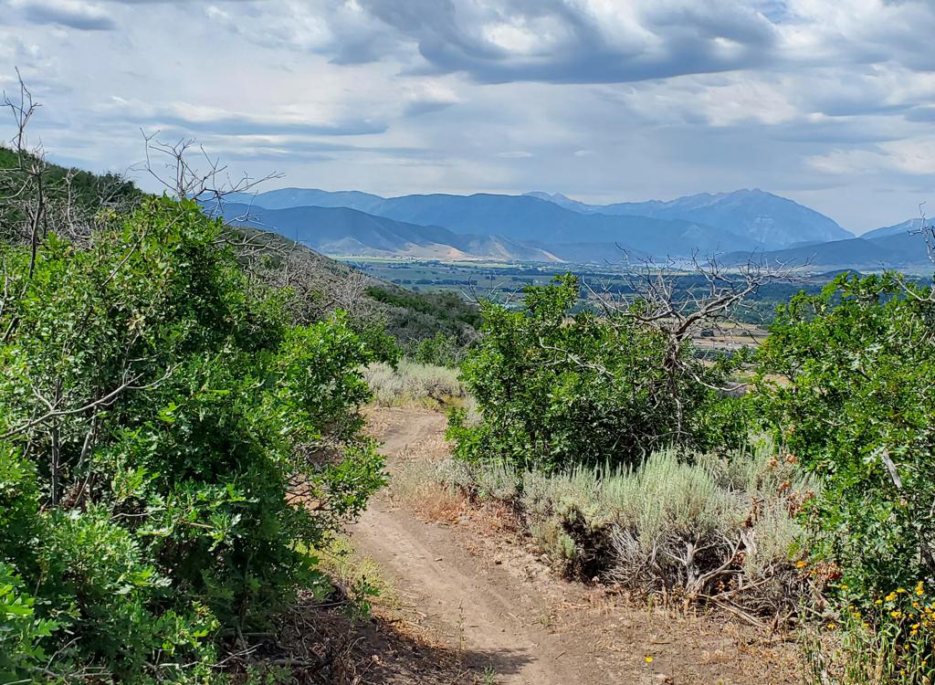
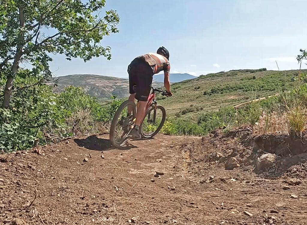
The Tom Bombadil is a downhill-only trail on the southern side of the Coyote (Jordanelle Ridge) trail system. The Jordanelle Ridge trails are more commonly known as the Coyote or Riverview trails and are located just north of Heber, with trailheads on Highways 40 and 32. Tom Bombadil drops from Stone Giants down to Myrtle (the southernmost segment of the route formerly known as Upper Riverview).


The expected riding season will be late May through October.
There are several different climbing options to reach Stone Giants and the top of Tom Bombadil. The most popular will be via UVU Connector, then Rivendell southbound to climb Chop'd Coyote. From Middle Earth, Bofur's Climb takes you directly to Chop'd Coyote.
Alternatively, you can simply climb south Coyote and divert north onto Stone Giants. For a longer ride, you can climb to An Unexpected Journey or Lonely Mountain and traverse south to Stone Giants.


Most riders get to the Riverview area west-side trails from the UVU Wasatch Campus trailhead. This is found on the far north end of Heber on Highway 40, one mile south of the Highway 32 junction. At the UVU campus entry, turn east (toward the mountain). Go to the uppermost level of parking behind the UVU buildings. Look for the duck-under ATV barrier and kiosk just uphill from parking.
The UVU Connector trail climbs uphill from the trailhead to the Upper Riverview (Rivendell) trail after 1.5 miles. On the way, it crosses the easy rides on Lower Riverview, the Riverview Doubletrack, and Middle Earth. ( This trailhead is also closest to Frodo's Playground and the beginner skills area trails at Lower Potatoes and Isengard.)


Turn to the right when the UVU Connector reaches Upper Riverview. Pedal 0.4 miles south, then turn hard left uphill on Chop'd Coyote.
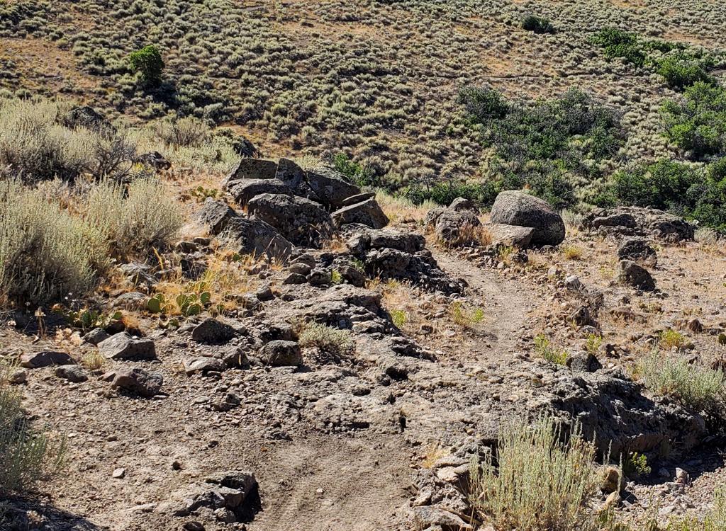
Turn hard right to stay on Chop'd Coyote at the trail fork with Lonely Mountain Traverse. After 1/10th mile, keep straight as Chop'd Coyote turns hard left. You're now on Stone Giants. Pedal 0.6 miles to the top of Tom Bombadil.

If you came uphill via Coyote Canyon, it's 1.2 miles on Stone Giants from Coyote to Tom Bombadil. After climbing uphill on Stone Giants from the Coyote Canyon Road crossing, you'll turn hard left downhill to start Tom Bombadil.


The terrain is stunted gambel oak on a rocky ridge. There will be no shade.


One mile south of the junction of Highway 40 and 32 (a couple of miles north of Heber), turn east (toward the mountain) at the UVU campus. Go to the uppermost level of parking behind the UVU buildings. Look for the duck-under and kiosk N40 32.798 W111 24.735. A singletrack trail climbs 1.5 miles to the Riverview Trail.
Riverview Trailhead:
From Salt Lake, take I-80 eastbound to Silver Creek Junction (just
past Park City). Go south on US-40, past the Jordanelle reservoir and
descend past the dam. At the traffic light at mile 14.2 from I-80, turn
left on 32 and climb 1.1 miles. When you see the second entry into
Riverview on your left, note the gravel parking area on your right N40 34.403 W111 25.214. That's
your spot.
From Utah County, drive up Provo Canyon to Heber. At the traffic
light on US-189/US-40, turn left and drive north through Heber. 4.7 miles
from the intersection, turn right on Highway 32 and climb 1.1 miles to the
parking area as above.
Trailhead options!
UVU Wasatch Campus Trailhead: One mile south of the junction of Highway 40 and 32 (a couple of miles north of Heber), turn east (toward the mountain) at the UVU campus. Go to the uppermost level of parking behind the UVU buildings. Look for the duck-under and kiosk. A singletrack trail climbs 1.5 miles to the Riverview Trail.
Wile E Canyon trailhead: The Wile E Canyon trailhead is located on the southern side of Highway 32, just over 4 miles from US-40. It's 1/10th mile east of the old Cutthroat trailhead (see below). There's room for about 8 cars here. From the parking lot, a connector trail takes you 120 yards uphill to the Wile E Canyon loop. To get to Beep Beep (or the Coyote Switchbacks or East Riverview), turn right at the trail fork, keep right at the next fork, then turn left onto the Coyote Riverview Connector trail as you approach the gravel road.
Coyote Riverview Connector trail (old Cutthroat): You can still connect through the old Cutthroat trailhead, although there's no longer a parking area here. For example, if the crowds have forced you to park where construction workers leave their vehicles along Highway 32, you can pedal to the gravel road to the new golf course leaves the highway, four miles east of US-40 and just east of the big rock-wall road-cut.
Puddy Tat parking: On Highway 3 around three miles from US-40, watch for a dirt road turning to the right in a huge sage meadow. There are a couple of buildings across Highway 32 at this spot. The parking spot is just through the fence, with a connection to Puddy Tat on the eastern side of parking. (This spot was still being worked on at the time of my review.)
Riverview trailhead: From US-40 just south of the Jordanelle reservoir, turn east at the traffic light onto Highwat 32 (at mile 14.2 from I-80 if you're coming from the north). On Highway 32, climb 1.1 miles. When you see the second entry into Riverview on your left and a road under construction to your right, the Riverview Connector trail starts on the uphill side of that road just after it leaves Highway 32. (In 2025, there's no longer protected parking here. It's unclear whether the trailhead will be restored when construction is complete.)Coyote Trailhead: The southern Coyote trailhead has been lost to subdivision construction. Access to the southern side the trail system is in limbo, but some riders find their way through the construction zone by pedaling up the gravel Coyote Canyon road.
Canal DT trailhead: Just uphill from the light on highway 32, watch for the canal crossing. Park along the road. Start riding south on the doubletrack just uphill from the canal.