Cherry Ridge Bike Park
Spring Canyon is on the east side of Springville, just north of Hobble Creek Canyon. It's the site of a set of DH trails, new in 2023, with some updated construction in 2024. Also, the old Spring Canyon Road has been closed to vehicles and is now a cycling/hiking path.
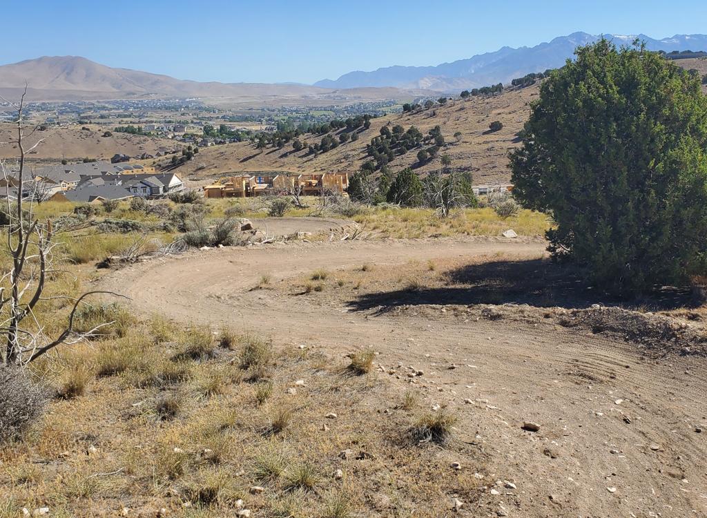
The Spring Canyon system is officially part of the Cherry Ridge Bike Park, although construction of the lower portion -- 1/4 mile away -- is still ongoing, and at this time no trails connect the two sites.


There's no trailhead and no user services at this time (May 2024). Parking and facilities will be constructed in the near future. For now, you'll need to either arrive via the BST (not an easy navigation task) or park on residential streets near an access point. The most direct access is a doubletrack on 2080 East (see below). You can also go to the park on Spring Creek Drive (a continuation of Center Street) and take the Spring Canyon doubletrack uphill to the BST, then drop into the bike park from there.
If you park in the paved parking area of the main Cherry Ridge Bike Park, you'll need to pedal uphill on streets. It's about 1/4 mile. Take a right turn at the top of parking, left uphill, then left uphill again and watch for the entry trail on your right.

As the climbing/collector trail starts at the southwest corner, there's a singletrack connector to the southbound BST. The northbound BST can also be reached from the climbing trail. Mid-way up the climb, you'll pass a singletrack connector that climbs uphill to the BST (and the Spring Canyon DT, should you want to ride up the canyon).

The trail is 0.3 miles long, descending 130 vertical feet.

At the bottom, hook right and ride just below the top of the retention dam, then left up onto the climbing trail.

The middle DH route has table jumps, a couple of rock gardens, and two big wall hits. Of the three routes, this one seems to have the most "fun stuff." This trail is 0.2 miles long, dropping 130 vertical feet.
This trail starts at the ramp on the south side of the launching platform. There's an immediate rock drop to scare away the beginners. The riding gets easier after that.


BST northbound: Climb a singletrack connector uphill from the climbing trail and find the BST at the Spring Canyon doubletrack.
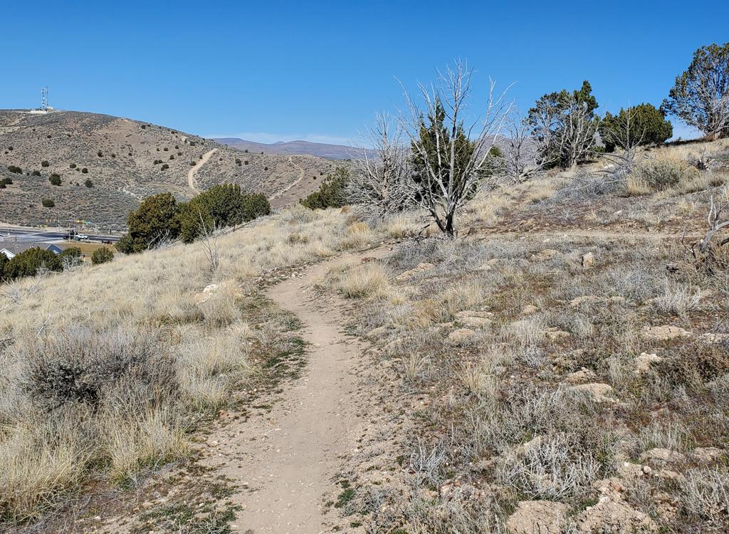
Spring Canyon: The old road up Spring Canyon has been gated off, and is becoming popular with hikers and horsemen. Climb uphill from the bike park as above.

Retention dam entry DT: From I-15, take the Springville 400 South exit and drive east toward the mountains. Keep straight on 400 South for 3.2 miles. At the roundabout, go right (south) on Canyon Road. The road will turn east toward Hobble Creek Canyon. At 2080 East, turn left and drive 1.1 miles. The 1/10th mile doubletrack to your right is the path to the trails. Park at roadside.
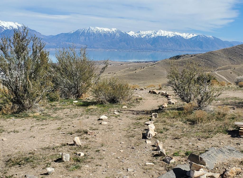
Begin pedaling the doubletrack toward a retention dam. You can push-a-bike to the top of the DT, or when you reach the BST -- around 250 feet from the road -- you can fork right on singletrack. (See photo below.) Take a hard right as you reach a trail fork and head back south. Turn left when you reach the flood-control "hump" and you're on the climbing trail.
There's also room for a couple of cars to park at the end of the road, where you can catch the Spring Canyon doubletrack uphill, then drop into the bike park from the BST.

From Center Street via the Spring Canyon doubletrack: Go to Center Street in Springville and head east toward the mountains. Around 1600 East, the road will veer to the right and become Spring Creek Drive. Find a spot at the park on the right side of the road, then pedal uphill around the gate on the gravel road, which is the old Spring Canyon Road. Go uphill 0.3 miles. You'll see an old quarry on your left, with a trail crossing the road. Go right and descend to the climbing trail of the bike park.

From the north: Go southbound on the BST at Slate Canyon or from a BST connector. As the trail gets to Spring Canyon, take the lower fork along an excavated area. Go straight across the Spring Canyon DT to singletrack, keeping straight at two trail forks until you find yourself on the doubletrack climbing trail.
From the south: It's still a bit of a mess in 2023. On neighborhood roads, head into the canal trail going north. Watch for a trail on your right that links uphill to the BST. Go north on the southern Springville BST, going around two locked gates. A bit past the second gate, there's a trail fork. The right-hand trail will take you up to the retention dam, where you can keep straight onto the climbing trail. The left fork takes you to the DT access trail, where you should turn right uphill.

The lower portion of the Cherry Ridge Bike Park on 400 South is still under construction. There will be lots of parking, a large covered picnic zone, and nice paved kiddie trails, as well as stunts for the big guys.