Bar M Sidewinder
The Bar M Sidewinder is a short singletrack in the Brand Trails riding area north of Moab. It isn't a "ride" all by itself. Most riders will use it as a dirt alternative to the paved Old 191 bike path when traveling up or down-canyon. It's intermediate in technical difficulty.
Because there was already a Sidewinder Trail in St.George (and newer "Sidewinder" trails other places), our web site will always add a qualifier to the name of this trail. If you see "Sidewinder" all by itself, I'm usually talking about the St.George trail -- NOT this trail, the Bar M Sidewinder.


Bar M Sidewinder is 1.5 miles long. There's 300 feet of elevation change. At the top, it starts on Old 191 just downhill from the lower trailhead of Rusty Spur. As it descends, it makes multiple connections. First it connects to the east (downhill) side of Rusty Spur. It sends two connectors eastbound over to Old 191, then joins Old 191 midway between the bottom ends of Deadman's Ridge and Killer B.
The trail opened in April 2013. (At the time of this writing, the trail surface is still loose. Early-intermediates may have issues with bike control on some of the steeper loose sections. Give it a couple of months, and a few rainstorms, to pack down.)


The trail can be done in either direction. There's one relatively stiff climb either way. Most riders will drop onto this trail as they return from riding in the Brand Trails. Stronger bikers can use this route uphill when returning to the Bar M from the Killer B or Deadman's Ridge rides.
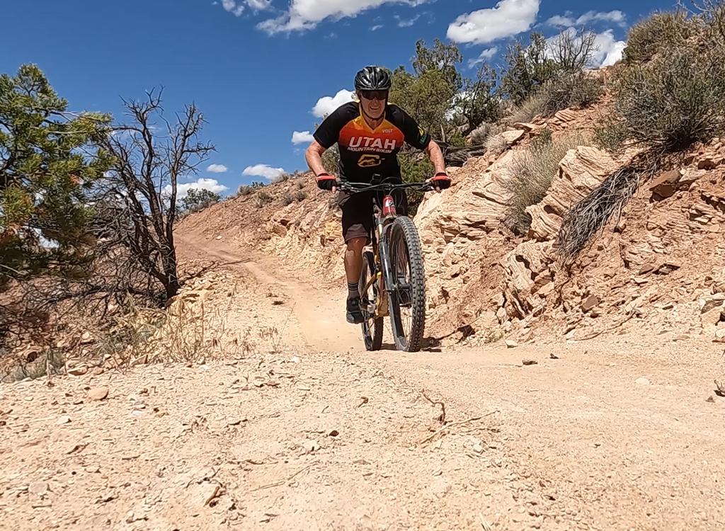
The trail follows the Moab fault down the steepest section of the canyon, lying midway between Highway 191 and the paved Old 191 bike path. Half-way down, a deep cliff-lined wash separates you from Old 191. There are some cliff and side-slope exposures that make this route inappropriate for beginners.


The bottom third is up-and-down riding in tilted rock layers. In this spot the Moenkopi formation (the chocolate rock on the skirts west of the highway in the lower canyon) meet much younger rocks that have been dropped downward by the Moab Fault.
Connections from trails downhill...
When exiting Deadman's Ridge onto Old 191, there's a trail connector entry on the west side of Old 191 0.2 miles uphill and 0.4 miles downhill. (The bottom of the trail is 0.7 miles downhill from Deadman's Ridge.)

 descent on narrow tread.")
To catch this trail from Killer B (to go back uphill), turn right and ride uphill on Old 191 for 0.6 miles. Turn left into the singletrack at the sign. At the first two trail forks, keep left. The trails to the right connect back to Old 191. At the third fork, veer right to stay on Bar M Sidewinder, or veer left then right to take Rusty Spur back to Old 191. At this point, you can go past the kiosk to connect to the rest of the Brand Trail system.
Connections from uphill...
To go directly from the Bar M parking to Bar M Sidewinder, hop on Old 191 and ride 1.2 miles south of the kiosk where the paved trail ducks under the highway (and where the gravel road turns to the lower parking area). Pass two connectors to Rusty Spur on the right, then find the Sidewinder Bar M trail on your right. It's 1.4 miles from the new parking lot.


To connect via EZ (of the Lazy-EZ loop), veer right at mile 1.5 (where EZ turns L uphill to become "Lazy"). Take Bar M past the kiosk of Bar M's southern corner, then onto Old 191. Ride 800 feet south of Bar M kiosk to Sidewinder Bar M. (Pass two trailheads for Rusty Spur on the way.)
Or, take the first right turn after the kiosk onto the south (second) trailhead of Rusty Spur and ride 0.2 miles to the connector. Fork left onto the connecting trail and keep straight as you reach Sidewinder Bar M.
To connect from Moab...
Heading north on Old 191, ride 4.9 miles from Highway 128 and turn left onto the singletrack. There will be a second connector at mile 5.2, and a third at mile 5.8.
0.0 Right off Old 191 on Bar M Sidewinder
N38 38.313 W109 39.297
0.1 Keep straight (R = to Rusty Spur)
N38 38.227 W109 39.253
0.2 Keep right (L = to Old 191)
N38 38.099 W109 39.092
0.5 S turn above gorge
1.1 Keep right (L = to Old 191)
N38 37.723 W109 38.884
1.4 Join Old 191
N38 37.531 W109 38.713
0.0 L off Old 191 onto ST
N38 37.531 W109 38.713
0.3 Fork L (R to Old 191)
N38 37.723 W109 38.884
1.2 Keep L (R = to Old 191)
N38 38.099 W109 39.092
1.3 Keep R (L = to Rusty Spur)
N38 38.227 W109 39.253
1.4 L uphill on Old 191
N38 38.313 W109 39.297

Getting there:
From the north, exit I-70 at Crescent Junction and drive south on US-191 for 22 miles. From Moab, drive 7 miles north from the Colorado River on 191. When you see the Gemini Bridges parking area, look for a gravel road on the opposite side (east, away from the cliffs). Turn onto the gravel road and immediately go right. Drive past the first parking lot. (This is restaurant parking or fee parking GPS N 38° 39.38' W 109° 40.66'.) As you approach the fence and kiosk at the paved trail, turn left and drive 1/4 mile to the gravel parking lot in the bottom of the valley N38 39.107 W109 40.110. To find the trailhead, see the directions above.
Riding resources for this trail:
Single-page riding guide
GPS track files (right-click and "Save as..."):
Multi-track file, Brand
Trail area
GPX track Sidewinder Bar M
only
High-res topo map for printing:
View
Lodging, camping, shops:
Links to Moab area resources