These trails are found on the northeast side of the Powder Mountain resort area, at an average elevation of 8700 feet. The riding season will be late June through September. The trails are easier-intermediate in difficulty. On this page I discuss Doctor's Dozen, Sunrise, and their connections. The old Hidden Lake Lodge route has been "decommissioned" but is included on my map -- and is mentioned in the trail descriptions -- because some riders are still using it at the time of this writing.
The Doctor's Dozen trail consists of a singletrack and a less-used doubletrack segment. The singletrack section connects the northeast corner of Power Mountain's Brim Trail to Hidden Lake (not the lodge but the lake itself). This singletrack portion is 3.7 miles long. From the lake, a gravel road continues west for 1.3 miles, over a ridge and down to the main Powder Mountain lodge.


On its southeast end, Doctor's Dozen forks northbound away from the counterclockwise Brim Trail loop just 100 feet before the singletrack ends on the doubletrack. Starting at 8550 feet altitude, Doctor's Dozen contours northbound around the eastern side of the mountain, gradually rising to an elevation of 8750 over 1.4 miles. On the east side of the mountain, you're looking into Brown's Hole and the Middle Fork of the Ogden River.


On a saddle area at mile 1.4, Doctor's Dozen crosses an open area to a dirt road then veers off the road to the left. (On the right on this saddle, the Sunrise trail forks to the right. Sunrise meanders further east then returns to the west lower on the slope, running parallel to and just downhill from Doctor's Dozen.)
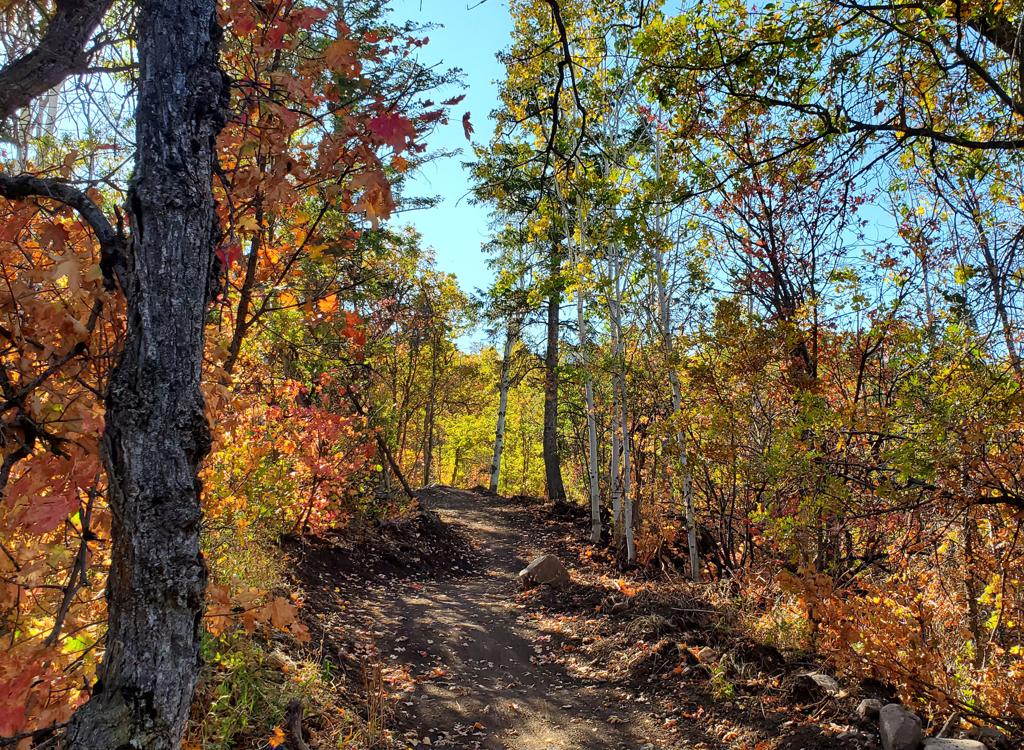
The trail alternates between meadows, low scrub, and stands of aspen or fir. On the northern slope, there are views that extend past Wellsville Creek Canyon to the mountains in the Logan area.


Then the trail drops through a series of turns and crosses the old bench-cut for the Hidden Lake Lodge trail. Keep straight as you cross. To your right, a few feet down the old Hidden Lake Lodge trail, the Sunrise trail forks away to the left downhill.
Doctor's Dozen continues to twist through multiple turns down to Hidden Lake. You'll drop about 450 vertical feet over 1.3 miles of descent.


Doctor's Dozen continues as a wide dirt road 0.7 miles down to the main Powder Mountain Lodge parking. There's little to recommend here -- when compared to the descent on Brittain's Ribbon -- unless your objective is to get downhill as quickly as possible.
Doctor's Dozen from the downhill end is straight-forward. Go to the left of the main Powder Mountain Lodge. Stay on the doubletrack uphill from the lodge, and then crank on up the dirt road (350 vertical in 0.7 miles). Cross the ridge and descend to the lake. Just past the lake, fork right on singletrack and begin climbing. Stay straight until you hit the Brim Trail, 3.7 miles after joining the singletrack.


If your destination is Sunrise or the Trail Yeah! loop, don't cross the bench-cut, but veer left on the shelf, then drop quickly to the left onto the Sunrise trail.
At mile 2.1, a connector to Sunrise joins from downhill on your left. Keep level and straight.


If your goal is to ride the Trail Yeah! loop, you'll need to get onto Sunrise to make the connection (see the Trail Yeah! trail page ).
If your goal is to get somewhere quickly, keep right onto the Picnic trail. This trail is only 0.2 miles long and mostly flat. Picnic's 0.2 miles bypasses 0.8 miles and 150 vertical feet on the official Sunrise trail.


A left turn here joins Doctor's Dozen heading south, with 1.3 miles to the Brim Loop .


Excellent addition to the Powder Mountain system, especially since the construction of the new Sunset trail and Trail Yeah! Use Doctor's Dozen with the Brim Trail Loop as an extended loop ride, with Paper Airplane and Woody's as the other side of the loop.


From I-15, take Exit 347 to Ogden Canyon. Drive 7 miles up Highway 39 and turn left across the Pine View dam onto Highway 158. Four miles later as you pass the gas station in Eden, keep straight at the stop sign. Drive steep uphill 7 more miles to Powder Mountain. Pass the lower lifts on your left as you follow a turn in the road. The next road on your right is Powder Ridge Road. To go to the main Powder Mountain Lodge, keep straight and continue into the parking area. The bottom of Brittain's Ribbon (singletrack) and Doctor's Dozen (doubletrack) are on the left (east) side of the lodge.
Starting from Woody's World: Use this trail for an epic loop ride around Brim and Doctor's Dozen. The bottom of Woody's World is 1/10th mile up the Powder Ridge Road, which was on your right just before the main parking lot. There's a bit of parking on the shoulder of Powder Ridge Road, presumably legal. Pedal uphill until you see the trail on your right.
From the Brim Trailhead: Drive up Powder Ridge Road. Pass the entry to the Hidden Lake Lodge parking. Continue on the main road past Summit Village, then find the Brim Trail trailhead. Go southeast on doubletrack 0.5 miles, as though you were riding the Brim loop clockwise (keep straight at any DT forks). Find singletrack on the left. Follow it 100 feet, then make a hard left onto the Doctor's Dozen trail's south end.
Riding resources:
GPS track files (right-click and select "Save as..."):
Area
multi-track file
High-res topo map for printing:
View
map
Lodging, camping, shops:
Links to Ogden area resources