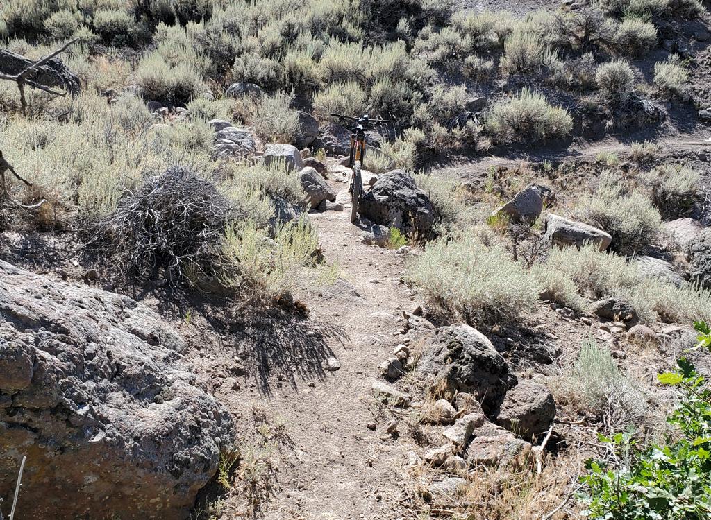
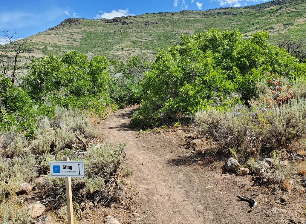
Climbing Lonely Mountain, with Cascade Mountain and Timpanogos to the west. Revi...
Climbing Lonely Mountain, with Cascade Mountain and Timpanogos to the west. Review by Bruce on June 3, 2022.
Isengard and Mordor Area
of Heber's Riverview System

This page reviews the multiple trails at the northwestern side of the Coyote Canyon/Riverview trail system just north of Heber. The navigation can be a bit complex, with additional trails still being added in June 2022. There are small trailside signs identifying the trails at forks and cross-overs, but knowing where you're going requires excellent map skills or a GPS navigation app.

The trails include beginner-level routes on the lower mountain such as northern Lower Riverview and Bag End, northern Middle Earth , and the downhill-only Lower Potatoes. The Isengard Skills Trail is beginner-level if you bypass the stunts which require upper-intermediate skills to clean. These trails lie between Middle Earth and Lower Riverview.

Intermediate trails located above Middle Earth include Upper Potatoes and Lonely Mountain. Lonely Mountain (at this time) is two-directional, although it seems to be engineered as a downhill flow trail and may become one-way when other access trails are finished.

Upper Potatoes has been used mostly as a downhill from Riverview to Lower Potato...
Upper Potatoes has been used mostly as a downhill from Riverview to Lower Potatoes. Now that Lonely Mountain and Mordor are complete, the usage may change.
Two air opportunities on Mordor. Hit one or both. Theres a big rock drop on the ...
Two air opportunities on Mordor. Hit one or both. There's a big rock drop on the right and a launching lip on the left a bit further downhill.

Mordor is an expert-level descent from the top of Lonely Mountain to Lower Riverview. At the time of this review, it's reached by climbing up Lonely Mountain, but that will likely change as new trails are finished. It crosses (and sometimes briefly joins) Upper Riverview , Middle Earth, and the Riverview doubletrack. Mordor includes some double-black optional lines. 

The trails described here are a small portion of a huge riding area. You may want to refer to other trail pages for detailed information on connecting trails that may be mentioned on this review page:

   Coyote Loop - 21-mile loop around the mountain
   Riverview Trail page - Upper Riverview and connections
   Chop'd Coyote page - Alternate route that bisects Coyote Loop
   Lower Riverview page - Trails on the lower front-side
   Wile E Canyon page - trails off Highway 32 on northeast Coyote

Bruce on the Coyote Loop.
Getting to the riding area
Hitting the UVU Connector to climb up above the canal, where Lower Riverview awa...
Hitting the UVU Connector to climb up above the canal, where Lower Riverview awaits.
Trailheads

The two closest access points are the UVU and Upper Riverview trailheads. The UVU trailhead is behind UVU, which is about a mile south of the trails of the Isengard/Mordor area. From this trailhead, you can take Lower Riverview, the Lower Riverview doubletrack, Middle Earth, or Upper Riverview north to catch these trails at various levels.

The Upper Riverview trailhead is on Highway 32 about 1-1/2 miles north of the trails. After connecting to Upper Riverview, you can pedal to the top of Upper Potatoes to start downhill, or a go bit further to Lonely Mountain to head uphill to Mordor. See trailhead information at the bottom of this page.

Lower Riverview to Lower Potatoes and Isengard

For the lower trails, head uphill on the UVU Connector. There's a meandering singletrack and a straight up the hill route. Take either one. After you cross the canal at mile 0.2, find the singletrack on your left. This is the combined UVU Connector and Lower Riverview . After another 0.1 miles, keep left on Lower Riverview while the Connector heads uphill toward Middle Earth and Upper Riverview .

Bruce cranks north on Lower Riverview.
Looking uphill as Bag End forks away from Lower Riverview.
Now pedal 1/2 mile north on Lower Riverview and fork to the right uphill on Bag End. You'll reach the doubletrack after 0.1 mile. You're now 0.9 miles from the trailhead. Turn right on the doubletrack.

Continue north 0.2 miles. The connector to the Isengard drops loop will be on your right uphill, and the skills trail is directly across on your left.

After a few feet Mordor crosses. Now the doubletrack climbs gently to cross Lower Potatoes. Turn left to descend the one-way Lower Potatoes trail. (If you're headed further up the mountain, I believe the bit of Lower Potatoes uphill from the doubletrack is two-way to allow you to reach the bottom of Upper Potatoes.)
Riverview (UVU) Connector to Doubletrack or Middle Earth

This route lets you access all levels of the trails. When Lower Riverview and the UVU Connector split at mile 0.3 from the UVU trailhead, turn to the right uphill. Cross the Lower Riverview Doubletrack at mile 0.4 (or you can turn left on the Riverview DT to head directly to the Isengard trails).

Heading uphill on the Connector Trail.
The trail on the left is northbound Middle Earth.
At mile 0.7 from the trailhead, Middle Earth joins the Connector trail for a few feet, then splits away again. Keep left at the first fork, then 30 feet later, keep left again for Middle Earth. Middle Earth will take you 0.9 miles north to the bottom of Upper Potatoes and the top of Lower Potatoes.
UVU Connector and Riverview to Middle Mordor, Lonely Mountain, or Upper Potatoes

Climb 1.6 miles on the UVU/Riverview Connector trail. When you reach Upper Riverview , fork left to head north. After 1.1 miles, Mordor crosses to start the Middle Mordor trail section.

Arriving at Upper Riverview on the UVU Connector trail. Left turn here.
View northwest as we traverse the hillside.
After another 1/3 mile, you'll reach the bottom of Lonely Mountain. Fork right to head uphill to Mordor, or keep left and pedal another quarter mile to reach the top of Upper Potatoes for a descent. The top of Upper Potatoes is 1.7 miles north from the junction of the UVU Connector with Riverview .
Upper Riverview Trailhead to Middle Mordor, Lonely Mountain or Upper Potatoes

From the Riverview trailhead on Highway 32, pedal uphill on the Riverview trail until you reach the Coyote Loop at mile 0.3 then turn to the right.

At mile 0.4, Sheep Bones forks to the right downhill. If you're headed for the easier trails, descend Sheep Bones for one mile, then continue south on the doubletrack until Lower Potatoes crosses.

Looking back downhill to the Highway 32 trailhead.
Westbound on Riverview.
At mile 1.6 on Riverview, Upper Potatoes forks to your right on a ridge as the Riverview trail makes a left turn.

Lonely Mountain will be on your left at mile 1.9 from the trailhead. If you're headed for Middle Mordor, it's 1/2 mile further south on the trail at mile 2.4 from the Highway 32 trailhead.


Trail Details
Isengard Drops Loop and Skills Course
Connector to the Drops Loop from the doubletrack, looking south.
Isengard consists of a drop practice loop and a skills flow trail. The drops loop is around 1/10th mile with very little elevation change. It lies uphill from the Riverview doubletrack, just to the south of Lower Potatoes and Mordor.
The drops are on the far end of a short loop. The staging area above the drops is short, so you'll be taking the drops at low speed. For those of you riding clipped-in, there isn't room for you to get clipped, balanced, and comfortable if you start cold from the top. You'll want to pedal into the top of the staging area then turn toward your drop of choice.
Looking west and downhill, with ramps on the right and rock drops on the left. T...
Looking west and downhill, with ramps on the right and rock drops on the left. This picture is shot from the very top of the staging area. You have very little time to get balanced and up to speed.
Looking south at the relative heights of the drops. The rock at the far left sid...
Looking south at the relative heights of the drops. The rock at the far left side is a big one.
In 2022, there are three wooden drop ramps and three lines for rock rollovers and drops. The drops are more difficult as you go right to left. The landing-recovery zone is short without much of a run-out, so you'll need to recover your balance quickly. (The short approach and run-out prevents morons from smashing other riders at high speed.)

After you turn right at the bottom, you'll loop back up for another go.

The Isengard skills trail is 0.3 miles long with 75 feet of elevation loss from the doubletrack down to Lower Riverview. My understanding is that it's designated as a two-way trail (so you can backtrack to try something a second time), but intended to flow top to bottom.
Two split logs to balance on, and a rock-pile rumble strip.
This log is a bit more anxiety-provoking, as you must navigate a turn while 18 i...
This log is a bit more anxiety-provoking, as you must navigate a turn while 18 inches in the air.
Stunts vary in difficulty but are fairly forgiving if you fall off.
A table jump to practice on. A bit long for the speeds that are possible on this...
A table jump to practice on. A bit long for the speeds that are possible on this gentle slope, but go for it.
There's a series of connected banked turns to practice keeping your sight lines ...
There's a series of connected banked turns to practice keeping your sight lines high and rolling through.
To make a second run, keep left at the (non-marked) bottom of the skills trail to join Lower Riverview Pedal 1/10th mile south, then turn left uphill onto Bag End to climb back to the doubletrack.
All of the stunts have generous ride-arounds. Heres a nice steep partial-circle ...
All of the stunts have generous ride-arounds. Here's a nice steep partial-circle bridge.
Upper Potatoes
The bottom of Upper Potatoes is where northbound Middle Earth turns to the west ...
The bottom of Upper Potatoes is where northbound Middle Earth turns to the west to become Lower Potatoes. My bike is on Upper Potatoes, and the track on the right is the connection to Middle Earth. Note that most riders are turning from Upper Potatoes to Lower Potatoes.
Upper Potatoes is a two-way trail, but until now it's been heavily used as a descender from Upper Riverview through Lower Potatoes to Lower Riverview With the completion of Lonely Mountain and upper Mordor in 2022, more people will be climbing Upper Potatoes.
The trail is smooth and non-technical, with a gentle grade. The turns, and some sections of trail, have a bit of pitch that may give true beginners a problem. I'd rate the trail as early-intermediate in aerobic requirement and technical skill.
Looking downhill as Upper Potatoes descends through oak brush thats been bitten ...
Looking downhill as Upper Potatoes descends through oak brush that's been bitten by a late frost.
Looking west toward Timpanogos as Upper Potatoes makes a gentle downhill run.
Upper Potatoes is 0.8 miles long, with 250 vertical feet of elevation change. When combined with Lower Potatoes as a continuous downhill, that's 1.2 miles and 350 feet of descent.
As mentioned, Upper Potatoes can be a legit climbing route to Upper Riverview. You'll arrive at the bottom of Upper Potatoes from Middle Earth. Once you get to the top, turn to the right on Riverview if you're heading for Lonely Mountain.
Looking east uphill as we climb Upper Potatoes.
Looking west as Upper Potatoes forks away from Riverview.
If you're descending Upper Potatoes, you'll find the top of the trail on Upper Riverview at mile 1.6 from the Upper Riverview trailhead on Highway 32. Upper Potatoes forks to your right on a ridge as the trail makes a left turn.

If you're arriving via the UVU Connector trail, it's going to be 1.6 miles climbing the Connector then 1.7 miles north on Riverview to reach the top of Upper Potatoes.

Lower Potatoes
View west over the Heber Valley, with Cascade Mountain and Timpanogos in the dis...
View west over the Heber Valley, with Cascade Mountain and Timpanogos in the distance.
Lower Potatoes is the continuation of northbound Middle Earth. The transition occurs where Upper Potatoes forks away to the right uphill. Lower Potatoes is 0.4 miles long with a bit over 100 feet of elevation loss. It's a one-way downhill trail.

Lower Potatoes is very easy to ride, suitable for children and true beginners. If you have enough skill to arrive at the trail, you're skilled enough to ride it.

At the bottom of Lower Potatoes, Mordor will join from your left (junction currently non-marked June 2022). Then Lower Potatoes joins the Lower Riverview singletrack heading south. From here, you'll pass the bottom of Isengard (also non-marked) on your left. If you keep straight, in a bit over a tenth of a mile, you can turn back uphill on Bag End to reach the doubletrack, or continue south for a bit under a mile to the UVU Connector trail to climb higher on the mountain.
Rolling through a few final wiggles before the trail ends on Lower Riverview.

Descending Upper Potatoes and Lower Potatoes...

[Back to video list ]
Lonely Mountain
Arriving at the bottom of Lonely Mountain (to the left) while southbound on the ...
Arriving at the bottom of Lonely Mountain (to the left) while southbound on the Riverview trail.
Lonely Mountain joins Upper Riverview to Chop'd Coyote. It is also the access route to ride Mordor or Smaug. The trail is two-way (although this may change), but the trail seems engineered to favor riding downhill -- from Chop'd Coyote.
The bottom of Lonely Mountain begins on the Upper Riverview trail. It's 1.9 miles from the Upper Riverview (Highway 32) trailhead southbound, or 1.4 miles north from the junction of the UVU Connector with Upper Riverview.

The top of Lonely Mountain forks away from Chop'd Coyote at 2.2 miles from Upper Riverview if you're using Chop'd Coyote as your uphill. When descending Chop'd Coyote from the Coyote Loop at the top of the mountain, it's 2.7 miles from Coyote to the Lonely Mountain fork.

Climbing north past outcrops of granite.
There will be frequent views, as very little of the trail is shaded. Here were l...
There will be frequent views, as very little of the trail is shaded. Here we're looking west at Timpanogos. The climbing is fairly steady but gentle, until you hit a turn. The turns feel very much as though they're intended for DH.
The Lonely Mountain trail is 2.5 miles long with 650 feet of elevation change. The top at Chop'd Coyote is around 6900 feet elevation, which means the trail should be ready to ride around mid-May in most years.
The trail is suitable for strong intermediates. As mentioned, the trail seems to be cut as a downhill flow trail. Most experienced riders will be able to power up and around the turns without much difficulty, but beginners and less-strong intermediates won't find this ride fun.
Typical turn on Lonely Mountain, as seen in the downhill direction. Everything a...
Typical turn on Lonely Mountain, as seen in the downhill direction. Everything about this trail screams "downhill."
Looking across Heber Valley toward Provo Canyon from Lonely Mountain.
At mile 1.2 from the bottom of Lonely Mountain -- or 1.3 miles from the upper end on Chop'd Coyote, Mordor has two entries on your right. The choices -- a steep series of spooky drops on the right versus one monster hip-high drop for the left path -- should tell you that intermediates have no business on Mordor.
The Smaug Loop forks away from Lonely Mountain at 1.4 miles from the uphill end, 1.1 miles from the bottom. Smaug is a very easy ride. It's worth a quick trip around the loop, with Smaug rejoining Lonely Mountain just 100 feet from where you entered.
Theres a series of turns above the Mordor trail fork, and a long traverse over t...
There's a series of turns above the Mordor trail fork, and a long traverse over to Chop'd Coyote. We're looking south as the trail heads to Chop'd Coyote.
A rare spot of shade among taller trees as we approach Chopd Coyote.
A rare spot of shade among taller trees as we approach Chop'd Coyote.
The Lonely Mountain trail opens up several loop ride opportunities, both short and long. For intermediate riders, I'd suggest you get to Upper Riverview then climb Chop'd Coyote half-way, then descend Lonely Mountain and Upper/Lower Potatoes .
Smaug
The trail forks to the Smaug Loop are on a flat ridge area around the middle of ...
The trail forks to the Smaug Loop are on a flat ridge area around the middle of the Lonely Mountain trail, just downhill from the fork to Mordor.
Smaug is a short loop ride located around the middle of the upper Lonely Mountain trail, just downhill from the top of Mordor. The beginning and end of the loop are only about 100 feet apart. The trail is very easy and quick to ride.
Smaug is 0.4 miles in length. It can be done either direction and is gently uphill as you ride away from Lonely Mountain. A counterclockwise ride puts the banked turns of the southern side of the loop on the downhill.

The trail is a dirt bench-cut in an area of sage and oak brush. There's only about 50 feet of elevation gain as you pedal away from Lonely Mountain.

Handlebar view on the Smaug loop.

A climb up Lonely Mountain to Smaug!

[Back to video list ]
Mordor
The easy drop-in. Three drops then a turn on a rock wall. The harder line is the...
The "easy" drop-in. Three drops then a turn on a rock wall. The harder line is the chest-high diving board at mid-left.
Mordor is an expert-level one-way downhill trail with some double-black optional lines. It consists of three segments: Upper Mordor from the ridgeline down to Upper Riverview, Middle Mordor from Upper Riverview to Middle Earth, and Lower Mordor from Middle Earth to Lower Riverview.
Mordor is 1.7 miles long, dropping 700 vertical feet. That's a respectable rate of descent. Add the many engineered and natural challenges, and it makes Mordor a legit DH.
Roaring downhill into some table jumps.
A couple of rocks coming up. Rollover or straight-up drop? Who knows.
Upper Mordor is 0.6 miles from the top of Lonely Mountain to Upper Riverview. You'll drop 250 vertical. After the attention-getting drop-in, there are some optional rock stunts and table jumps.
The final bit of Upper Mordor is an insane plunge through tight wiggles in a ravine. Veer left at the bottom to find Middle Mordor on the other side of Riverview.
Gravity drags us relentlessly down the ravine. No stopping here.
Mellower section. A couple of bumps then a jump, then another jump.
Middle Mordor has some "cruiser" sections mixed with challenges. There are several A/B splits. Usually you can see the easier route as you approach, but not always. A slower "scouting" run really helps. It's not that hard to climb back up and hit it again.
We're well into an optional line before we see the rock drop ahead. Not too bad,...
We're well into an optional line before we see the rock drop ahead. Not too bad, but there's a turn as soon as you land.
And a bit further down the alternate line, we find this little jewel. Gotta keep...
And a bit further down the alternate line, we find this little jewel. Gotta keep some speed and hope your line holds.
The left line comes to a hip-high drop.
The ride alternates between open sage with views and maple-oak forest. Some additional stunts and optional lines are still under construction.
When the trail hits Middle Earth, keep left, and after about 30 feet you'll see the entry to Lower Mordor dropping downhill to the right. During this uppermost segment of Lower Mordor (between Middle Earth and the doubletrack), the trail swoops around with few challenges.
Middle Mordor joins Middle Earth southbound for a few feet before turning off to...
Middle Mordor joins Middle Earth southbound for a few feet before turning off to the right as Lower Mordor.
This little beauty is a rim-bender. Hmm. Launch or roll?
Once you cross the Riverview Doubletrack, the trail's character changes. Now you're on hand-built track in the bottom of a wash. There are plenty of alternate lines, and some of them are spooky. Rock challenges are constant, and decisions about where to put your tires come quickly.
At the bottom of Mordor, you'll join Lower Potatoes. Watch for beginners and keep straight as the trail turns south and joins Lower Riverview. You're done!
Almost there. Not quite so steep now, but still pretty tricky.
Map of the Mordor/Isengard area
Getting there!

UVU Wasatch Campus trailhead:  One mile south of the junction of Highway 40 and 32, turn east (toward the mountain) at the UVU campus. Northbound from Utah County, the UVU campus is a couple of miles north of Heber's business area. Go to the uppermost level of parking behind the UVU buildings and look for the step-over and kiosk. The singletrack UVU Connector trail climbs to Lower Riverview at mile 0.2 and Middle Earth at mile 0.7, then continues to the Riverview Trail at mile 1.6.

Coyote Lane trailhead: On US-40 just north of Heber, turn east on Coyote Lane. Just after the road crosses a canal, turn left into the parking lot. The singletrack starts at the northeast corner at the step-over, where you'll also find a repair stand and a kiosk with a trail map. The Coyote singletrack takes you uphill, where you can connect to Riverview after climbing 2.1 miles. You can also connect northbound via the Riverview Doubletrack and Lower Riverview trail or the Sheep Pen and Middle Earth trails. (NOTE:  There is subdivision construction in the Coyote Lane area in 2022, which may affect your access plans. The trails below the Riverview Doubletrack are closed at this time.)

Upper Riverview Trailhead:
From Salt Lake, take I-80 eastbound to Silver Creek Junction (just past Park City). Go south on US-40, past the Jordanelle reservoir and descend past the dam. At the traffic light at mile 14.2 from I-80, turn left on 32 and climb 1.1 miles. When you see the second entry into the Riverview subdivision on your left, note the gravel parking area on your right. That's your spot.
From Utah County, drive up Provo Canyon to Heber. At the traffic light on US-189/US-40, turn left and drive north through Heber. 4.7 miles from the intersection, turn right on Highway 32 and climb 1.1 miles to the parking area as above.

Canal DT trailhead:
Just uphill from the light on highway 32, watch for the canal crossing. Park along the road. Start riding south on the doubletrack just uphill from the canal.

Cutthroat (Highway 32) Trailhead:
Drive up Highway 32 four miles. Look for a gravel road on the right side N40 35.430 W111 23.389. You can park along the road and clamber over the fence near the (locked) gate. Ride uphill on doubletrack and find the singletrack on your left about 100 yards uphill. You'll reach the fork that starts the Coyote Loop 1/2 mile from the highway.

Riding resources:
GPS track files (right-click and "Save as..."):
     Multi-track GPX area master file
Lodging, camping, shops:   Links to area resources
Trail pages:
     Coyote Loop
     Riverview Trail page
     Chop'd Coyote page
     Lower Riverview page
       Wile E Canyon page
Bathrooms: No public restrooms nearby.
Water: Gas stations in Heber, campgrounds.
Camping: Hailstone campground at Jordanelle on US-40, about 6 miles away.
Bike services: Slim and Knobby's bike shop, Heber