View north over Pineview Reservoir from the John Wick trail. Review by Bruce on August 20, 2024.
Legacy MountainLegacy Mountain is a trail system that lies between Highway 39 and Old
Snowbasin Road. The trails are on north-facing slopes above the south side
of Pineview Reservoir. There are 6.2 total miles of trail with 13
individual trail segments. The trails lie within the Legacy Mountain
subdivision.
The riding area's elevation ranges from 5200 to 5800 feet.
Because it's on a north-facing slope -- and because of the nature of the
dirt here -- the riding season will start later than you'd expect. The
trails should be dry by late May or early June and stay good until
November.

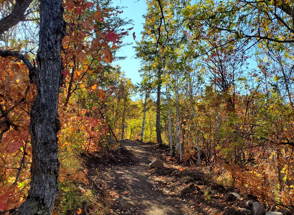
Typical section of trail in tall forest, on the What Goes Up trail.

Taking a tight steep turn on Blue Crush, an intermediate DH trail.
My checkout ride to hit everything was 9 miles with 1900
feet of overall climbing. I did not follow the trail that forks northbound
off lower Green Mile (which appears to connect to Highway 39), so it's not
included in this review.
In general, the trails are heavily forested in mature oak
and maple with occasional stands of aspen. The trails are engineered
bench-cut with banked turns and man-made bumps.
Where the trails cross roads, there is rockwork that makes the trail
entry obvious.
Much of the soil here is a type of clay that's miserable when wet. In spring, trail
surfaces often crack deeply and erode easily. I don't recommend riding
here in early spring or after heavy rains!

The entry to upper Shane's World from paved road in the subdivision.

A rare stretch of sun-exposed trail, heading east on Shane's World.
You can shuttle the trail system by driving to the
water-tank road on Old Snowbasin Road (see below). There are several ways
to do loop rides through the area. See the descriptions in the individual
trail listings below. For most riders, the highlight of this riding area
is the set of three DH trails on the northwest corner (Green Mile, Blue
Crush, and Blackhawk Down).
Trailhead and Shuttle Info

Looking west toward Pineview from the Nighthawk Lane pull-off.
Legacy Mountain entry on Nighthawk LaneFrom Highway 39 south of Pineview Reservoir, turn onto Old Snowbasin Road.
Take the second right, Quail Lane. As the road turns uphill, turn right
onto Nighthawk Lane. At the Legacy Mountain sign, turn to the right into a
small parking area. The Home Run trail is east of the sign, heading
downhill toward the lake. The Last Dance trail climbs the hill across
Nighthawk Lane.
NOTE! I don't know if this primitive parking strip will be available in the
future. It's marked as a building lot, and I saw a "sold" sign there when I rode.

Looking north as the paved water tank road turns off Old Snowbasin Road. The doubletrack on the right is the way down to Goes To 11.
Goes To 11 entry off Old Snowbasin RoadFrom Highway 39 south of Pineview Reservoir, turn onto Old Snowbasin Road.
Drive 2.5 miles uphill. As Old Snowbasin Road makes a turn to the left,
turn to the right on the paved road to the community water tank. The
doubletrack heading downhill to the right, just after the water tank road
leaves Old Snowbasin Road, will take you 100 yards downhill. Veer to the
left when you spot the singletrack Goes To 11.
This spot can function as a shuttle drop-off. The right side of the water tank road, just
uphill from the doubletrack, has a broad gravel shoulder. There's room for around 5 to 6 cars. Do not block
the gate on the water tank road!
Loops and Climbing Trails
Last Dance trail - clockwise climbing route

The entry to Last Dance, south uphill. We're looking across Nighthawk Lane from the entry to parking.
The Last Dance trail climbs from the parking spot on
Nighthawk Lane. It's part of a climbing route that includes two sections
of Last Dance separated by 1/10th mile of road, Shane's World, another
1/10th mile of road, then another section of unlabeled singletrack to
upper Goes To 11. (At the top of Last Dance, some riders divert onto John
Wick and Crazy 8's then climb upper Home Run.)
The first segment of Last Dance is 0.4 miles of gentle
non-technical climbing. It ends on paved road. Ignore the circle on your
right and turn left to ride pavement for 0.1 mile. As the paved road turns west (veering to the
right), find the second portion of Last Dance on your left.

Last Dance is less forested than most routes in the area, with frequent open views.

Making our connection. The continuing trail is on the left as the paved road turns right.
The second portion of Last Dance's singletrack is 0.3 miles. This segment is also easy singletrack with a gentle rate of climb.
It extends from the road up to a trail fork with Shane's World and
John Wick.
Last Dance ends at a trail fork 0.8 miles from the trailhead
parking. Straight ahead is Shane's World, which can take you up to paved
road (where you can again turn to the left and pedal until you find
continuing singletrack for the climb to Goes To 11). To the right is John
Wick, which connects to Crazy 8's.

Climbing upper Last Dance.
Shane's World trail (clockwise climbing route)

Shane's World is similar to Last Dance, being more sun-exposed with more views than other area trails.
Shane's World is an easy short trail that links the top of
Last Dance to Nighthawk Lane higher on the mountain. It's 0.4 miles long
with just over 100 feet of climbing.
Shane's World can be part of a continuous climbing route
from the parking on Nighthawk Lane to upper Goes To 11. This is Last
Dance, a section of road, upper Last Dance, Shane's World, another section
of road, then unlabeled singletrack to Goes To 11 at 5700 feet. This trail fork is 0.2 miles
below the origin of Goes To 11 on the Old Snowbasin Road.

Another trail view on Shane's World.
Shane's to Goes To 11 (clockwise climbing route)

The top end of the connector trail, seen from downhill on Goes To 11.
This section of singletrack creates a loop ride, but as of
August 2024, it's not on Trailforks and has no name on the signpost. It's
0.2 miles long, linking upper Nighthawk Lane to Goes To 11 at 5700 feet
elevation.
This section of trail can be part of a clockwise climb for a
loop ride. The climb starts at lower parking via Last Dance, a section of
road, upper Last Dance, Shane's World, another section of road, then this
piece of unlabeled singletrack to Goes To 11. The trail ends on Goes To 11
at a spot 0.2 miles below the origin of Goes To 11 on the Old Snowbasin
Road. The trail junction occurs just uphill from where Goes To 11 crosses
an old dirt road (the same dirt road that you took to leave pavement at
the bottom).

Typical trail scene.

Lower origin of the trail on dirt road.
To find the bottom of the trail, climb from the top of
Shane's World to the road. Turn left and pedal 1/10th mile. When the road
reaches a turn-around circle, veer to the right on a dirt road. In 100
feet, turn onto the singletrack on the left.
Home Run trail (counterclockwise loop, climb to DH trails)

The Home Run trail begins at the Legacy Mountain entry sign, just downhill from the parking area.
The Home Run trail is an important route within Legacy
Mountain, linking the lower parking at the subdivision entry to the Goes
To 11 trail on the upper mountain. From bottom to top, it has connections
to We All Float, Crazy 8's, What Goes Up before it ends on Goes To 11.
Home Run is 1.3 miles long, with a lowest elevation of 5200
feet where it contours the hill above Highway 39 and a top of 5475 at Goes
To 11.

Typical trail view on Home Run, with aspen, maple, and oak.

Approaching a ravine with a wooden bridge.
You can use the whole length of Home Run as a climbing route
from the base up to Goes To 11 -- and then over to the DH trails (Green
Mile, Blue Crush, and Blackhawk Down). If you're new to the area, this may
be your best option. Experienced riders often use only the upper portion
of Home Run as a climbing route for doing laps on the DH trails, getting
uphill via Last Dance and a combination of road links and other trails.
The lower portion of Home Run is a good return path back to parking.
While most of Home Run lies in mature oak
forest like the other Legacy Mountain trails, the eastern 1/2 mile skirts
the property border between forest and farmland. On this traversing
section, there are unobstructed views to the north of Pineview Reservoir
and the surrounding mountains.

Eastbound on lower Home Run.

Climbing a steeper section of Home Run, between We All Float and Crazy 8's.
The section of Home Run between We All Float and Crazy 8's
has 0.3 miles of peg-the-meter climbing at 12% pitch. It's straight and
non-technical, but it's a harder grunt back to the top of the DH trails
(when you continue on to the end of We All Float) than the combination of
What Goes Up and upper Home Run. (See the map.)
When scouting the tracks of regular Legacy riders in summer
2024, it seems that most of them save lower Home Run (from We All Float to
parking) for the final piece of their ride.

We're about to leave the forest as we finish the ride and head back to parking.

Arriving at Goes To 11 after climbing Home Run. The DH trails are to the right.
When you reach the top of Home Run, turn to the right to
take lower Goes To 11 over to the top of the DH trails. (This trail fork
was unmarked in August 2024).
Or head uphill on Goes To 11 for an up-and-back.
Variations on loop rides
John Wick trail - option off clockwise loop

Fork with John Wick, as seen from Shane's World.
The John Wick trail is an easy short connector between the
trail fork where Last Dance becomes Shane's World and the top of Crazy
8's. It's only 0.3 miles long, and for the most part is a traversing trail
with little elevation change.
Many riders climb from parking to John Wick (including
1/10th mile on pavement between two segments of Last Dance). Then they
cross the road to Crazy 8's and drop down to Home Run where they climb up
to Goes To 11.
John Wick ends on Nighthawk Lane across from Crazy 8's.

Traversing the hill on John Wick.
Crazy 8's DH trail (combine w John Wick)

Entry to Crazy 8's, across from John Wick, on Nighthawk Lane.
The Crazy 8's trail drops off Nighthawk Lane as the
continuation of John Wick from Last Dance or Shane's World. It's only 0.3
miles long, ending on the Home Run trail -- aiming in the uphill
direction.
Crazy 8's drops 150 vertical feet. While not highly
technical, the steepness of the multiple tight turns makes Crazy 8's an
expert-level trail.

An open look at Pineview from Crazy 8's.

Turns are very steep. Perhaps some riders can successfully attack them uphill, but you'll probably be happier riding this trail downhill.
Although listed as a two-way trail, Crazy 8's was obviously
built to be done in the downhill direction. The turns are simply too steep
for most riders to power up.
Most riders who hit this trail climb via Last Dance, then
take John Wick to the top of Crazy 8's. After dropping to Home Run, the
obvious path is to climb up to Goes To 11, then fork right to the top of
the DH trails.

Like most trails in the area, Crazy 8's runs through north-facing mature forest.
Shuttled rides, add-on miles, final connection to DH
trails
Goes To 11 trail
 straight segment of Goes To 11, heading north just after the top of Home Run.")
Looking down a (rare) straight segment of Goes To 11, heading north just after the top of Home Run.
The Goes to 11 trail links the Old Snowbasin Road to the top
of the three DH trails (Green Mile, Blue Crush, and Blackhawk Down). Many
riders will shuttle to the top of Goes To 11, but the trail rides both
directions and is a nice -- but strenuous -- out-and-back. The trail is
0.9 miles long, twisting through an oak forest with almost constant turns.
As an uphill, the middle portion of Goes To 11 has a
constant moderately steep pitch. There will be 300 feet of climbing in a
bit over 0.5 miles.
You can connect to the Snowbasin area trails from the top of Goes To 11
by climbing up the Old Snowbasin Road. For example, it's 1.1 mile to the
Art Nord trailhead and the Wheeler Creek trail.

Heading into a turn as we climb Goes To 11 out-and-back.

There are a lot of bridges within the trail system, aiding your passage over the many little ravines.
At 0.2 miles from the top of Goes To 11, or 0.5 miles uphill
from the fork with Home Run, a trail forks away to the east. This trail
links to a subdivision road uphill from the end of Shane's World. This
route (Last Dance and Shane's World) provides an alternate climb or
descending path, but it's interrupted by two sections of paved road, so
you need to know where you're going.
As a shuttled downhill, Goes To 11 is a quick fun ride in
the northbound direction. But it's not a high-speed, wide-open descent.
Turns are linked together in series, and they're tight enough that you
can't just roll. You'll be using a bit of brake.

A view from the highest point of Goes To 11, near the water tank.

There are a ton of turns on Goes To 11. Most are banked, but are tight enough that you can't "turn loose and bomb down."
As mentioned, Goes To 11 is your route to the DH trails. If
you arrive at the top of Home Run, turn to the right on Goes To 11 and
pedal 0.2 miles (with another 50 feet of climbing) to where two DH trails
split away within about 50 feet before Goes To 11 ends and Green Mile
continues straight.
DH Trails!
Blackhawk Down DH trail

Blackhawk Down begins at this sharp highly-banked turn of Goes To 11.
The Blackhawk Down DH trail is a one-way expert
downhill-only trail. It forks away from the downhill end of Goes to 11,
just a few feet uphill from the origin of the Blue Crush and Green Mile DH
trails. As Goes to 11 makes a hard left turn with a steep bank, go
straight to pop up and over the bank to enter Blackhawk Down.
Blackhawk Down is 0.4 miles long, descending 200 vertical
feet before ending on Blue Crush. Then there's another 0.1 mile of
downhill before you can turn back uphill for another lap.

Blackhawk Down is steeper than Blue Crush, but is similar in character.

Looking back uphill at a series of bumps and wiggles.
Turns are banked, but are a bit tight for high speeds. Like
Blue Crush, there will be bumps that can function as jumps. The trail is
rated expert, but there are no obligatory drops or gap jumps. A skilled
upper-intermediate rider should be able to handle this descent.
At mile 0.2 of Blackhawk Down or mile 0.3 of Blue Crush, the
two routes run side-by-side for 50 yards. Some riders cross over here. To
stay on Blackhawk Down, keep to the right on the lower trail.
Blackhawk Down joins Blue Crush for 100 yards. You'll then merge with
Green Mile for around 50 yards before you reach a trail split. The right
trail is What Goes Up, which will climb to Home Run for a return to the
top. Downhill to the left is We All Float, which connects to Home Run for
a return to the trailhead.

Too close for comfort. Some riders cross over here. Blackhawk Down is on the right, while Blue Crush is the higher trail on the left.

Plunging down Blue Crush.
Blue Crush is a downhill-only intermediate-level trail. It
begins on the downhill end of Goes To 11, between the start of Blackhawk
Down and Green Mile.
Blue Crush is 0.6 miles long, descending 300 vertical feet.
Turns are highly banked, but some are tight enough that you'll need to tap
your brakes to avoid blowing through them.
Many bumps come in sets of two. If you have significant speed, you'll
need to treat these as gap jumps.

Typical highly-banked engineered turn on Blue Crush, with Pineview as a backdrop.

A series of rounded tables on a rare straight section of Blue Crush.
Blue Crush joins Green Mile just above the What Goes Up
trail fork. If you keep to the right, you'll head back uphill for another
lap.
A left turn downhill takes you on We All Float 0.2 miles to Home Run.
Here you can either go to the Nighthawk Lane trailhead, or climb the
steepest section of Home Run to get back uphill for another lap.

Entry to Green Mile as Goes To 11 ends, straight ahead. That's Blue Crush on the right.
The Green Mile DH trail is a one-way, easier descending
route. It's 0.9 miles long, descending 300 vertical feet. It begins at the
end of Goes To 11 and ends at the trail fork with What Goes Up and We All
Float.
At 0.8 miles downhill, I ran across a trail sign that
confused me. There's a fork here, with the right fork dropping downhill to
join Blue Crush. A sign "Fight Club" is oriented as if
it's the name of the trail to the right. The trail to the left (which
would be your path if you kept straight) does not rejoin the trail system.
Strava's heat map indicates that it's a seldom-used route down to Highway
39.
So, drop to the right at this trail fork!

Trail fork where the Green Mile DH route continues on the right at the "Fight Club" sign.

Green Mile has longer straight sections than Blue Crush.
Around 100 feet after joining Blue Crush, you can keep to
the right to climb What Goes Up -- which will take you to upper Home Run
for the climb up to Goes To 11.
In my opinion, Green Mile isn't appropriate for true
beginners. It takes a bit of strength to get up there, and Green Mile
itself is more of an unskilled-but-experienced, early-intermediate type.

Rolling a banked turn on Green Mile.
Return Routes from DH trails
What Goes Up trail

Standing on the trail fork where the DH trails end. To my left is We All Float. Straight ahead is What Goes Up.
What Goes Up links the bottom of the three DH routes (Green
Mile, Blue Crush, and Blackhawk Down) to upper Home Run for a climb back
uphill.
What Goes Up gently climbs through forest for 0.4 miles
before descending to a junction with Home Run. Keep to the right (uphill) at this trail
fork.

What Goes Up descends to meet Home Run to continue the climb back to the top of the DH trails.

We All Float twists around through thick forest.
We All Float is a short connector between the bottom of the
DH trails (Green Mile, Blue Crush, and Blackhawk Down) and Home Run. It's
0.2 miles with a bit of trivial up-and-down.
Most of We All Float is in tall forest of mature oak, maple, and aspen.
You can use We All Float as a climbing route, taking Home
Run from parking, then We All Float, then What Goes Up to upper Home Run.
(This bypasses a steeper climb on Home Run.)
Most riders will ride We All Float in the west-to-east direction when
they've finished their DH laps and are headed for Home Run to ride back to
parking.

Dropping through the ravine near Home Run, eastbound.
Bottom Line!Good trail system. Lots of fun stuff and multiple riding options. The DH
trails will be the target for most riders. Climbing rates are occasionally
a bit stiff for beginners and intermediates. The clockwise climbing route
(with diversions onto paved roads) can be difficult for newcomers to
navigate.
Getting there:
Legacy Mountain entry on Nighthawk Lane
From Highway 39 south of Pineview Reservoir, turn onto Old Snowbasin Road.
Take the second right, Quail Lane (at the Edgewater sign). As the road turns uphill, turn right
onto Nighthawk Lane. At the Legacy Mountain sign, turn to the right into a
small parking area. The Home Run trail is east of the sign, heading
downhill toward the lake. The Last Dance trail climbs the hill across
Nighthawk Lane.
Goes To 11 entry off Old Snowbasin Road
From Highway 39 south of Pineview Reservoir, turn onto Old Snowbasin Road.
Drive 2.5 miles uphill. As Old Snowbasin Road makes a turn to the left,
turn to the right on the paved road to the community water tank. The
doubletrack heading downhill to the right, just after the water tank road
leaves Old Snowbasin Road, will take you 100 yards downhill. Veer to the
left when you spot the singletrack Goes To 11. This spot can function as a shuttle drop-off. The right shoulder, just
uphill from the doubletrack, has room for around 5 to 6 cars. Do not block
the gate on the water tank road!