and Midmountain Extension trail
The Humdinger (aka Midmountain Connector) trail links the Midmountain Extension to the trails of the Mayflower system. New in 2024, this trail allows bikers to reach Spin Cycle (and the new Mayflower trails) on dirt, without navigating through complex private subdivision roads. This Park City area trail is on an east-facing slope between US Highway 40 and Deer Valley.

 before Humdinger ends on Midmountain at 7950 feet elevation.")


The Deer Crest Trailhead is located at the uphill corner of a three-section parking lot just off Deer Hollow Road. (This route is heavily impacted by construction in 2024. The directions here take you around a closed section of Deer Hollow Road.) Exit US-40 at Mayflower. Turn east toward the reservoir, then left on Jordanelle Parkway. Turn left under US-40 onto Mayflower Mine Road. Veer left to go south. Turn right to head uphill on Deer Hollow Road, then left again to pass between two large buildings. Now work your way uphill to the far corner of the parking area, where you'll see the kiosk. Head uphill to start your ride on the We'll Go From There trail.

Drive to Deer Hollow Road as above, but continue uphill past the large buildings for another 100 yards. Turn to the left into a large parking area. Head toward the little wood-and-glass kiosk. Find a trail that heads away from parking. Keep to the right and uphill as the "We'll Go From There" joins.

First! Consider parking in town and taking the Park City shuttle bus up to Silver Lake Lodge at Deer Valley Resort. If you're driving, follow the signs toward Deer Valley Resort. To get to the upper (Silver Lake) lodge, turn left on Royal Drive just after the road divides -- before you actually see the Snow Park (lower) lodge. Drive 4 miles uphill, following the signs to the Silver Lake lodge. (I recommend parking at the lower lodge and taking the city shuttle bus uphill instead of driving to the upper lodge.) Once you're at the lift area, face the mountain and look around for trail signs. The northbound Midmountain Trail is to your right, coasting downhill to the underpass then left onto singletrack. The Midmountain Extension is to your left, beginning as a doubletrack. It will be 0.9 miles to the Midmountain Connector trail.
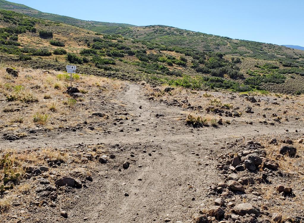
, looking to the trail fork where the top of the Connector trail begins.")
The trail fork is 0.7 miles from the Deer Crest trail if you're coming from lower Deer Valley.


At mile 2.1, keep straight as an intermediate-level DH trail forks downhill to the right. (This downhill trail is also new in 2024. I'm told the name will be "Rory of the Mountain." After crossing a doubletrack, it will climb to upper Kaboom. See the Mayflower page for information.)
Other trail connections are planned for the future as the Mayflower system is developed.


If you're arriving via bike at the resort staging area, southbound Midmountain joins doubletrack to go under a ski overpass. Then you'll pass in front of the resort buildings. Stay straight across the broad multi-trail base area until doubletrack converts to singletrack heading eastbound. This is the Midmountain Extension.
The Midmountain Extension official ends at the intersection with Deer Crest and Ripple at mile 1.6 from Silver Lake Lodge.

Getting there, Midmountain Extension at Deer Valley
In Park City, follow the signs
toward Deer Valley Resort. (I recommend you park in town -- or at the lower Deer Valley Lodge -- and take the shuttle bus up to Silver Lake Lodge.) To drive to the upper (Silver Lake) lodge, turn left on Royal Drive just
after the road divides -- before you actually see the Snow Park lodge.
Drive 4 miles uphill, following the signs. Note that in 2017 the previous
parking lot no longer exists, being replaced by a new building. So on
weekends your chance of finding a parking spot aren't good. You can park
at the lower Snow Park lodge and take the city shuttle bus uphill. Once
you're at the lift area, face the mountain. Your
ride will start by turning 90 degrees to the left and riding east. This is the Midmountain Extension. (The northbound Midmountain trail is to the right downhill to the underpass. As
you pass underneath, turn left onto singletrack. This is the northbound Midmountain Trail.)
Deer Crest (We'll Go From There) Trailhead
The Deer Crest Trailhead is located at the uphill corner of a three-section
parking lot just off Deer Hollow Road. (This route is heavily impacted by
construction in 2024. The directions here take you around a closed section of
Deer Hollow Road.) Exit US-40 at Mayflower. Turn east toward the reservoir, then
left on Jordanelle Parkway. Turn left under US-40 onto Mayflower Mine Road. Veer
left to go south. Turn right to head uphill on Deer Hollow Road, then left again
to pass between two large buildings. Now work your way to the right uphill to the far
corner of the parking area, where you'll see the kiosk. Head uphill to start
your ride on the We'll Go From There trail.
Mayflower (You Get It) Trailhead
Drive to Deer Hollow Road as above, but continue uphill past the large buildings
for another 100 yards. Turn to the left into a large parking area. Head toward
the little wood-and-glass kiosk. Find a trail that heads away from parking. Keep
to the right and uphill as the "We'll Go From There" joins.