Looking down to a turn in the Hickman Hill beginner loops. Eagle Mountain trails...
Looking down to a turn in the Hickman Hill beginner loops. Eagle Mountain trails were first photographed and described by Bruce in 2009, with the latest update September 22, 2022.
Eagle Mountain - North Trails
Nirvana, Brass Monkey, Creed, Hickman beginner loops, Hidden Canyon, Rockabilly

This trail page discusses the trails on the northern end of the Hidden Canyon area in Eagle Mountain's trail system. Note that a quick description of all trails can be found on the Eagle Mountain Overview Page . Other area trails are described on pages for the southern Eagle Mountain trails , the Eagle Mountain Race Loop , the Mountain Ranch Bike Park , the Treadstone-area (Prayer Flag hill) trails , and the Lake Mountain slope trails .

In September 2022, I must caution you that these northern trails continue to be affected by expanding subdivision construction. The paved Hidden Hollow trailhead is open for parking, but development of the surroundings -- including the routes from parking to trails -- is ongoing at this time. While every effort is being made to keep an open route through to the trails, there will be occasional closures.
Looking down Rock-a-Billy, one of the trails that connects the Pony Express Park...
Looking down Rock-a-Billy, one of the trails that connects the Pony Express Parkway area to the trails further south.
Trailheads
Parking lot, looking southwest.
Hidden Hollow
The Hidden Hollow trailhead is open, with room for over 40 vehicles. But work on the amenities and the surrounding hillside is ongoing in fall 2022. You'll need to find your way to the trails through a construction zone. When complete, this trailhead will have all services, which may change your parking, trail access, and riding plans.
The connector to Rock-a-Billy can be found on the southern end of the parking strip. A doubletrack across the road to the west will take you to the Hickman Hill loops and to Supersonic, Cracker Jack, and Given-to-Fly southbound, plus Creed and Brass Monkey northbound.
Looking down on the race staging area from Treadstone.
Rockpile race staging area
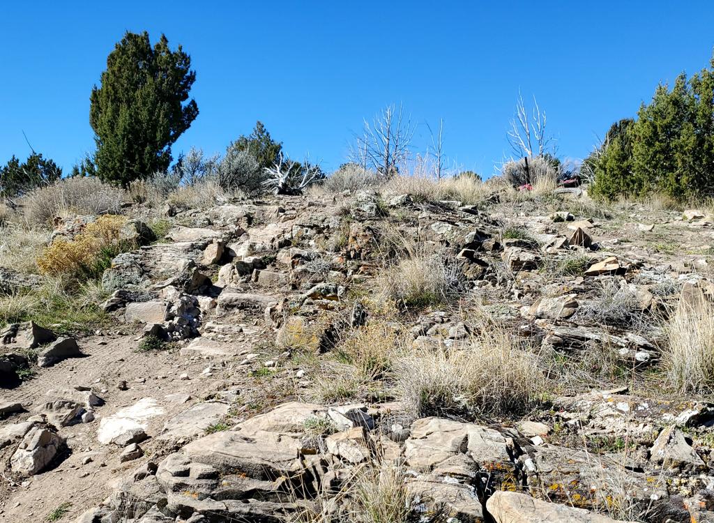
On Pony Express Parkway heading west, turn left to the Hidden Canyon road at 1.1 miles from Ranches Parkway. Continue up the paved road until it turns into dirt. Keep generally left and heading southeast at any road forks, staying just below the slope of the hill on your left. When you reach a rockpile followed by a broad open area with several dirt roads forking away at mile 1.3 from Pony Express Parkway, you're there. The northern trails are most easily reached by taking Deer Tracks to Cracker Jack, just up the hill west of the staging area.
Brass Monkey
At the trail fork heading north. Take a left turn for Brass Monkey. (The handleb...
At the trail fork heading north. Take a left turn for Brass Monkey. (The handlebar is sticking up from a bike lying on the side of the Hickman Hill loops connector.)
The Brass Monkey trail runs around Hickman Hill on the western side. It begins by forking away from the southern end of Creed. After riding around and over the flank of the hill, it connects to the bottom of Nirvana at the Pony Express Parkway.
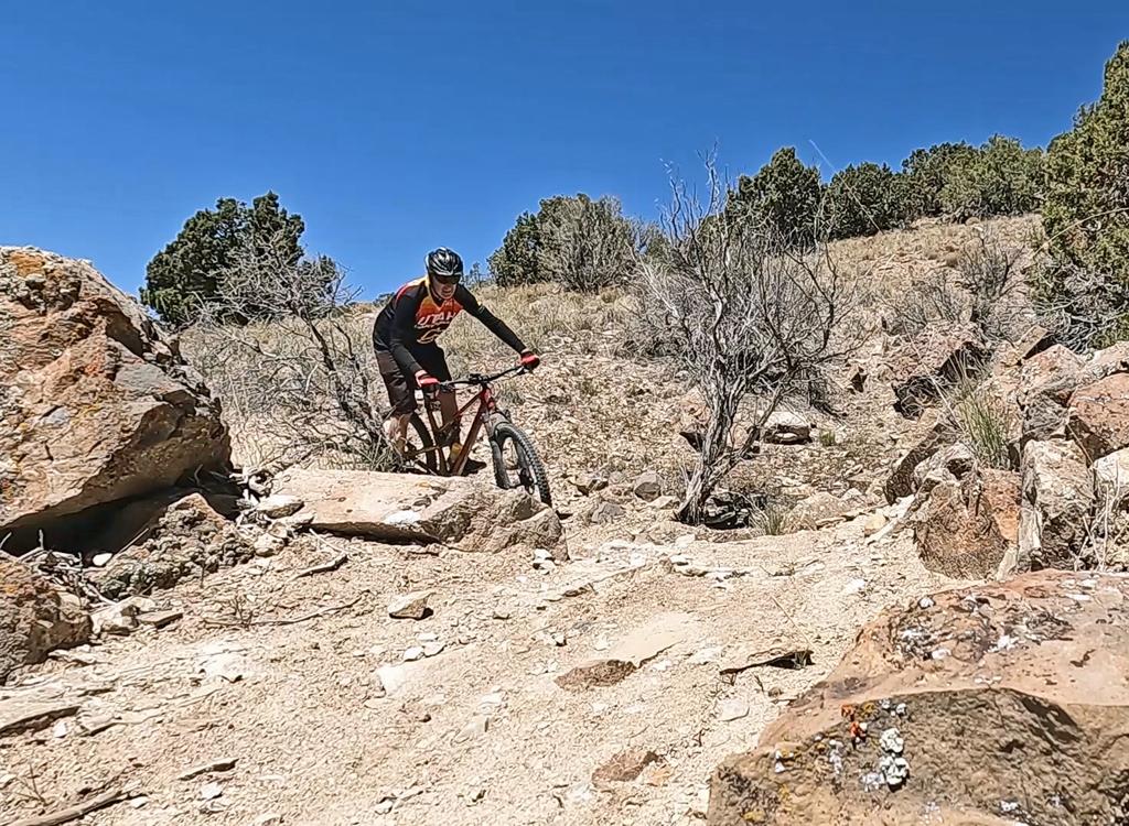
Brass Monkey is 0.9 miles long and has around 100 feet of climbing when done in either direction. It requires intermediate riding skill and aerobics.
From the south, as the Given to Fly connector crosses the ATV track and becomes Creed, the connector to the Hickman Hill beginner loops forks 90 degrees right. Then the trail splits. The left fork is Brass Monkey; the right fork is Creed.
Creed has a short connector to the climbing trail (Radio Free Europe) of the beginner loops. Creed can be an alternate quicker climbing route for any of the three DH trails of the Hickman Hill loops. It's 0.3 miles from the intersection of I-15 and Creed to the connector.
Climbing through the junipers on Brass Monkey.
Decending Brass Monkey northbound towards the Pony Express Parkway..
After the trail descends down to the farmland along the Pony Express Parkway, the trail will veer to parallel the road westbound. After crossing the open field, it will hit the bottom of Nirvana at the sage brush.
Creed Trail
Creed is 1.4 miles in length, spanning between the Given to Fly trail (after it descends off the hill northbound) and the Pony Express Parkway. The trail climbs up and over a hill -- whichever direction you ride it. The climbing is around 250 vertical feet.
Heading away from the Pony Express Parkway on a north-to-south ride on Creed in ...
Heading away from the Pony Express Parkway on a north-to-south ride on Creed in late December 2017.
Jumps and drops are of modest size, and all have easy ride-arounds.
The trail can be done either direction, but it rides much better from south to north. However most riders do it north to south to take advantage of the stunts built into the southern end. The southern end is about 50 vertical feet higher than the northern end, so there's a bit less climbing to get to the top of the hill. Also, there are turns and drops on the north face of the hill that are easy to descend but difficult to climb.
On the southern end, Creed starts by forking away from Given to Fly just before it reaches a doubletrack at a field of winter wheat in the valley. If you're riding west from the trailhead area, turn left at this unmarked trail fork. After about 100 yards westbound, the trail will turn north, cross the valley, then begin climbing the small hill.
There are open views of the mountains as the trail twists back and forth. Thats ...
There are open views of the mountains as the trail twists back and forth. That's Timpanogos straight ahead of my bike.
A bermed turn hugs the slope above the subdivision and elementary school to the ...
A bermed turn hugs the slope above the subdivision and elementary school to the northeast.
To start from the northern end, park east of Hidden Valley Elementary School. Take the sidewalk, then paved path, west along the Pony Express Parkway until you spot the trail on the hill to your left. In 2017, you'll need to rattle through some cobble decoration to reach the trail above it, because there's no formal trail connection here. Your second chance is a direct uphill connector at the (temporary) end of the paved path.
Turns are bermed for speed, and there are plenty of spots to launch. But the trail is OK for an early intermediate rider.
The south end of Creed connects to Brass Monkey and I-15 (to the Hickman Hill flow loops). From this intersection the trail continues southbound across the shallow valley to Given to Fly with connections to Supersonic and Cracker Jack.
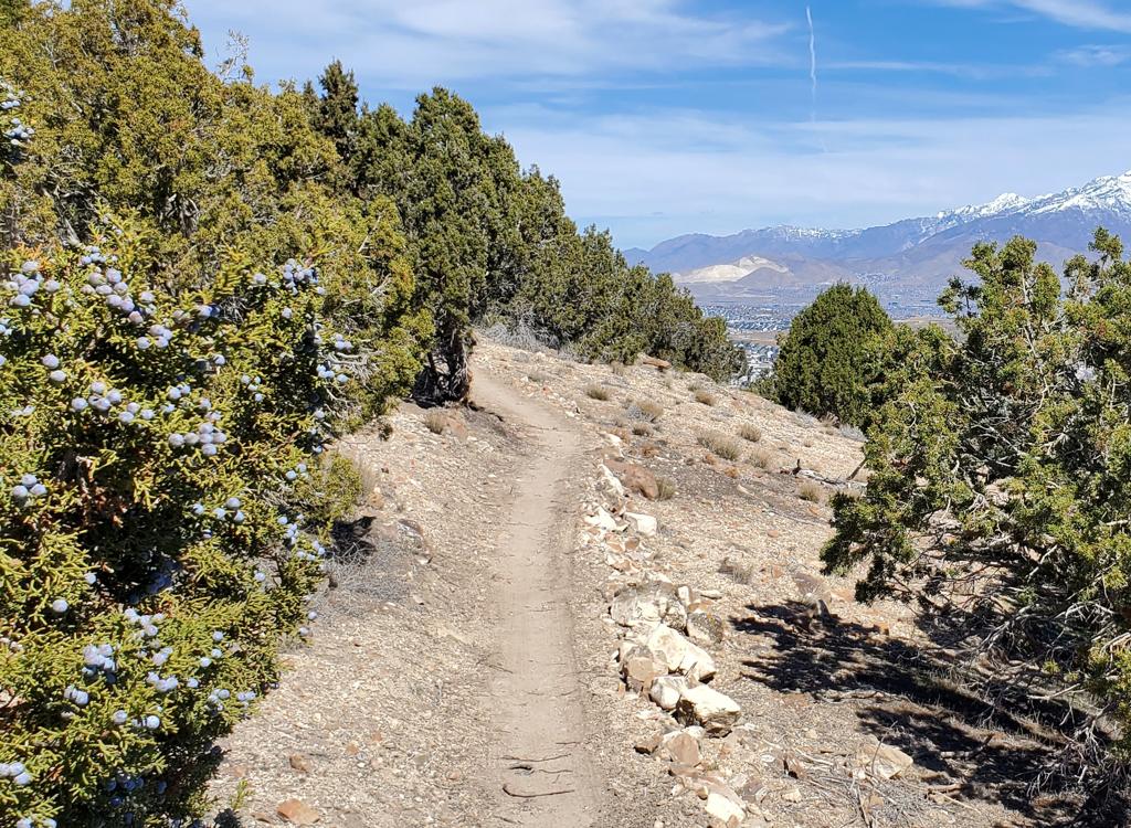
Cresting the top of the hill, with the Oquirrh Mountains to the west behind me.

Creed Trail and the northern end of Treadstone...

[Back to video list ]
Hickman Hill beginner loops
The two-way I-15 trail begins on fairly flat terrain about 1/10th mile west of t...
The two-way I-15 trail begins on fairly flat terrain about 1/10th mile west of the main parking lot. Once it begins climbing to the north, it will become Radio Free Europe and is one-way.
The Hickman Hill trails lie east of the southern side of Creed, just uphill from the subdivision in Hidden Canyon. At this time (September 2022) there's a short two-way trail called I-15 that extends 0.2 miles from the southern end of Creed to the bottom of the first DH, a 0.6-mile climbing-only trail, and three downhill-only flow trails 0.4, 0.3, and 0.2 miles in length.
At this time access is a bit tricky. Directly below the loops is active road and home construction for the subdivision. For now, park in the large paved Hidden Hollow parking lot, then cross the construction area west of the middle of that trailhead to an ATV road going west. Find a connector uphill to I-15 on your right. Now turn right again to go north. I-15 will turn into Radio Free Europe after you pass two DH trails that join I-15 on your left from uphill.
You can also climb Creed to the beginner loops. At mile 0.3 miles from I-15, Creed has a 100-yard connector to the top of Radio Free Europe, allowing you to quickly get onto any of the three DH flow trails.
On the upper hillside, the trail begins to run back and forth, so theres always ...
On the upper hillside, the trail begins to run back and forth, so there's always a recovery between each turn.
Radio Free Europe - one-way climb for the flow trails
On the upper hillside, the trail runs back and forth. Theres always a recovery b...
On the upper hillside, the trail runs back and forth. There's always a recovery between each turn.
The counterclockwise loops begin with a climb up an easy trail, Radio Free Europe. The riding is suitable for experienced beginners. Younger children may find the amount of climbing beyond their physical ability, but older experienced kids should do fine.
Each lap will be between 0.8 and 1.0 miles with approximately 120 vertical feet of climbing per lap.
Radio Free Europe itself is 0.6 miles long, with 100 feet of elevation change. There's some occasional brief downhill coasting, which brings total climbing to around 120 feet per lap. At the top, you'll be joined on the left by a connector trail from Creed. Keep straight.
Now you'll reach a three-way trail split. To the right is the easiest and longest DH flow route, Huey & Louie. Straight ahead is Rick Roll, which is steeper and has a short bit of bumpy rock. To the right is the most difficult DH route (not yet named as of September 2022).
Climbing around a broad turn, looking south.
Huey & Louie - easiest DH flow trail
Huey & Louie has flatter traverses between banked turns.
As you head southbound on the top traverse of Radio Free Europe, you'll come to a three-way trail split. The option to the left is Huey & Louie, the easiest of the downhill flow options. This trail is 0.4 miles long and will descend just under 90 vertical feet.
Huey & Louie becomes almost flat between the turns so it's done at lower speed. When you get to the bottom, you can veer right to return on the I-15 access trail, or keep straight and left to begin another climb on Radio Free Europe.
Looking down from the climbing trail at the second turn in the DH flow trail.
Rick Roll - faster DH flow trail
This is a rough as the riding gets. On the second flow trail, theres this bit of...
This is a rough as the riding gets. On the second flow trail, there's this bit of exposed rock.
The second downhill option is straight ahead at the three-way trail split. This is Rick Roll. It's a bit steeper than Huey & Louie, but is also quite easy to ride. Rick Roll is 0.3 miles long and will descend 100 vertical feet. It ends on I-15 about 150 feet downhill from the bottom of Huey & Louie and Radio Free Europe
Rick Roll maintains more slope between the turns, so it's done at higher speed. There's also a short stretch of bumpy rock to ride over. Nothing tricky but it may spook kids -- especially if they haven't learned to stand on the pedals yet.
Looking down toward the homes under construction in Hidden Valley.
DH Flow Trail #3
This trail is steeper and straighter than the other two DH flow options.
At the three-way trail split at the top of Radio Free Europe, fork to the right (slightly uphill) for the most advanced DH flow option. This route is 0.2 miles long. It's within the abilities of intermediate riders, although there's a spooky rock section that some will choose to walk.
This route ends on I-15 right at its origin on Creed. On your left is the skills area, still under construction in September 2022. For another trip to the top, turn left on I-15.
Rolling into a set of rock ledges. No problem.

Hitting all three of the Eagle Mountain DH flow routes in one video...

[Back to video list ]
Hickman Hill Skills Area
Riding through the beginner skills area.
The skills area lies just uphill from the western side of I-15. It is still under construction at this time and is not open for riding.Stay tuned!
Rock-a-Billy
Southbound early on Rock-a-Billy. Junipers occasionally obscure the sight lines,...
Southbound early on Rock-a-Billy. Junipers occasionally obscure the sight lines, so be cautious about riders coming the other way!
Rock-a-Billy forks to the south from the Hidden Canyon trail 0.2 miles uphill the paved Hidden Hollow trail (which forks from the Pony Express Parkway paved trail just east of the entry road). A bit further south, Rock-a-Billy can also be reached via a short connector trail from the paved Hidden Hollow trailhead.
Rock-a-Billy is 1.1 miles long, climbing 200 vertical feet from Hidden Canyon to Cow Tracks (riding south). Surface is early-intermediate technical, effort level is easy.
Rock-a-Billy rolls up and down, but generally climbs, as it traverses the western slope of Lake Mountain. The Rock-a-Billy trail ends on the Cow Tracks trail just above the "Rockpile" parking area.
Looking downhill toward the parking lot from the intersection of Rock-a-Billy Co...
Looking downhill toward the parking lot from the intersection of Rock-a-Billy Connector's south limb.
Climbing uphill on the northern limb of the Rock-a-Billy Connector as we approac...
Climbing uphill on the northern limb of the Rock-a-Billy Connector as we approach the trail, headed for Hidden Canyon and the bike park.

At this time, you'll find the Rock-a-Billy connector trail just south of the paved parking area in Hidden Hollow. The hillside around the parking lot is still being smoothed at this time, so the location of the trail entry will likely change.

The trail splits 1/10th mile uphill. The left fork will join Rock-a-Billy northbound and will take you to the Hidden Canyon trail (and ultimately, the Mountain Ranch bike park ). The right fork takes you to Rock-a-Billy southbound for a trip to the rockpile area and the central area trails .

Other Trails and Connections
Paved Access Trail
From the paved bike path along the Pony Express Parkway, there's a new paved trail extending uphill into Hidden Canyon. At this time (June 2022) it's only partially paved, but will provide a connection uphill to the Hickman Hill beginner trails as well as Creed, Brass Monkey, Supersonic, and Given to Fly. For now, it ends on Hidden Valley Parkway just north of the trailhead. I anticipate that a riding path will connect to the trailhead.
Paved bike path from the road.
Given to Fly
Given to Fly begins in a shallow valley just west of the paved Hidden Hollow trailhead. It's two-directional, but you'll like it more as a downhill. As a climber, it's mellow and easy at first, then reaches a steep area with a couple of rock drops that will probably have you pushing your bike.
Length 1.4 miles. 350 vertical feet of altitude change. The steep spots make it an upper-intermediate trail, although most of the trail is quite easy.
The bottom half of Given to Fly is very smooth and easy to ride, with minimal gr...
The bottom half of Given to Fly is very smooth and easy to ride, with minimal grade. If you're riding it uphill, things will get substantially more difficult on the second half.
Nirvana
Runs from Treadstone at the top of the Prayer Flags hill northbound to end at the Pony Express Parkway. Here there's a connector to the north end of Brass Monkey. Can be part of the northern end of a longer loop ride in either direction. NOTE! Nirvana has been interrupted by a fence in November 2022. The trail re-route is still pending.Length 2.0 miles. Vertical 300 ft elevation loss when done from south to north. Trail surface intermediate skill and aerobic requirement.
Descending Nirvana. After the initial drop, the trail will run through sage just...
Descending Nirvana. After the initial drop, the trail will run through sage just west of a flat valley.
Hidden Canyon
The Hidden Canyon trail starts just off the paved trail at the Pony Express Parkway north of Hidden Canyon Elementary. It climbs the hill to the area above the Mountain Ranch bike park, connecting to Rock-a-Billy, Ridgeline/Cow Tracks, and Golden Eagle.Length 0.7 miles, climbing 200 vertical feet when done from Hidden Canyon up to the bike park connector trails. Surface upper-intermediate technical, upper-intermediate in aerobic effort.
Looking northeast on the Hidden Canyon trail.
Cow Tracks
Cow Tracks links the trails at the top of the Mountain Ranch bike park to the "Rockpile" parking area in the middle of the Eagle Mountain trails. It contours the hillside before making a descent to the Rockpile. The trail has one steep pitch and there are some embedded rocks. Cow Tracks joins Rock-a-Billy as it descends to the east side of the Rockpile parking area.
Length 0.8 miles. Surface intermediate in technical requirement, one steep pitch of upper-intermediate aerobic effort. Around 50 feet of elevation change north to south.
The steepest spot is the climb just before the Ridgeline trail fork. Theres both...
The steepest spot is the climb just before the Ridgeline trail fork. There's both embedded and loose rock, but it's very do-able.
map
Map of northern area trails
Getting there:
Take the I-15 Lehi Main Street exit and turn west. Continue west on SR-73, crossing Redwood Road (11600 West). Continue westbound uphill. Just after climbing the hill, turn left at the stop light onto The Ranches Parkway. At Pony Express Parkway, turn right. The road will veer a bit south (left), then back west (right) as you get one mile from Ranches Parkway. After you pass a large hill on your left, just before Hidden Hollow Elementary, take the next left. In 0.2 miles turn left into the large parking area. The Rock-a-Billy connector is south of the trailhead. The ATV trail across the street from parking leads to the northern trail system.

Creed:  At 0.25 miles past the elementary school, spot the trail on the hillside to your left and cross the decorative patch of chunk rock to get there.

Race Loop (rockpile) Parking:
Note 2022! While construction crews are trying to preserve access, it is occasionally not possible to drive through construction area! If so, you must ride from the Pony Express Parkway, or take the dirt road (OHV route 1) in from the west.   On Pony Express Parkway, turn south and drive uphill past Hidden Hollow Elementary. When the pavement ends, keep as straight as possible southbound through the construction area. Drive a mile up the dirt road. After you reach the top of a small rise and see another valley in front of you, there's a big rockpile on the left. The parking is the primitive open space south of the rockpile. Deer Tracks is west of the parking area (across the dirt road), Cow Tracks is at the northeast corner, and dirt roads on the east and south connect to other singletrack trails.

Bathrooms:  None. Porta-Potty at the Mountain Ranch Bike Park. A full-service trailhead is planned for Hidden Canyon.
Camping:  No developed or designated campgrounds. Flat spots can be found in the race staging area near the rockpile.
Bike services:  UtahMountainBiking store in Lehi.

Riding resources for this trail:

GPS track files and route (right-click and "Save as..."):
     Multi-track GPX area file
High-res area topo map for printing:   View topo
Lodging, camping, shops:    Links to Provo area resources
Latest update September 2022