Bruce rolls down Cyn City. Trail review and photos July 19, 2022.
Cyn City is a downhill-only bikes-only trail located high on the mountain above Park City, new in 2022. Riding Cyn City means additional intermediate-skills trails to get to the top and to ride back from the bottom. Therefore Cyn City is recommended for intermediate or better riders, even though very experienced beginners could manage this trail by itself.
The Cyn City trail is 2.7 miles long with 700 feet of elevation loss. It begins on Charlie's 9K trail 1.7 miles west of Empire Pass and ends on the Midmountain Trail 3.4 miles west of the Deer Valley resort. The trail can be done as a shuttled ride with various downhill destinations, or as a loop ride with several options for the climb uphill.
A rare breakout from the dense forest with a view down to the ski lift area.
View of typical Cyn City trail
This is a ride that you do for the riding itself. 99% of the trail is in deep tall forest. But there will be plenty of views from Charlie's 9K trail on your way there.Most riders are starting at Bonanza Flat parking and riding a reverse-profile loop. Riders who want to get the climbing done first can park at the Midmountain parking strip on the Empire Pass paved road.
  Getting to the trail
Hitting the 9K trail from Empire Pass.

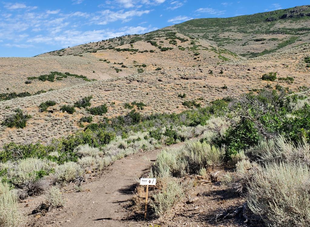
The Empire Pass parking area is the most direct route. This is also the drop-off if you're shuttling. From Empire Pass, a short connector takes you to the 9K trail, where you'll pedal 1.7 miles to the combined top of Black Forest and Cyn City at the gravel McConkey Road. The Empire Pass parking lot will usually be full on weekends, and I suggest you save it for the hikers anyway.

On the 9K trail westbound toward the top of Cyn City.

The Bonanza Flat trailhead is the preferred parking lot. The trail is next to the bathroom. Cross the road to the connector trail and pedal gently uphill until you cross a doubletrack hiking trail to continue on the singletrack Charlie's 9K . It's 2.0 miles from Bonanza Flat parking to the top of Cyn City/ Black Forest .

There's a strip of roadside parking where the Midmountain Trail crosses the Empire Pass road. This is a good option for doing a loop ride with the climbing first.

Looking uphill on Tour des Suds.

Upper Tour des Suds is a climbing route to the 9K trail. Find it on the Midmountain Trail 100 feet east of the Empire Pass paved road, combined with the Boulder trail. Turn right on Tour des Suds and climb to the doubletrack and turn left. Connect to Moosebones . When you hit the paved road, climb uphill to Empire Pass.

Connect to Boulder from Midmountain as above. After crossing the gravel road, turn left on Moosebones and climb to Empire pass as above.

Located just west of the Empire Pass paved road. Links to TG, then Upper Corvair to reach 9K at Empire Pass.
Arriving at the top of Cyn City when riding from Shadow Lake, looking east.
Team Big Bear heads uphill from Midmountain about 1/3 mile east of the Empire Pass Road. When you reach a doubletrack, turn right off Big Bear and connect to Moosebones.To the north on Midmountain. Fastest way back up. But, yeah, it's a dirt road.

This is a longer tougher loop option for conditioned skilled riders. From Midmountain north of the bottom of Cyn City (in the PCMR area) catch Tommy's Two Step uphill to the Yurt, then cross the roads to Three Candles . Take Keystone to the Shadow Lake trail. When Shadow Lake ends on old doubletrack, turn 180 degrees left onto Blazing Saddles. Fork left downhill when you reach the fork for the 9K trail and follow it a few miles to the top of Cyn City.

  Cyn City trail
Bruce rolls into a banked turn on upper Cyn City. Every turn flows nicely. The t...
Bruce rolls into a banked turn on upper Cyn City. Every turn flows nicely. The trail can be a great confidence-builder for an early intermediate rider.
Cyn City is an intermediate-level downhill-only flow trail. It's restricted to bikes. The trail begins at a bit over 9000 feet elevation and lies on a north-facing slope, for an expected riding season of late June through early October.
The trail begins on Charlie's 9K, 1.7 miles from Empire Pass. It will drop 700 vertical feet through a series of traverses, reaching the Midmountain Trail after 2.7 miles.
Another right-handed turn, this time viewed from the handlebars. The riding feel...
Another right-handed turn, this time viewed from the handlebars. The riding feels very natural and lines flow well. This trail was expertly built.
Just getting started. This is a view down the combined Black Forest and Cyn City...
Just getting started. This is a view down the combined Black Forest and Cyn City shortly after leaving the 9K trail at McConkey Road.
The first 1/4 mile will be combined with the Black Forest trail. (This section is technically two-way trail, although nobody will be expecting a rider coming uphill from Black Forest.) This first bit is straight and fairly flat. When you hit a meadow, Black Forest keeps straight while Cyn City forks away hard to the left.
Cyn City is machine cut and is heavily engineered. The traversing sections have almost constant dips and humps. The turns are highly banked and designed to be rolled with speed. The excavated platform for the trail is wide, allowing for a very forgiving riding surface.
At the bottom of a turn, the continued berm herds riders onto the traversing tra...
At the bottom of a turn, the continued berm herds riders onto the traversing trail.
The trail lies in a mature fir forest with occasional aspen. Most of the ride wi...
The trail lies in a mature fir forest with occasional aspen. Most of the ride will be in the shade.
There will be one breakout view on your way down. Take a minute to look around b...
There will be one breakout view on your way down. Take a minute to look around before resuming the plunge.
Another handlebar view of a turn.
This ride is a lot of fun. The trail is constantly in motion, even on the traversing sections. It's either rolling up and down or swooping side to side. Or both. The trail is expertly constructed for a natural feeling flow.In July 2022, the trail signs aren't yet complete. So unless you're riding with an experienced group, I suggest you use a navigation app to confirm where you are when you hit a trail fork.
View down the trail as it twists and dips. The rate of descent is always gentle ...
View down the trail as it twists and dips. The rate of descent is always gentle and controlled.
Bruce rolls around a turn. Some turns are tighter and highly banked while most a...
Bruce rolls around a turn. Some turns are tighter and highly banked while most are swooping curves.
When you burst out of the forest onto a ski slope, the Link trail is to your right. This trail will descend and cross Midmountain to hit John's 99 , Little Chief, and Speedbag Note that Little Chief can take you down to Sam's, which connects to Empire Link for a continued descent.
In the middle of the ski slope at the bottom of Cyn City, were one set of turns ...
In the middle of the ski slope at the bottom of Cyn City, we're one set of turns down the mountain from the Link trail fork. The trail will go to the right here, and will connect to the Midmountain Trail in another 1/10th mile.
Heading northeast on an old road-cut. In just a little bit, well turn hard right...
Heading northeast on an old road-cut. In just a little bit, we'll turn hard right downhill and drop to the Midmountain Trail.
After winding around a couple of turns on the ski slope, the trail enters an old road-cut northbound, then turns hard right to descend to the Midmountain Trail. At the T intersection, a right turn will take you toward Deer Valley. On the way, you have options to connect further downhill via Link, Little Chief/Sam's, and the TDS Ontario Bypass.
With a right turn, your uphill connection options for a loop ride include Corvair (mostly used as a downhill but I like it for climbing), Tour des Suds, Boulder, and Team Big Bear. These last three options all link to Moosebones, which takes you to the Empire Pass paved road just below the summit, where you can either climb uphill on pavement, or go down and across the road to Upper Corvair for the trip uphill to 9K.Most riders are turning to the right on Midmountain, either returning to Deer Valley resort or climbing one of the two-way trails near the Empire Pass paved road.
Midmountain Trail, northbound.
At the Keystone trail after climbing Tommys and Three Candles. Keystone will tak...
At the Keystone trail after climbing Tommy's and Three Candles. Keystone will take us to Shadow Lake and Blazing Saddles, where we'll connect to 9K.
A left turn will take you northbound on the Midmountain Trail, where there are multiple possible destinations. From northbound Midmountain, your first options are Empire Link for a descent to town, then Tommy's Two Step to start the climb back uphill to 9K. Note that the loop of Tommy's with Three Candles, Keystone, and Shadow Lake to Blazing Saddles will create a 16.5-mile ride with 2000 vertical feet of climbing, and will expose you to the more technical (rocky) stretch of Charlie's 9K.
If you're headed back to town, Empire Link is a good choice. This trail forks away from Midmountain 1/4 mile north of the bottom of Cyn City (left turn when you hit the bottom). At the bottom of Empire Link, take Ontario Bypass either direction, depending on where you want to hit the pavement. See the Park City trail map or Trailforks for options here, as the trail system is fairly complex as you approach town.
On Empire Link for a descent back to town.

Video of a Cyn City ride...

[Back to video list ]
Map of Cyn City area
As you enter Park City, follow the signs for Deer Valley and Guardsman Road. Get on Bonanza Drive heading south uphill. At the roundabout, turn toward Empire Canyon (SR 224). Stay on that road for about 3.5 miles. Go through the roundabout in front of Empire Canyon Lodge and head uphill on 224. Just after the turn to the right, there's parking on the left side of the road. Park here if you'll start your ride on the Midmountain Trail (back downhill just above the turn). For Empire Pass (direct access to 9K) continue to the top of the mountain to the parking area.On the Guardsman Road about 1/2 mile west of Empire Pass, turn downhill into the trailhead. The connector to the 9K trail is across the road from parking.There are toilets at the Empire Pass and Bonanza Flat trailheads.
Midmountain Parking, Empire Pass Road:   As you enter Park City, follow the signs for Deer Valley and Guardsman Road. Get on Bonanza Drive heading south uphill. At the roundabout, turn toward Empire Canyon (SR 224). Stay on that road for about 3.5 miles. Go through the roundabout in front of Empire Canyon Lodge and head uphill on 224. Just after the turn to the right, park on the left side of the road. The Midmountain Trail is back downhill just above the turn. For Corvair, head left (west) on Midmountain as you coast down to the trail. For Tour des Suds, Boulder, or Team Big Bear, go right (east).
Riding resources:
GPS tracks (right-click and "save as...")
     Area trails (over 150 tracks)
Lodging, camping, shops:    Links to Park City area resources