Bofur's Climb, Bifur, Nori, Hobbiton Bypass, and Dori
This page discusses an expert-level hand-built singletrack route consisting of five short trails. Bofur's Climb is a one-way uphill that connects to the two-way Bifur trail, which in turn leads to Nori which takes you to Dori. This route extends from Middle Earth (at the spot where Frodo's Playground crosses) to southern Rivendell at Chop'd Coyote, then further south to Myrtle where Tom Bombadil ends. These trail segments are called the Dwarf Trails.


Many riders are now using Dori -- and sometimes Nori plus or minus Bifur -- as a continuation of technical riding after descending Tom Bombadil. When riding northbound on Bifur, you'll turn right on upper Bofur's Climb to the UVU Connector. When done northbound, the combination of Dori, a portion of the Hobbiton Bypass trail, then Nori, then Bifur, then upper Bofur over to the UVU Connector trail, is 2 miles.


This expert singletrack makes a good loop when combined with a downhill on the expert DH routes Second Breakfast (Skidder 2) or Doors of Durin. And because the south end of Bifur ends right where Chop'd Coyote starts, it's a good (but tough) beginning to a climb up to Stone Giants and down Tom Bombadil.
Most riders get to the Riverview area west-side trails from the UVU Wasatch Campus trailhead. This is found on the far north end of Heber on Highway 40, one mile south of the Highway 32 junction. At the UVU campus entry, turn east (toward the mountain). Go to the uppermost level of parking behind the UVU buildings. Look for the step-over ATV extruder and kiosk.
As you cross the canal, turn left onto Lower Riverview, then turn right as the UVU Connector climbs uphill. Cross the doubletrack (also known as Lower Riverview), then turn to the right on Middle Earth. After 1/10th mile, veer left uphill on Bofur's Climb at the spot where Frodo's trail crosses Middle Earth.
 to cross the canal.")

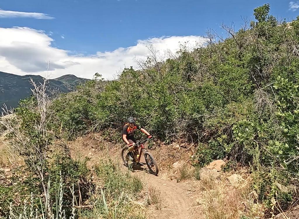
Bofur's Climb is one-way expert uphill trail, starting on Middle Earth at the Frodo's Playground crossing. This is just south of where Middle Earth crosses the UVU Connector. To climb via Bofur's, take the UVU Connector uphill to Middle Earth, 0.7 miles from trailhead parking. Turn right on Middle Earth and ride 1/10th mile south, veering left uphill on Bofur's Climb.
After 0.3 miles, there's a trail fork. To the left is the final 100 yards of Bofur's Climb to the UVU Connector. (The junction is just uphill from the Upper Frodo's crossover. To the right is Bifur to continue climbing up to Nori and Rivendell.
I'm assuming that the final 100 yards of Bofur's Climb is two-way, allowing riders to reach Bifur (a two-way trail) from the UVU Connector. There was no "do not enter" sign at the UVU Connector, but there was one on Bofur's Climb at the north end of Bifur.


If you're heading for Chop'd Coyote, keep left and climb up another 100 yards to Rivendell. Here Bifur joins Rivendell aiming northbound. If you keep straight and to the right, you'll immediately enter Chop'd Coyote to continue uphill. If you stay left and level, you'll be on your way north toward other DH opportunities such as Second Breakfast, Mordor and Skidder 1.


Nori is significantly easier to ride in the north-to-south direction. This puts the monster rock gardens on the downhill.


Overall, Hobbiton Bypass is 0.4 miles long, with 100 feet of elevation change. When continuing to Dori, you'll ride 1/4 mile uphill -- east then southwest -- to cross the Hobbiton Hill trail.


Dori is two-way hand-made singletrack, rated expert. As the Hobbiton Bypass trail reaches Hobbiton Hill, you can cross over to Dori. You'll probably notice a prominent track of riders turning from Dori to descend Hobbiton Hill. Many people are descending Tom Bombadil, then crossing Myrtle to continue the descent on Dori. Then they transfer to Hobbiton Hill at this spot. (This review is done in the opposite direction.)
Dori is the final segment of the Dwarf Trails.
There will be about 100 feet of elevation change over the course of Dori. You'll do some climbing in either direction. When southbound, there are rocky expert descents and easier climbs.


When Dori reaches Myrtle (Upper Riverview) at mile 0.4, veer right if you're continuing on toward Sheep Pen and the Coyote South Switchbacks.
If you're doing a loop that takes you back north via Myrtle and Rivendell, turn hard left to go north.

One mile south of the junction of Highway 40 and 32 (a couple of miles north of Heber), turn east (toward the mountain) at the UVU campus. Go to the uppermost level of parking behind the UVU buildings. Look for the duck-under and kiosk N40 32.798 W111 24.735. A singletrack trail climbs 1.5 miles to the Riverview Trail.
Trailhead options!
UVU Wasatch Campus Trailhead: One mile south of the junction of Highway 40 and 32 (a couple of miles north of Heber), turn east (toward the mountain) at the UVU campus. Go to the uppermost level of parking behind the UVU buildings. Look for the duck-under and kiosk. A singletrack trail climbs 1.5 miles to the Riverview Trail.
Wile E Canyon trailhead: The Wile E Canyon trailhead is located on the southern side of Highway 32, just over 4 miles from US-40. It's 1/10th mile east of the old Cutthroat trailhead (see below). There's room for about 8 cars here. From the parking lot, a connector trail takes you 120 yards uphill to the Wile E Canyon loop. To get to Beep Beep (or the Coyote Switchbacks or East Riverview), turn right at the trail fork, keep right at the next fork, then turn left onto the Coyote Riverview Connector trail as you approach the gravel road.
Coyote Riverview Connector trail (old Cutthroat): You can still connect through the old Cutthroat trailhead, although there's no longer a parking area here. For example, if the crowds have forced you to park where construction workers leave their vehicles along Highway 32, you can pedal to the gravel road to the new golf course leaves the highway, four miles east of US-40 and just east of the big rock-wall road-cut.
Puddy Tat parking: On Highway 3 around three miles from US-40, watch for a dirt road turning to the right in a huge sage meadow. There are a couple of buildings across Highway 32 at this spot. The parking spot is just through the fence, with a connection to Puddy Tat on the eastern side of parking. (This spot was still being worked on at the time of my review.)
Riverview trailhead: From US-40 just south of the Jordanelle reservoir, turn east at the traffic light onto Highwat 32 (at mile 14.2 from I-80 if you're coming from the north). On Highway 32, climb 1.1 miles. When you see the second entry into Riverview on your left and a road under construction to your right, the Riverview Connector trail starts on the uphill side of that road just after it leaves Highway 32. (In 2025, there's no longer protected parking here. It's unclear whether the trailhead will be restored when construction is complete.)Coyote Trailhead: The southern Coyote trailhead has been lost to subdivision construction. Access to the southern side the trail system is in limbo, but some riders find their way through the construction zone by pedaling up the gravel Coyote Canyon road.
Canal DT trailhead: Just uphill from the light on highway 32, watch for the canal crossing. Park along the road. Start riding south on the doubletrack just uphill from the canal.