
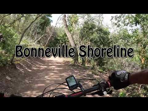

Wild Rose to North Canyon
This section of the Bonneville Shoreline Trail (BST) opened for riding in 2022. Additional miles are currently under construction this year, for example the segment from lower North Canyon to lower Mueller Park . The Wild Rose to North Canyon segment is 8.0 miles long and climbs as it progresses from west (and south) to east (and north).
The lower end of the trail can be reached on the Upper Viewpoint Trail of the Wild Rose System at 5580 feet elevation. You can access the north end via the North Canyon trail, where you'll reach the BST at 6370 feet.
You can also pedal to the exact middle of this eight-mile segment of the BST via the Hidden Lake trail.
The expected riding season will be mid-May through October.


The southwestern end of the trail can be intercepted by climbing from the Wild Rose trailhead (see below). Take the singletrack uphill from the trailhead. It's located just downhill from the bathroom and begins as a paved path. Turn right uphill at the fork in 50 feet. Continue uphill and join the trail from the top of the park at mile 0.1, turning left uphill.
Pedal uphill above the ravine, keeping straight as a trail joins from the left uphill and the DH trail crosses. At a 5-way intersection with a bench 0.5 miles from the trailhead, turn to the right and take the Viewpoint Trail uphill. After you pass another bench, the trail will get steep and loose. You may need to hike a bit.
At mile 0.8, the BST crosses. Turn right. (The trail to the left ends after 100 yards in July 2022.)
 next to the sign.")
From US-89, turn east on Eagle Ridge Drive. Stay on Eagle Ridge Drive past the golf course to Summerwood Drive and head uphill. Turn onto Hidden Lake Drive then turn at Hidden Lake Circle. At the end of the circle, continue uphill on paved road to the water tank and trailhead. Note that the building is for utilities -- it's not a bathroom. The trail entry is the doubletrack to the right of the building. Pedal uphill 100 yards and turn right on the singletrack. In one mile, you'll reach the middle of this segment of the BST.

From the end of the pavement on Canyon Creek Road, pedal uphill 1.5 miles on North Canyon . Keep to the right as the new section of the BST forks uphill. (The section that crosses the hill to lower Mueller Park is not open yet.) Climb another 0.4 miles, then fork to the right on the BST. This intersection is not yet marked in July 2022.

From the Mueller Park trailhead at the end of Mueller Park Road, climb the Mueller Park trail 6.3 miles to Rudy's Flat, then descend North Canyon 1.9 miles. Make a hard left turn onto the BST. A BST segment linking lower Mueller Park (a bit over a mile uphill from the Mueller Park trailhead) to the North Canyon trail is under construction and should be completed during 2022.


As you progress to the northeast, the forest becomes taller with larger trees, including mature fir trees and an occasional aspen grove.


The trail surface is very smooth dirt with only an occasional section of embedded river-delta rock. The path is machine bench-cut with a wide riding surface. Slopes are very gentle and easy to manage.
At 4 miles from the Wild Rose trails (also 4 miles from North Canyon) you'll reach the top of the Hidden Canyon trail. This one-mile trail connects to the Summerwood trailhead.
To climb to Rudy's Flat at the top of the Mueller Park trail, make a hard right turn uphill on North Canyon. It's 1.9 miles with around 650 vertical feet of climbing to Rudy's Flat.


Very nice trail. Fun to ride and a great addition to the area. Lots of miles and views without too much work. Add on the newer BST section from North Canyon to Mueller Park Of course we need a new section at the southwest end to avoid the hike-a-bike on the Viewpoint Trail from Wild Rose. For now, my recommended ride is the out-and-back from Wild Rose to Rudy's Flat.

The northbound Bonneville Shoreline Trail to Mueller Park forks away from the North Canyon singletrack 0.1 mile below the junction of North Canyon with the BST from Wild Rose. It traverses west slightly uphill, crosses a low hill, then turns and descends gradually into the next canyon north to join the lower Mueller Park trail. (The continuing BST northbound after crossing the Mueller Park trail is under construction and was closed at the time of this review. The plan is that the BST will curve around Bountiful with over a dozen more miles of trail.)

On I-15 northbound, take exit 312 (US-89). Just after the exit at the first stop light, turn right on Eagle Ridge Drive. Keep on Eagle Ridge (straight) at the roundabout. Climb the hill for about two miles. Watch for Eaglepoint Drive on the right at N40 49.803 W111 53.771. (If you reach the golf course, you just missed it.) Drive 0.2 miles on Eaglepoint and turn left uphill on Sky Crest Lane. The parking lot is at the end of the road. From parking, find the singletrack on the left just below the bathroom. It connects to the uphill trail. Alternately, you can take sidewalk up through the park and find the uphill trail at the top of the grass, among several picnic-table spurs.
Mueller Park: On I-15, take the 2600 south Bountiful/Woods Cross exit. Go east towards the mountains. The road will turn north and be renamed Orchard Drive. While heading north, turn right (east) on 1800 south. This street takes you to the trailhead about 2 miles later, where you'll see parking places on the right side of the road. Go across the stream on the bridge to begin the ride.

GPS track files (right-click and "Save as..."):
Area multi-track GPX file
Mueller Area GPX
Lodging, camping, shops:
Links to northern SLC resources
Links to Ogden area resources


