Looking north from the BST as we roll into Mill Creek Canyon. Initial photos and trail review by Bruce on September 12, 2022. Update 2024.
Bonneville Shoreline Trail
Bountiful North Canyon to Mueller ParkThis section of the Bonneville Shoreline Trail (BST)
links the
North Canyon
trail to the
Mueller Park
trail(both the trail and the park itself). It's exactly 4 miles from North Canyon to the Mueller Park trail, then 1 mile down to the Mill Creek road, and another 0.6 miles on the BST connector singletrack to the paved canyon road just uphill from the Mueller Park trailhead.
This trail is popular as an out-and-back, usually from the Mueller Park trailhead. It's also
nice as a loop ride (in either direction) when combined with Mueller Park
and the upper 2 miles
of North Canyon.
The expected riding season for this trail would be late May through October. Top elevation
of the trail is 6500 feet.

View uphill as we head gently uphill from the BST after leaving North Canyon.

The trail leaves maple forest for stunted scrub oak as we hit a west-facing slope with a view over the valley.
On its southern end, this section of the BST can be reached via the
North Canyon
trail, or via the
BST
from Wild Rose
.
From the end of paved road in North Canyon, it's 1.5 miles uphill to the BST.
On the northern end, you can climb 1.3 miles up the
Mueller Park
trail
to intersect the BST as it crosses the Mueller Park trail.
(Only
the southbound -- uphill -- portion of the BST can be ridden at this
time!)
Trailheads and Connections

End of Canyon Creek Road. The singletrack begins on your right 100 feet uphill.
North CanyonAt the uphill end of Canyon Creek Road in Bountiful (reached via
Bountiful Blvd), you can find roadside parking and begin pedaling uphill.
You'll have the option of gravel service road or a singletrack trail on
the right (south) side of the road 100 feet uphill from the gate.
It will be 1.5 relatively steep miles to the trail fork, where you'll keep
left for the BST. (The southbound BST is 0.2 miles further uphill on the
North
Canyon
trail.)
NOTE: There's a plan for a road and formal trailhead for access to North Canyon, with construction
likely starting in 2023. For now, these instructions are accurate.

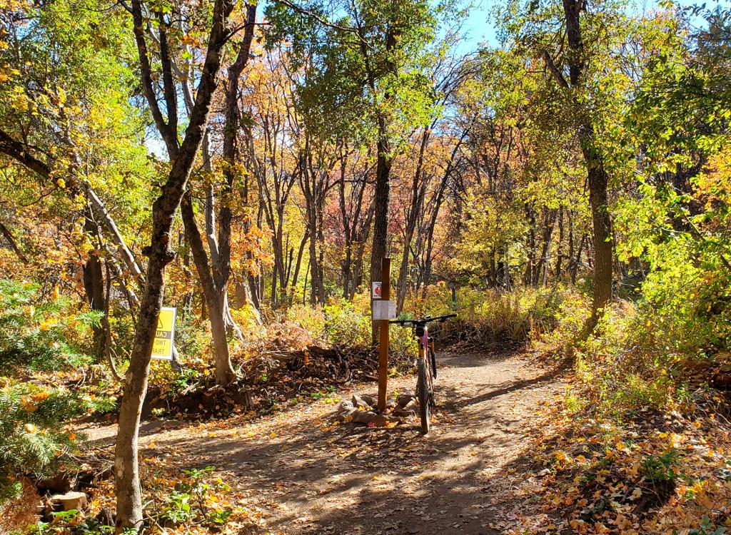
The entry to the BST on the Mill Creek Canyon road.
via Mueller Park Road to BST ConnectionThe
Mueller Park road is a continuation of 1800 South Street in
Bountiful. The Mueller Park trailhead is a very popular trailhead and will be crowded on weekends. Pedal
past the trailhead up the
Mueller Park road. In 0.1 miles, the Kenny Creek trail forks left. Go past
and take the smaller singletrack 50 feet uphill. You're now on the BST
Connector. Keep right at the trail fork and descend back to cross the road
to begin climbing uphill again.

Cruising through the tall maples of lower Mueller Park.
via Mueller Park trail
Climb the Mueller Park trail itself.
Pedal uphill on Mueller Park for 1.3 miles to the spot where the BST
crosses the Mueller Park trail. Turn hard right uphill on the BST. Or for
a short loop ride, fork left to descend back into Mill Creek Canyon on the
BST.

Wild Rose trailhead. The trail starts alongside the toilet.
Via the BST from Wild Rose TrailheadFor now (September 2022) you'll need to climb uphill from the Wild Rose
trailhead in Woods Cross. (See the
Wild Rose trail
page.) Take the Wild
Rose Overlook trail up the ravine, then hard right at the 5-way trail
intersection and up to the ridgeline. At mile 0.8 the
BST
crosses. Turn
left. (The southbound BST to the right dead-ends at this time.) It will
now be 8 miles to the North Canyon trail, where you'll keep straight and
descend 0.2 miles, then make a hard right turn onto the BST uphill just
after crossing North Canyon Creek.
The Bountiful BST - North Canyon to Mueller Park

Looking uphill from the North Canyon trail. My bike is sitting on the BST, as the North Canyon trail veers to the right across the bridge.
On the southern end, this section of the BST begins on the
North Canyon
trail. When heading uphill, it will be 1.5 miles from the end of the Canyon Creek Road and
0.5 miles from the National Forest border. Keep straight as the North
Canyon trail veers to
the right to cross North Canyon Creek.
From the
Woods Cross (Wild Rose) section of the
BST
, this trail fork is
0.2 miles downhill from where the BST merges into the North Canyon trail.
From the North Canyon trail to the
Mueller Park
trail, it will be 4.0 miles. There will be 175 feet of initial climbing, then 750 feet of descent.
The trail is a wide bench-cut with modern design features and a very gentle
rate of elevation
change.

View on a typical stretch of maple-shaded trail as we climb up from North Canyon.

Looking ahead as the trail traverses a west-facing slope near the ride's highest point.
At the North Canyon trail fork, you're at 6350 feet
elevation. You'll climb gently to 6500 feet elevation. Just before you
finish this climb, at mile 0.5 from the North Canyon trail, the Mahogany
Ridge trail crosses. Keep straight.
After another 1/10th mile, you'll begin a long and
continuous descent toward Mueller Park. At the Mueller Park cross-over,
you'll be at 5775 feet.
After a short stretch in fir forest, the trail lies in tall maple forest. There will be occasional
breakouts into sun-exposed oak scrub, where the air temperature will increase
significantly.

Typical trail view: Maples and an occasional fir, with a smattering of oak brush.

Looking north at Bountiful. The big white building is the Bountiful Temple.
There will be views over the valley when the trail reaches west-facing slopes, and an occasional
look up North Canyon or Mueller Park's canyon.
There's very little rock on this stretch of the BST. At this time the trail is a ribbon of
smooth dirt. The rate of climbing and the trail surface are very suitable
for beginning riders.
(Beginners should start from Mueller Park, as the climb up lower North
Canyon is brutal.)

Trail view on the Mueller Park side.

Looking uphill at Cave Peak from Mill Creek Canyon near Mueller Park.
There are two popular loop ride possibilities using the BST: (1) Start at Mueller Park and
ride the BST southbound, descending North Canyon. Return via city streets.
(2) Do a lariat
loop ride from either trailhead. First climb uphill to Rudy's Flat. Continue
across the summit
for a couple of descending miles, then turn onto the the BST to return
to your original climbing
trail. This loop is most popular from the Mueller Park side.
When planning a loop ride, remember that the lower mile North Canyon is steep and not really
suitable for beginners. (A beginner with good control could surf the loose
doubletrack, but
either of the singletracks would be beyond their skill and/or climbing
strength.)

A stretch of cool fir forest as we descend toward North Canyon on the southbound ride.

Here's the trail crossover of the BST with Mueller Park, seen from uphill on the Mueller Park trail. To the left and uphill is the BST, straight ahead and downhill goes to the Mueller Park trailhead.
At the Mueller Park end of this trail segment, the BST crosses the Mueller Park trail. Many riders choose to descend Mueller Park here. If so, fork to the left downhill. To continue down the BST, keep straight. (A right turn takes you uphill on Mueller toward Elephant Rock.)
BST from Mueller Park trail to Mill Creek Road
 crosses the Mueller Park trail.")
Looking downhill as the BST (on the left) crosses the
Mueller Park trail.
The segment of the BST between the Mueller Park trail is 1
mile long with 300 feet of elevation change. It's nice as either a
climbing route or a downhill.
The trail hugs a north-facing slope through forest of fir
and maple. It's a wide bench-cut with smooth riding surface. The
switchback turns have a generous radius considering the slope of the hill.

A rare view up Mill Creek Canyon as the BST descends.
99% of this piece of the BST is shady forest.

Looking uphill at the bottom of the BST from the
canyon road.
When the BST hits the Mill Creek Canyon road, the continuing
singletrack is directly across. You have the option of descending the road
if you don't want to tackle the turns and climbing on the singletrack back
to the lower canyon.
(If you're headed uphill and wish to have an easier route, you can climb
the canyon road to get to uphill trail along the creek (as shown in the
photo). Pedal 0.5 miles from the trailhead and fork to the right across
the bridge.)
BST from upper Mill Creek Road to Mueller trailhead

Ready to climb up the BST connector.
The trail section here is optional, as you can skip it by
riding the canyon road. Located across the canyon road, this singletrack
is 0.6 miles upper-road to lower-road. There's about 50 vertical feet of
climbing to get uphill to the traverse that takes you down-canyon.
If you're climbing the BST connector, you'll have a bit over 200 feet
of stiff climbing to get uphill.
If you've just descended the BST from the Mueller Park
crossing, find the continuing BST across the canyon road. Climb uphill
through a couple of turns, then begin a slightly-downhill traverse toward
the mouth of the canyon.
Keep straight as the Hornet trail forks uphill to your right. (See the Mueller area northern trails page for details on the trails you'd reach via Hornet.)

The trail runs through forest of maple and oak.

Dropping down through the turns toward the canyon
road.
You'll now begin a series of switchbacks to drop back to the
canyon road.
(These climbing turns are a bit of a grunt when done in the uphill
direction.)
At the bottom, keep left at the connector to Kenny Creek.
100 feet later, bounce onto the paved canyon road and turn to the right
downhill. In 1/10th mile, you'll be at the Mueller Park trailhead.
(If you're climbing this trail, you'll find the bottom entry on your
left as you head up the Mill Creek Canyon road, just 50 feet uphill from
the larger Kenny Creek trail entrance.)
The singletrack leaves the paved road for the trip
uphill. The marking is meager.

A typical stretch of buff BST.
Bottom Line!
Excellent trail that opens a world of new ride possibilities above Bountiful. Yes it will make
Mueller Park even more crowded, but I expect it will take some pressure
off the two-way traffic
on the upper mountain by putting more riders onto a clockwise loop path
rather than up-and-back.
Well constructed and easy to ride; suitable for beginning riders from
the Mueller Park side.
Getting there:North Canyon: On I-15, take the 2600
south Bountiful/Woods Cross exit. Go east towards the mountains. The road
will turn north and be renamed Orchard Drive. While heading north, turn
right (east) on 1800 south. Just as you reach the bottom of a steep hill,
turn right at the intersection. (This is about 0.6 miles before the
Mueller Park trailhead. If you arrive there, backtrack.) After 1.7 miles,
turn left on Canyon Creek and go uphill 0.7 miles to the end of the
pavement. Start your ride by heading east (uphill) on the dirt road.
Mueller Park: On I-15, take the 2600 south
Bountiful/Woods Cross exit. Go east towards the mountains. The road will turn north and be
renamed Orchard Drive. While heading north, turn right (east) on 1800 south. This street
takes you to the trailhead about 2 miles later, where you'll see parking places on the
right side of the road. Go across the stream on the bridge to begin the ride.

Map of the Bountiful BST