

Rolling a turn on EZ Breezy. Original photos and trail notes April 28, 2018 by Bruce, with frequent updates since. Latest update April 2022.
Alpine to Three Falls
Area Overview Page
Cooperation between Alpine City and real estate developers has resulted in a great new public trail system in the mountains north of Alpine. As of 2024, there are some long satisfying loop rides with plenty of climbing, and there are short and easy options. The riding ranges from upper-intermediate to easy. There are four formal trailheads to access these trails. The system connects through to Draper's Corner Canyon trail system.
Bodily Harm

View northeast into Dry Canyon from Bodily Harm.
The Bodily Harm trail starts on the edge of Alpine Cove at 5400 feet elevation. A connector trail drops off Three Falls Way just after it crosses the creek to begin climbing the hill. The bottom of the trail also connects to Stoney Way. Bodily Harm ends on the Three Falls Fort Canyon trail at 5900 feet
elevation. For loop opportunities, Bodily Harm has connections to Stoney Way and Forbidden on the lower slope. Near the top, two DH trails fork off Bodily Harm. It's 1.7 miles long, with some stiff climbing on the way up.
Three Falls Trail (Fort Canyon Section)

Crossing the ridge between Utah Valley and Fort Canyon, with Lone Peak forming a picturesque background.
The Fort Canyon section of Three Falls trail connects the Three Falls Ranch trailhead in Fort
Canyon to the Vista Ridge trail, then the Bodily Harm trail on the ridgeline. It then crosses the ridge to descend into through Fort Canyon to the Forbidden trail
and the Draper section of Three Falls. To the Bodily Harm junction, it's 1.4 miles with 500
vertical feet of elevation change. At mile 2.3, the Three Falls trail reaches the Forbidden
trail junction then continues westbound toward Draper.

The bridge over the creek. Take a minute to enjoy the spot.
The Three Falls Fort Canyon trail becomes the Three Falls Draper section at the border between
the two cities. The Draper Three Falls trail continues west uphill to the Carpe Diem trail and the Jacob's Ladder connector. Shortly thereafter, it becomes the Peak View trail and descends to the Peak View trailhead on Traverse Ridge.
Forbidden trail

Looking east toward Box Elder Peak on Forbidden shortly after leaving the Three Falls trail.
The Forbidden trail lies to the northeast of Bodily Harm, taking the "other way" around Fort
Canyon. It's 2.5 miles long, running from the Bodily Harm trail just above Alpine Cove to the Three Falls trail on the north side of Fort Canyon. Forbidden was re-routed in 2024 because of landowner disputes. The re-route incorporates the trail known as "More Effort" plus a new cut across the top of the knoll. The lower portion of Forbidden rides best in the downhill direction.
Vista Ridge

On Vista Ridge with Lone Peak as a backdrop.
The Vista Ridge trail is a two-way trail on a ridgeline with great views. It's popular as a connection to Stoney Way for bigger loop rides. At the bottom, Vista Ridge is the continuation of Heritage Hills at the point where Stoney Way intersects
the uphill route. Vista Ridge is 1 mile long, climbing 250 vertical feet in the first 0.6
miles then descending a bit as it drops to the opposite side of the ridge to connect to the
Fort Canyon Three Falls trail.
North Point - Heritage Hills

Looking east toward East Mountain and Timpanogos.
The North Point Collector, Heritage Hills, and Vista Ridge trails are a continuous route from
the Heritage Hills (North Pointe) trailhead up to the Fort Canyon portion of the Three Falls
trail. It's is a nicely constructed bench-cut trail with swooping bermed turns. The slope is
moderate. It's 1.8 miles from the trailhead on Heritage Hills Drive to the Three Falls Fort
Canyon trail.
Stoney Way

Looking northeast, showing the bench-cut nature of the trail and the constant mountain views.
Stoney Way is a traversing trail running east-west along the hillside above northeast Alpine.
It's 1.3 miles in length with a highest elevation of 5400 feet and low point at 4850. The riding
is easy, suitable for beginners. There are no steeps or technical features. It connects the
bottom of Bodily Harm to the junction of Heritage Hills and Vista Ridge.
DH Trails in Big Hollow's Left Fork
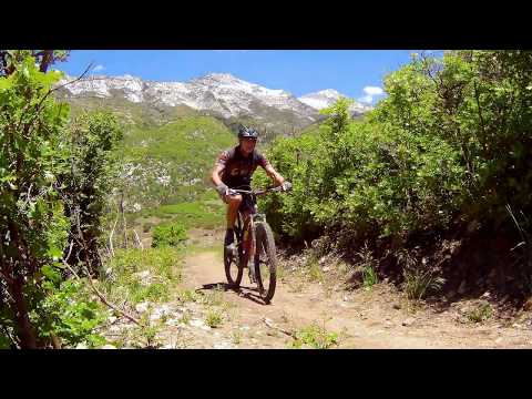
EZ Breezy (easier DH flow trail)
EZ Breezy (easier DH flow trail)

Flying away from Lone Peak on EZ Breezy.
Machine-built in the left fork of Big Hollow in 2021, EZ Breezy is an early intermediate downhill
flow trail. It descends from upper Bodily Harm down to the bottom of the canyon, where the
Last Chance trail climbs to the Three Falls Fort Canyon trail section. This is Alpine's first
directional flow trail and it's a lot of fun. The trail is one-way from east to west (from
Bodily Harm west to Three Falls in Fort Canyon). The EZ Breezy trail is machine-cut singletrack,
0.7 miles in length, with 250 feet of elevation loss. It's a smooth and easy trail to ride.
Alpine Slide
(expert DH flow trail)

Turns are highly banked for speed.
The Alpine Slide upper-intermediate to expert DH flow trail in the left fork of Big Hollow
is 0.5 miles long, descending 250 vertical feet to the bottom of the hollow. It forks away
from upper Bodily Harm at 0.3 miles from the junction with Three Falls Fort Canyon, just 1/10th
mile above the trail fork for EZ Breezy.
Last Chance
(climbing trail)

Looking north on the Last Chance climbing trail.
Last Chance is the climbing route to return from either EZ Breezy or the new intermediate DH
trail. It's 0.8 miles long with 200 feet of climbing as you pedal up to the Three Falls Trail
on the ridge above Fort Canyon. On the western side, the trail's exit is 1.1 miles uphill from
the Fort Canyon trailhead, 0.4 miles downhill from the junction of Bodily Harm and the Three
Falls Fort Canyon trail.
Trailheads!

Looking northeast in the paved parking lot in Fort Canyon. The Three Falls Fort Canyon trail is just to the left of the bathroom.
Fort Canyon Ranch Trailhead
As Alpine's main street begins to turn a bit to the east, turn left on the Fort Canyon Road. Drive uphill to the main gates, but turn right to the trailhead. From the Fort Canyon Ranch Trailhead in Alpine's Fort Canyon, find the Three Falls Fort Canyon trail to the left of the bathroom and climb up to your destination trail. For example, the top of Forbidden is at mile 2.4 from the Fort Canyon Ranch trailhead.
As Alpine's main street begins to turn a bit to the east, turn left on the Fort Canyon Road. Drive uphill to the main gates, but turn right to the trailhead. From the Fort Canyon Ranch Trailhead in Alpine's Fort Canyon, find the Three Falls Fort Canyon trail to the left of the bathroom and climb up to your destination trail. For example, the top of Forbidden is at mile 2.4 from the Fort Canyon Ranch trailhead.
")
View up Dry Canyon with the North Point trail straight ahead.
Heritage Hills (North Pointe)
On Alpine's main street, continue north until the road turns right at Fort Canyon, then watch for a small paved Heritage Hills (North Point) trailhead on your left in about 1/4 mile. Climb up North Point, then cross the street to continue on Heritage Hills. When you reach a trail fork, Stoney Way is on the right. Vista Ridge continues uphill.
On Alpine's main street, continue north until the road turns right at Fort Canyon, then watch for a small paved Heritage Hills (North Point) trailhead on your left in about 1/4 mile. Climb up North Point, then cross the street to continue on Heritage Hills. When you reach a trail fork, Stoney Way is on the right. Vista Ridge continues uphill.

The Ridge (Big Hollow) trailhead. Stoney Way goes both directions from here.
The Ridge Trailhead
At the first T intersection when northbound on Alpine's Grove Drive, turn left. After 1/10th mile, turn left again. Go 1/10th mile and turn right on Savannah Circle, then right into The Ridge trailhead. You can take Stoney Way in either direction. South (left) will take you to the intersection of Heritage Hills with Vista Ridge. North (right) takes you to Bodily Harm.
At the first T intersection when northbound on Alpine's Grove Drive, turn left. After 1/10th mile, turn left again. Go 1/10th mile and turn right on Savannah Circle, then right into The Ridge trailhead. You can take Stoney Way in either direction. South (left) will take you to the intersection of Heritage Hills with Vista Ridge. North (right) takes you to Bodily Harm.

The trail at left crosses the ravine, then descends to catch Forbidden about 1/10th mile uphill.
Schoolhouse Spring (Hammagog) Trailhead
On Alpine's Grove Drive, head north to the second T intersection (where a right turn would take you across the bridge into Lambert Park). Instead, turn left on Alpine Cove Drive. At the 4-way intersection, turn left. As Alpine Cove Drive turns downhill, turn uphill on Aspen Drive. It will turn to the Three Falls Lane road. As the paved road veers left to cross the creek, keep straight onto a smaller dirt road and drive about 0.2 miles uphill until you hit the Lehi gate that prevents further travel. Park, then coast back downhill to the paved road, pedal 150 feet uphill and fork onto the singletrack heading south on the left side of the road.
On Alpine's Grove Drive, head north to the second T intersection (where a right turn would take you across the bridge into Lambert Park). Instead, turn left on Alpine Cove Drive. At the 4-way intersection, turn left. As Alpine Cove Drive turns downhill, turn uphill on Aspen Drive. It will turn to the Three Falls Lane road. As the paved road veers left to cross the creek, keep straight onto a smaller dirt road and drive about 0.2 miles uphill until you hit the Lehi gate that prevents further travel. Park, then coast back downhill to the paved road, pedal 150 feet uphill and fork onto the singletrack heading south on the left side of the road.
Getting to Lambert Park from Draper!

The slopes above the cove are fully sun-exposed, and will be hot at mid-day in the summer..
At the bottom of Bodily Harm, keep to the left as Stoney joins. Pedal north to the paved road, then turn right on the road. Descend down to Aspen Drive. At the end of Aspen Drive, turn left at the T intersection with Alpine Cove Drive.
Pedal 0.2 miles to the 4-way intersection and turn right downhill. Keep straight as you pass Juniper Circle and the road veers east (left). Turn left onto Grove Drive. Cross the bridge, then keep right on Box Elder Drive. 200 feet later, turn onto singletrack. Left off the pavement is Rodeo Up; right and downhill is Middle.

Map of the northeast Alpine trails.
Getting there, Fort Canyon Ranch Trailhead: As you drive into Alpine
on Main Street, keep straight at all intersections until you reach 800
North. Then, just as Main Street turns to the right and becomes Heritage
Hills Drive, fork left on Fort Canyon Road to continue north. 0.9 miles
later, turn right just before the Three Falls gate. Quickly turn left into
the parking lot for the Three Falls Farm trailhead. The top of Bodily Harm
is 0.9 miles uphill on the Three Falls Fort Canyon trail from the end of
Vista Ridge.
Heritage Hills (North Point): Shortly after you veer to the northeast from Main onto Heritage Hills Drive as above, spot the small parking lot on your left and turn in. Climb Heritage Hills to Vista Ridge. Continue uphill on Three Falls to reach the top of Bodily Harm.
The Ridge TH (Stoney Way): At the T intersection of Grove Drive, turn left. After 1/10th mile, turn left again. Go 1/10th mile and turn right on Savannah Circle, then right into The Ridge trailhead. You can take Stoney Way in either direction. South (left) will take you to the intersection of Heritage Hills with Vista Ridge. North (right) takes you to Bodily Harm.
Schoolhouse Spring (Hammagog) Trailhead:
On Alpine's Grove Drive, head north to the second T intersection (where a right turn would
take you across the bridge into Lambert Park). Instead, turn left on Alpine Cove Drive. At
the 4-way intersection, turn left. As Alpine Cove Drive turns downhill, turn uphill on Aspen
Drive. It will turn to the Three Falls Lane road. As the paved road veers left to cross the creek, keep straight
onto a smaller dirt road and drive about 0.2 miles uphill until you hit the Lehi gate that
prevents further travel. Park, then coast back downhill to the paved road, pedal 150 feet uphill and fork onto the singletrack heading south on the left side of the road.
Facilities: bathroom at Fort Canyon trailhead, bathrooms at Lambert Park trailheads. (No services at Schoolhouse Springs, The Ridge, or Heritage Hills trailheads.)


