Flat trail down the middle versus over the rock on the right. Photos and review ...
Flat trail down the middle versus over the rock on the right. Photos and review ride by Bruce on March 18, 2016.
Twilight Zone to Petrified Whales
Three Peaks Riding Area

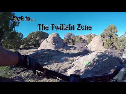
The Twilight Zone is a new singletrack trail in the Three Peaks riding area northwest of Cedar City. It connects the main mountain biking trailhead to the "Whale Trails" on the southwest corner. The Twilight Zone opens up new options for loop rides such as the Three Peaks Loop , as well as providing a direct route to the most-technical rock in Three Peaks.

Twilight Zone from trailhead
Twilight Zone starts on the Practice Loop trail, 0.2 miles from the mountain biking trailhead riding clockwise. (You get on Practice Loop by going left as you go through the opening in the fence at the kiosk.) Twilight Zone is 2.6 miles in length from the fork off the Practice Loop to the trail's end on Jumbled Jonah (one of the Whale Trails).

The overall altitude change is less than 100 feet north-to-south, but there's a lot of mildly up-and-down riding bringing the total climbing to about 250 feet.

Looking east early in Twilight Zone, back toward the Practice Loop. The red spot...
Looking east early in Twilight Zone, back toward the Practice Loop. The red spots are trail-digger's flags, not flowers.
Some rock areas have faded paint spots. Navigation may require an occasional sto...
Some rock areas have faded paint spots. Navigation may require an occasional stop to look around, and rarely, a retreat to see where things went wrong.
Overall, the trail would rate intermediate in technical requirement. You can easily pick the easier routes over the rock areas. Or not. There are some ladder bridges, all of which I found relatively easy to ride, and I'm a bit of a wood-o-phobe.

In some areas, faded paint-spots mark the route through the rock. But paint seems to die quickly on the rough pink granite of Three Peaks -- paint spots in the Whale Trails that were obvious last year were barely detectable on my most recent ride.

If you're in a big hurry to blow through the area, there's an shorter (by 0.4 miles) alternate route that bypasses some of the fun technical rock on the northern end. At just under 1/10th mile on Twilight Zone, you'll come to a trail fork. Right is the main trail. Left takes you south 0.4 miles to reconnect to Twilight Zone. Just after the bypass trail reaches a fence, keep left for the southbound Twilight Zone. (2016 note: the alternate trail is new and there's one spot where you might get lost as the trail reaches a flat area before crossing a dirt road 0.2 miles from the fork. GPS recommended.)

You can also access the shortcut via the west end of the parking area. Go to the far west side of parking, head through the fence and then straight on the doubletrack. 200 feet from the fence, spot the trail heading into oak brush on your left. Taking this route drops 0.8 miles.

A chute on the newer bypass trail (labeled as Twilight Cutoff on my map).
Just another fun spot. Ramp, rock, ramp, rock, ramp, and back to dirt.
Most of the rock is on the northern half of the trail. The technical areas seem to be within the capabilities of an experienced intermediate rider, but sometimes require an aggressive approach. There are a few ladder bridges with a high fun-to-spooky ratio.

As the trail passes south of the campground, it becomes entangled with the foot paths for the disc golf. There are a few signs to help you stay on course, but you may need to stop and look around occasionally to stay on the right trail.

Critical navigation areas of the Twilight Zone!

(1) At mile 0.1 of Twilight Zone, keep right at the trail fork.
(2) At mile 0.8 of Twilight Zone, keep right at the trail fork to continue south. The bypass trail comes through the fence on your left.
(3) As you cross a big dirt road at mile 0.9, keep on the right-hand side of the primitive camping area to find continuing singletrack. If you wind up on ATV trail, you were too far to the left.
(4) At mile 2.4 (0.15 miles after passing the entry to the primitive RV camping area), there's an unmarked (as of 2017) fork. L to Jumbled Jonah, R to Petrified Whales.

Where in doubt, look for ribbons on trees and fresh dirt against rock surfaces.
Dirt cruisin on the southern half of the trail, looking south.
Dirt cruisin' on the southern half of the trail, looking south.
The southern portion of the Twilight Zone has a bit of dirt ribbon; high-speed and fairly flat. Still, there will be rock playgrounds at regular intervals. At mile 2.3 from the Practice Loop you'll cross a road that goes into the primitive RV camping area.

Now watch for a trail fork 1/10th mile later. Forking left takes you to the Jumbled Jonah trail after 2.6 miles on Twilight Zone (2.8 miles from parking). Right will deliver you to the northeast corner of the Petrified Whales loop in another 0.2 miles.

Petrified Whales (and alternates)

The Whale Trails are a series of loops and connectors. The riding is advanced technical with plenty of play opportunities.

If your goal is simply to get to the main Three Peaks loop, keep right as you reach Jumbled Jonah. Keep right again 0.2 miles later to enter the Petrified Whales loop counterclockwise. Stay right as you pass Moby Dick about 200 feet later, taking Petrified Whales 1/2 mile westbound to the Three Peaks Loop.

And were at the Whale Trails. This is a fun little el-twisto bridge. If it spook...
And we're at the Whale Trails. This is a fun little el-twisto bridge. If it spooks you, there's a route to the left.
Coming down a slot in the granite after a tricky climb on Petrified Whales.
Petrified Whales is the main loop in the Whale Trails, 1.4 miles in length. The two ends are less than 1/10th mile apart on the Three Peaks Loop trail. All the other trails link to the Petrified Whales loop.

Humpback branches off then rejoins the southern side of Petrified Whales as an alternate route 0.4 miles in length. In the middle of Humpback, Moby Dick forks off northbound.

Moby Dick is a short (0.3 mile) trail segment connecting the middle of Humpback (at its northernmost excursion) to the northern side of the Petrified Whales loop.

Jumbled Jonah is an extension loop off the east side of the Petrified Whales loop, a longer alternate line that's heavy on dirt cruising with less technical rock. It's 0.4 miles long.

Sample path on the south end of the Three Peaks Loop (yellow dots are mine). Loo...
Sample path on the south end of the Three Peaks Loop (yellow dots are mine). Looking southeast.
One of the few ladder bridges without a ride-around. So its wider than most.
One of the few ladder bridges without a ride-around. So it's wider than most.
There's no "best way" to ride these trails. They feel very different when done in opposite directions. My suggestion is, just ride around in circles until you've done everything both ways. It's all good.

Just as the rock here is the most techy in all of Three Peaks, the ladder bridges tend to be narrower and more challenging. But I only remember one bridge that you couldn't just ride around, and it was as wide as a sidewalk.

If you struggled with the open rock on the main Three Peaks Loop, you're not ready for the Whale Trails. The slickrock here requires an aggressive attitude and strong legs. And if you wipe out, those big granite crystals will tear off chunks of skin with the lightest bump.
Were on the Moby Dick trail, and were about to ride right up the leviathans back...
We're on the Moby Dick trail, and we're about to ride right up the leviathan's back. Looks simple, but the last push is kinda steep and if you stall, there's nothing but air on each side of you. And there's a water-filled pothole waiting for you right at the apex. Fun stuff!
Ready to rock Four Loco in May 2015. Tough stuff on the old route.
Where the south side of Petrified Whales meets the Three Peaks Loop trail, Four Loco heads east. As of March 2016, Four Loco will dump you back onto Petrified Whales. The old Four Loco track (available in my area GPS file) is wild, hairy, and a navigation challenge. The new presumably easier and more direct route shown on the BLM map doesn't seem to exist yet. Unless I missed something.

Ride to the Whale Trails via Twilight Zone...

[Back to video list ]
Riding notes, Twilight Zone to Whales lariat:
0.0  Through fence at kiosk, go L
        N37 46.017 W113 10.084
0.2   L on Twilight Zone
        N37 46.137 W113 10.146
0.3   Fork R (L = cutoff)
        N37 46.107 W113 10.197
0.55 Fork L (R = Race Loop joining)
        N37 46.236 W113 10.279
0.6   Cross R to singletrack
        N37 46.210 W113 10.302
0.7   Cross main road N37 46.192 W113 10.364
0.8   Another road
1.0   Keep R (L = Cutoff to parking)
        N37 45.914 W113 10.370
1.1   Cross road, veer R through rock to ST
        N37 45.891 W113 10.354
        (If you're on ATV track, go back!)
2.5   Cross road near primitive RV camp
        N37 45.562 W113 11.129
2.6   Left at intersection N37 45.476 W113 11.174
2.8   R on Jumbled Jonah  N37 45.353 W113 11.134
3.0   R on Petrified Whales
        N37 45.347 W113 11.242
3.05 R (L = Moby Dick)
        N37 45.375 W113 11.262
3.5   L on Three Peaks Loop
        N37 45.379 W113 11.568
3.55 L on Petrified Whales
        N37 45.344 W113 11.583
3.7   Keep straight (Four Loco on R)
        N37 45.223 W113 11.552
3.8   Fork R (L = Humpback)
        N37 45.171 W113 11.472
4.2   Fork R (L = Humpback again)
        N37 45.247 W113 11.348
4.3   R on Jumbled Jonah
        N37 45.286 W113 11.251
4.6   R on Twilight Zone 
        N37 45.353 W113 11.134
7.4   Back at parking
Map of the Twilight Zone to Petrified Whales ride.
Getting there: Just north of Cedar City, take the Enoch/Minersville I-15 exit #62. Go north on U-130 (towards Minersville) 2.6 miles, then turn left on Midvalley Road. Drive 6 miles straight west. Pass the "welcome area" which is the first turnout. Now watch for the sign indicating the Mountain Bike Trailhead. Turn right on a gravel road into the trailhead. The ride starts behind the kiosk and the picnic table.

Note: Click on this topo map link for a view that includes other area trails. See the Three Peaks page for alternate rides.

Note: Click on this topo map link for a view that includes other area trails. See the Three Peaks page for alternate rides.

Camping:  On site, option group or individual sites, option developed vs primitive
Water:  Trailhead, pavilion, and campground
Bathrooms:  Trailhead, campground, picnic area, pavilion
Bike services:  Cedar Cycle in Cedar City

Riding resources:
Single-page riding guide, Lariat Loop as above
GPS track files for this trail (right-click and "Save as..."):
    Area GPX multi-track file
    Twilight Zone lariat loop as above
     Three Peaks Big Loop
    Big Hole Loop (smaller)
    Race Course Loop
High-res area trail topo for printing: View topo map
Lodging, camping, shops: Links to Cedar City area resources

Updated December 2017
See other Three Peaks pages:
    Three Peaks System trail page
    Big Hole page
    Three Peaks Loop page