Jump lines let you choose how big to go as you practice. Initial photos and description by Bruce on May 23, 2006, with most recent trail update September 2023.
Trailside Loop and Skills ParkPark City's Trailside Park is located about a mile south of I-80 and a mile west of US-40 near Silver Creek Junction. This is on the northern end of the
Round Valley trail system. The park has flow trails and skills areas for riders of all ability levels. There are man-made features -- which change from year to year -- that offer challenges.
Trailside Park was first reviewed on this site in 2006 and has been updated since. This review by Bruce represents the status of the trail system in September 2023.
Trailside Park occupies the sagebrush terrain around a small hill, just north of the Round Valley riding area. The elevation is 6700 feet, for an expected riding season of mid-May through October.

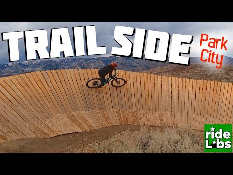
Here's a series of features on the Mr Muchrocks DH route, looking back uphill. Rock gardens and wooden ramps!

There are fun options for every ability level.
Most riders come here for the one-way DH flow trails Yabba Dabba Doo and Great Gazoo (easy), Bronto Jam (intermediate), Mr Muchrocks (advanced) and Bamm Bamm (skilled expert). Other advanced features include pump tracks and jump lines.
Trailside Park is a great outing for biking families or for groups of widely varying ability. In addition to the tricky stuff, there are the two easy downhill flow routes. There's also a very easy cross-country loop called the Trailside Park Loop that has beginner skills teaching stations. True beginners and young kids will like this.

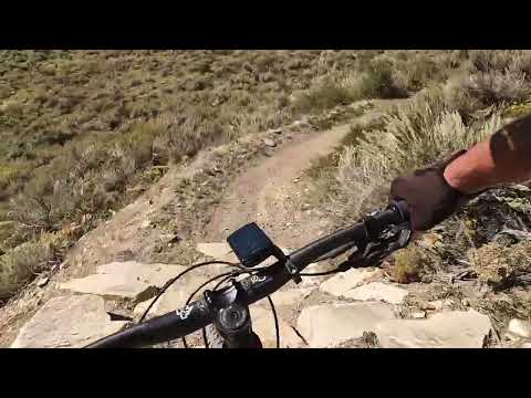
Looking north while rolling into a turn on the easy The Great Gazoo DH flow trail.
Trailhead and Connections

Here's the bicycle entry to the park.
Trailside Park Trailhead
Trailside Park has a large paved parking area. Because there are other
attractions here (such as skateboarding and sport courts), the parking lot may be full on weekends.
Overflow parking is available a short distance away at the Round Valley
North Trailhead.
From the Trailside Park parking lot, go back to the entry and pedal up the dirt path and around the
gate. You're now on the climbing trail, which will take you to all of the
park's bicycle attractions.

Climbing uphill from the Round Valley trail system to Trailside Park.
Connecting from Round Valley
At one mile from the North Round Valley Trailhead, there's a trail spur
from Happy Gilmor branching to the north. It will climb uphill and cross the return path
from Mr Muchrocks.

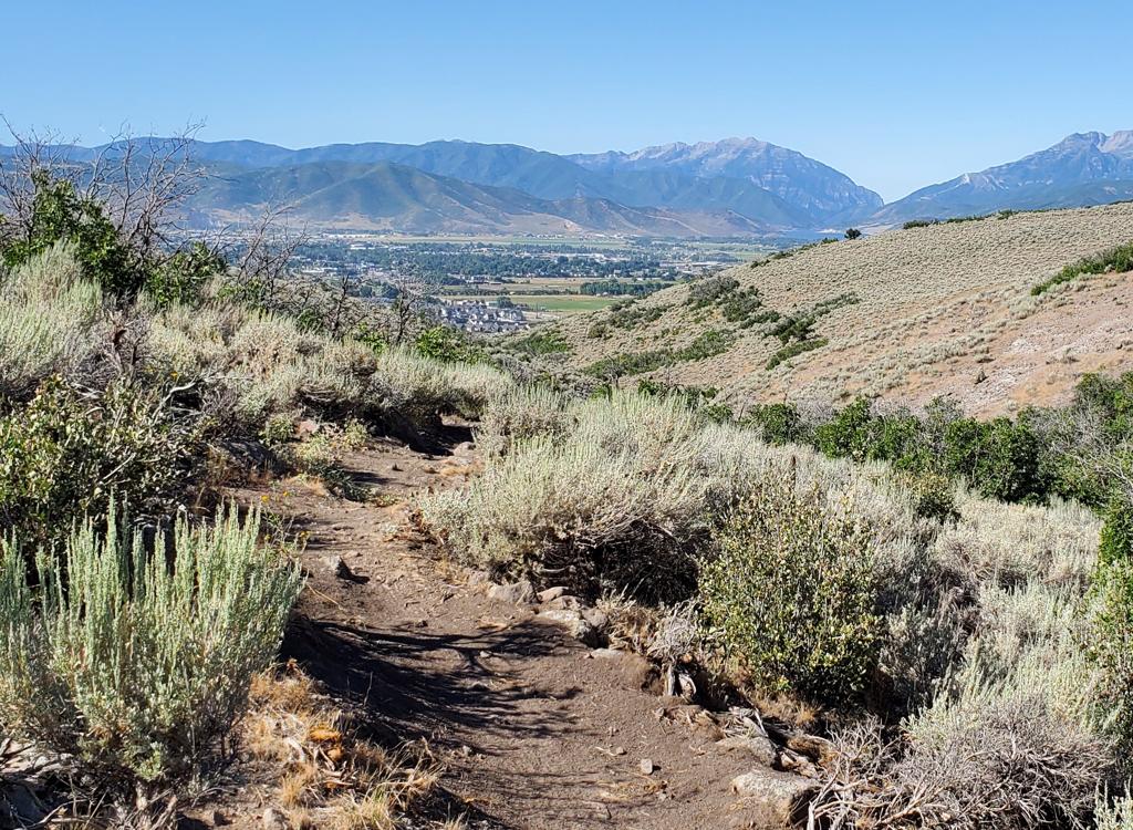
View west as we climb from Mountain Ranch Road toward the Trailside Park Loop.
Neighborhood Connectors
There are singletrack connecting trails from Mountain Ranch Road and
Trailside Drive that connect to the Trailside Park Loop at its northern
end. (See the map and the GPS track file.)

On the main climbing trail just uphill from Unga Bunga.
The climbing trail gets you to all of the park's attractions. It starts as a doubletrack route heading west, with a gradual slope. As it climbs uphill, it passes the entry to Unga Bunga, plus the one-way exits from the downhill flow trails.
After pedaling 0.2 miles and climbing 50 vertical feet, you'll reach
a fork where the broad trail splits. Straight ahead is the route uphill to
the top of the jump lines. This is also the way to the Trailside Park Loop and to Yabba Dabba Doo. The boardwalks are on your
right near the entry to the Trailside Park Loop.
When you reach the top, to your left is the drop-in for the jump lines, then the slalom course,
then the little drop loop.

Riding up the climbing trail alongside the jump lines, with the entry to Yabba Dabba Doo just ahead at the far right.

Climbing to the top of the hill for a DH run.
If you turn 90 degrees left at mile 0.2, the broad climbing
path will go past the pump track and climb to the top of the small hill.
On the way, you'll actually pass under a flyover for Bamm Bamm.
To reach the top of the hill (and four DH flow trails) it will be
another 1/4 mile, with just under 100 feet of climbing.

This canopy (with a bike workstation) is the official entry to Unga Bunga.
Unga Bunga is a skills area between the lower climbing trail and the park fence. There are two pump-track loops, and an XC that circles around. This is basically a play area, with lines popping up all over. You'll need to cruise around a bit to make sense of it.

Heading into Unga Bunga, there's a loop uphill and a loop downhill, with pumping bumps and banked turns.

Heading east over a series of pumping bumps, after which we'll circle around to do it again.
Another trail circles just downhill from the pump-track loops. It has some easy wooden features, and at the west end it sends a connector to the Trailside Park Loop.

Looking east as we approach wooden ramps.
Trailside Park Loop Trail

Heading north on the western side of the loop for a clockwise ride.
The Trailside Park Loop is a very easy singletrack ride at the northwestern side of the park. The loop is just under one mile in length, circling around through a sagebrush slope. While the trail is two-way, it's designed to be done clockwise -- starting higher on the hill just north of the jump lines, and returning just above the parking lot before turning west up to the climbing trail.
When riding clockwise, there are a series of skills stations. A sign precedes a split in the trail. The alternate line will take you to a feature, then return you to the main trail.

Arriving at a skill station.

Here we see the alternate line for a ramp roller with a downward bump at the end.
There are stations for rock gardens, wooden ramps, rock
obstacles, and rollers.
At the northern end, there are some connectors to neighborhood roads.
Keep to the right when riding clockwise. As you pass by the parking area
on the way back, again keep to the right on what appears to be the main
trail, and you'll return to the climbing trail.

A kid-size rock garden.

And an easy ramp for the nervous.
Yabba Dabba Doo Beginner Flow Trail

Entry to Yabba Dabba Doo from the climbing trail.
The Yabba Dabba Doo DH flow trail forks away from the main climbing trail at mile 0.3. Keep straight past the trail fork that leads to the DH trails on the hill, then turn sharply to the right as you reach the entry to Yabba Dabba Doo.
Yabba Dabba Doo is only 0.2 miles long. It's a series of
highly banked turns, with some bumps and rollers between those turns.
It's designed to be fun for experts to fly, but non-threatening for
beginning children.

We're completing a banked turn and headed straight into another one.

Looking down a straight-away with humps and tables to hit.
At the bottom, Yabba Dabba Doo hooks to the right to rejoin the climbing trail at a point below the trail fork to the other DH trails on the hill.

Looking up the climbing trail as we arrive at the skills area.
At the top of the main climbing trail is a mixed skills area. This area may change year-to-year. There are wooden skills features, the top entry to the Trailside Park Loop, then the drop-in to the three paths of jumps, the slalom course, and a little drop loop left over from the park's infancy.

If you've got it, flaunt it!
Jump LinesThere are 3 jump lines running back to the east, parallel to the
climbing trail. The lines are more difficult from left to right. The jump
line has a series of four table/gap jumps over 0.1 mile.
At the bottom, the three jump line options hook to the left and rejoin the upper climbing trail for a quick trip back up for the next run.

Looking down the 3 jump lines. Things get bigger as you go from the left track to the right track.

Looking west on the pump track.
Pump TrackBetween the bottom of the jump lines and the climbing trail for the
hill DH trails is a pump track.

This ramp rolls around as it rolls up and down. Good steering-control practice.
Boardwalk areaWooden ramps and practice features can be found in the
relatively flat area at the top of the climbing trail, just downhill from
the entry to the Trailside Park Loop. These will change periodically. (I
have a whole folder of photos of fun wooden features that no longer exist!)

Grab a friend and ride alongside each other. Push each other to improve.
Slalom CourseJust past the drop-in to the jump lines, a
slalom course descends. This is two parallel tracks with banked turns,
rollers, and tables. Like the jump lines, it's only 0.1 miles long.

This spot is one of the few that still exist from my first visit to Trailside in 2006.
Drop LoopThis tiny loop at the far side of the entry to the Slalom course goes
downhill to a rock drop (more difficult left to right), then immediately
circles to climb back up.

Rolling up to the platform from the climbing trail.
The Great Gazoo is an easy DH flow trail that starts at the
top of the DH hill and runs 0.5 miles back to the climbing trail. There's
150 feet of descending.
The Great Gazoo starts at the launching platform at the top of the hill
(as do all of the 4 DH options on the hill). Each trail is marked by a
sign at the edge of the platform.
The Great Gazoo is designed to ride smoothly. There are no tricky spots or stunts. Turns are banked for
speed. There are a few humps, but the trail can be rolled without taking
air, even at high speed.
At the bottom of the trail it will turn back uphill to place you on the
climbing trail.

Rolling a nice smooth turn!
Bronto Jam Intermediate DH Flow

The drop-in to Bronto Jam. Hard to get enough speed to launch.
Bronto Jam is an intermediate DH flow trail. It's 0.4 miles in length, dropping 150 vertical feet. Bronto Jam starts on the platform at the top of the hill. An entry barrier (to discourage beginners from taking this route) is a drop off a log into a hard turn.
When compared to The Great Gazoo, Bronto Jam has steeper
turns and taller features. There are plenty of bumps and table jumps.
Bronto Jam also has several fun wooden challenges.
At the bottom of Bronto Jam, the trail turns to aim you back uphill on
the climbing trail.

A fun wall ride on Bronto Jam.

I'm rolling into an uphill ramp as another rider is thinking about dropping the steep downhill side.

There are two of these "wall hit" ramps. You can bunny hop up, or just roll and turn on the bottom.
Mr Muchrocks Advanced DH Flow

Approaching the drop-in as we leave the platform on top of the hill.
Mr Muchrocks is an advanced (black diamond) DH flow trail that starts at the launch platform on top of the hill. It's 0.5 miles long, but descends further than the other DH trails. From the bottom, you'll have a short climb back up to the main climbing trail near the pump track.
Mr Muchrocks is loaded with rock and wood features. Although it's designated as a black diamond, an upper-intermediate rider can navigate this trail with an aggressive attitude and a lot of trust in the bike.

Coming into a series of rock paths and wooden ramps as we descend Mr Muchrocks.

A banked turn made of 100% slab rock!

And one made out of planks!

Hitting a final rock garden before we turn back uphill.
While the other 3 DH trails run on the north and east sides of the hill, Mr Muchrocks comes around the west side of the hill. It will drop into a small valley, where it crosses a connector from Happy Gilmor then climbs back up to the hill-climbing trail alongside the pump track.
Bamm Bamm Skilled-expert DH Flow

Approaching an upward ramp that spits the bike into the air.
Bamm Bamm is a double-black DH ride from the top of the hill. It features mandatory drops -- some of them pretty big -- and an elevated gap jump on a wooden feature.
Immediately after Bamm Bamm leaves the launch platform, it rolls up onto a wooden platform that ends in a 5 to 6 foot drop. Don't ride around this feature! It's there to keep morons like me from messing around on this trail.

Looking from the launch platform toward the platform with the "Newb Excluder" drop.

Approaching the flyover. Our route will take us over the top of the climbing trail, with a nice steep down-ramp on the other side.
Bamm Bamm has two other sizeable drops from wooden ramps.
There's also a step-up gap jump that occurs after hitting an uphill wooden
ramp. This feature ends with a swoosh and another big drop.
Like the other DH trails, Bamm Bamm will end on the climbing trail.

Looking back uphill at this diving board on Bamm Bamm.

Looking at the gap/step-up as we approach it from uphill.
Getting there:
From Salt Lake City, go east on
I-80 over Parley's Summit. Skip the Park City exit, and exit at the US-40
(Heber, Silver Creek) exit a couple of miles later. Turn right on US-40.
1/2 mile later, exit at Silver Summit and turn right on Silver Summit
Parkway. A mile later, you'll come to a stop sign. Here the main road
turns right, and you'll see a parking area straight ahead. Look left, and
you'll see a dirt trail going uphill alongside a paved trail. (The dirt
trail's the one you want.) Go through the stop sign and find a spot to
park, then backtrack to the dirt trail and start uphill.