Westbound as we hit a small break in the trees Road to WOS. Original ride review and photos by Bruce on July 18, 2015, with latest trail update July 8, 2022.
Summit Park Trails
Road to WOS, Short Stack, Short Ribs, No WorriesThe Summit Park trails offer well-designed fun singletrack in cool fir forest. Your likely
target for the ride will be the Road To WOS loop on the upper mountain. Road To WOS can be
reached via Short Stack, the lower Road To WOS, or No Worries. Distance and climbing will vary
depending on which route you take to the loop.
The riding in this area starts at 6800 to 7200 feet elevation. You'll climb via your choice
of three access paths to an undulating loop on the upper mountain with
a top elevation of 7900.
Because the riding is on a north-facing slope, the expected riding season
is late-June through
mid-October.

Looking west uphill as we climb No Worries to the Road to WOS loop.

There are occasional views downhill. Here we're looking north toward I-80 at a short break in the trees.
You can do a lariat ride from any trailhead. After climbing uphill on either Short Stack or
Road to WOS, you'll ride a stretched-out loop that combines upper Road
to WOS with Short Ribs.
The lariat from Short Stack is almost a mile longer but has the same amount
of climbing as
the lariat from the Road to WOS (Summit Park Peak) trailhead. Starting
at Toll Canyon or
Discovery Ridge
makes an even longer ride. Details below.

Entry to Toll Canyon from St Morritz Terrace.
Summit Park Peak (Road to WOS) trailheadThis is the main trailhead for Road to WOS. There's paved parking at the
top of Parkview Drive in Summit Park. A short doubletrack heads uphill to
the switchback portion at the bottom of Road to WOS. This trailhead will have a few more hikers and hounds.
Toll Canyon Road (No Worries)
When climbing Parkview Drive, turn left on St Morritz Strasse. Follow it
through two right-hand road forks, then turn left on St Morritz Terrace.
There's room for two or three cars on the right side of the road just before the
gate. Take the paved road down to the No Worries singletrack, on your
right after descending 0.2 miles.

Discovery Ridge trailhead, looking west.
Short StackThe Short Stack sorta-trailhead is reached by turning to the right after leaving I-80 at Parley's Summit.
Take Maple uphill until it becomes Innsbruck Strasse. It's the easiest
navigation, and is a good choice if you're doing the loop ride. You'll see
the trail on your right as you drive uphill, shortly after the road turns
to gravel.
Discovery Ridge trailhead
The trailhead for Gorgoza Park offers a longer ride with more climbing.
You'll take A Toll New World to Toll Canyon Road, then climb No Worries.
This trailhead is reached by taking Kilby Road east from the Summit Park
exit, then turning right on Discovery Way. This trailhead has bathrooms
and running water, and is my recommendation if you can handle a longer
ride.
Short Stack and Short Rib

Climbing up Short Stack through shady fir forest.
Short Stack starts on Innsbruck Strasse, on the right side of the road as you drive uphill.
There's a bit of roadside parking near the trail. Short Stack is 1.2 miles
long, with 350 feet
of climbing as you head up to the Road to WOS loop trail.
Short Rib connects the top of Short
Stack (where it turns into the western end of Road to WOS) to the lower
portion of Road to
WOS a few switchbacks above the Summit Park Peak trailhead. It is 0.4
miles long, and is the
piece that creates a loop out of Road to WOS. There's 100 feet of elevation
change over the
trail from west to east.
Both Short Stack and Short Rib are easier-intermediate rides and can be handled by experienced
beginners. The sustained climbing during the first part of Short Stack
puts this trail outside
the capabilities of most young children, but strong pre-teens will do
fine. For less-strong
riders, I'd suggest skipping Short Stack and entering Road to WOS directly
from the Summit
Park Peak trailhead.

Oak forest northbound on the upper portion of Short Stack near Road to WOS.

Cruisin' the Connifer at Road to WOS.
The Road to WOS trail is 3.0 miles long from the Summit Park Peak trailhead to the top of Short
Stack. There's 400 vertical feet of climbing over the length of the trail
(assuming you're
starting from the Summit Park trailhead, rather than simply riding the
loop with Short Rib
after reaching Road to WOS from another trail).
The trail base is broad and 90% of the surface is smooth as silk. Some short stretches have
a little limestone chunk, just enough to make noise under the tires, but
there are no ledges
or rock gardens or spooky side-slopes. Turns are nicely bermed with a
comfortable turning radius.
This is a ride where you just enjoy whooshing through the trees.

On the lower Road to WOS, we're riding through a jungle as we cross a drainage.

The entry into the dirt portion of Innsbruck Strasse. When the loop is done counterclockwise, the doubletrack connector starts out as pavement before turning to gravel.
One nice riding option is a loop ride that uses the doubletrack through the preserve to join
the Short Stack and Summit Park Peak trailheads. (This gravel connector
is a continuation of
Innsbruck Strasse, which is the road leading up to the Short Stack trail.
Gates keep the doubletrack
closed to vehicle traffic. On the east end, it begins as paved road passing
about three homes
before turning to gravel.)
This loop is 5 miles with 750 total feet of climbing. While you're on the mountain top I'd
suggest you do a loop-around: Instead of descending, use Short Ribs to
connect back for another
run around the upper mountain. This adds 2.6 miles and 300 feet of climbing
to your ride.
Most of the terrain is shaded fir forest. On occasion you'll ride sun-exposed east-facing slopes
with a canopy of oak trees. Wildflowers can be found here and there where
enough light gets
through the forest.
 blooms on a rare sun-splashed section of trail.")
Desert trumpet (scarlet gilia) blooms on a rare sun-splashed section of trail.

Sample turn on lower Road to WOS. Huge berm, wide radius, smooth track.
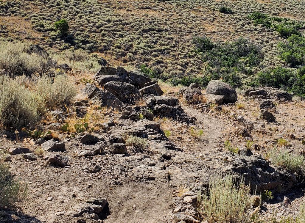
All trail forks are marked with carsonite posts. Navigation is easy. There are multiple spots
where narrow steep hiking trails cut across the bike route. These intersections
show the little
hiker symbol as well as the trail name. It should be obvious that these
are foot-traffic only.
Viewpoints are rare -- mostly a partial glimpse to the north through the trees. You'll want
to stop on the far east corner of the loop for the ride's best views.
On the edge of the ridgeline,
you'll be able to see many miles to the north and east.\

View to the east with receding mountain ridges of the Uintah Mountains in the distance.

Typical trail, with undulating smooth dirt ribbon in a forest of tall fir.
At a turn on the lower eastern side of the Road to WOS loop, the newer No Worries trail joins.
Make the hard turn if you're continuing the Road to WOS loop.

The entry to the bottom of No Worries from the Toll Canyon Road.
The No Worries trail offers another route for riding Road to WOS. It links the Toll Canyon
Road (the gated continuation of St Morritz Terrace) to the lower eastern
side of the Road to
WOS loop. In turn, the Toll Canyon Road links to the
A Toll New World
trail, which can take you to the
Gorgoza Park trail system
.
From the Toll Canyon Road, No Worries climbs through a lot of switchback turns. It's 2.1 miles
long, with 800 vertical feet of climbing. While most of the trail is smooth
dirt, there are
jagged bits of embedded limestone rock in some of the switchback turns
that require a bit more
skill and strength to clear when riding uphill.

Climbing uphill through fir forest at a pleasant pace.

A grove of maple fills a space in the dense conifer forest.
The terrain is heavily forested, with only a couple of narrow breakout views. The trees are
mostly mature fir but there are some stretches of maple, and an aspen
here and there. The understory
is generally lush where light can reach the ground. The north-facing slope
and tall trees keep
this trail cool until afternoon.
When you reach Road to WOS, go right downhill to head for the bottom of the loop and the Summit
Park Peak trailhead, or left uphill to climb to the top of the loop at
7900 feet. Most riders
will loop around Road to WOS before backtracking on No Worries -- which
makes a very nice downhill
romp.

We'll cross this thin strip of meadow on our way uphill.

About half of the switchback turns are butter-smooth dirt with a tall bank. But others have little peaks of rough limestone protruding through, giving this trail an intermediate technical rating.
My ride recommendation for stronger riders would be to
start at the Discovery Ridge trailhead in the
Gorgoza
area
. Drop back to
the Millenium paved trail and link to the Gorgoza Park trail for more
miles. Make a couple of laps around the
Gorgoza DH trail
system
. Climb
A
Toll New World
to the Toll Canyon Road, link to No Worries, and climb up
and around Road to WOS.
This ride will be around 20 miles (if you start by doing the Gorgoza Park trail then do a couple
of loops on the DH trails) with 3000 feet of climbing.
If you have the time and the endurance to add No Worries to your Road to WOS ride, I highly
recommend it. A simple lariat from Discovery Ridge to WOS and back will
be around 16 miles
with 2600 feet of climbing.

A rare breakout meadow on No Worries as we get closer to the top.

Looking south downhill after joining Toll Canyon Road from A Toll New World.
Toll Canyon RoadThe Toll Canyon Road links the southern end of the Sunridge Perimeter
(a PRIVATE trail for homeowners; don't go there) and the south end of A
Toll New World (public trail) to the bottom of No Worries to form a
continuous ride from the Gorgoza area uphill to Road to WOS. Toll Canyon
Road is part pavement
and part dirt doubletrack. It's 0.5 miles from the top of A Toll New World
to No Worries, with 150 feet of elevation loss.
The western end of Toll Canyon is an alternate trailhead with room for
only a couple of cars on the side of the road.

Heading south uphill on Spare Change.
Spare ChangeThis doubletrack will probably be of no interest to you. It's
0.4 miles long with 125 feet of elevation change. This trail is used by
locals to reach the Toll Canyon Road and link to No Worries or A Toll New
World. There's NO parking at the bottom, and the only reason you'd ever
use this trail is as an emergency bailout route downhill.

Climbing toward Toll Canyon in a mixed forest of aspen, fir, maple, and elderberry.
A Toll New WorldA Toll New World links the eastern
side of the Toll Canyon Road to the bottom of the Gorgoza DH loops (just a
bit uphill from the Discovery Ridge trailhead). The trail is mostly
forested with a gentle climbing pace on the uphill and smooth flowing
downhill. A Toll New World is 1.5 miles long with 400 feet of climbing
from Discovery Ridge to Toll Canyon.

Heading into a jump at the Gorgoza Park trails.
Gorgoza DH loopsThis is the famous "Arcylon"
loop, but with new DH routes added (an easy option and a technical
option). The new Discovery Ridge trailhead is just downhill, offering
quick access. A Toll New World heads west from the bottom, and Gorgoza
Park forks away from the middle of the Up trail.
Bottom Line:
Very fun ride with swooping trail in cool forest. Suitable for strong
beginners, but fun for advanced riders as well. Road to WOS is a short route by
hammerhead standards, but the addition of the newer trails No Worries and
A Toll New World offers the opportunity for much longer rides. It's
definitely worth the trip!

Climbing uphill through forest of maple and fir on the No Worries trail.
Loop (plus a loop) from Short Stack:
0.0 Park on Innsbruck Strasse
N40 44.467 W111 37.052
Climb Short Stack singletrack
1.2 Keep L uphill (R = Short Ribs)
Road to WOS N40 44.191 W111
37.228
1.5 Keep L uphill N40 43.998 W111 37.325
3.4 L straight onto Short Ribs
N40 43.990 W111 37.017
3.8 Hard L on Road to WOS
N40 44.191 W111 37.228
6.0 Back at fork, R downhill
N40 43.990 W111 37.017
6.8 Pavement at TH, go L uphill
N40 44.115 W111 36.976
Pavement turns into gravel
DT
7.6 Back at car at Short Stack

Map of Summit Park area
Getting there:
Road to WOS (Summit Park Peak) trailhead. Get onto Aspen/Maple Drive as above
and follow it to Crestview Drive. Take the left fork where Crestview turns
eastward. As you reach a Y intersection, go right on Parkview Drive. Now
stay on Parkview until you hit the T intersection with Matterhorn Drive.
Cross the road to find a spot to park. The trailhead is just a bit east of
the intersection on the south side of the road. It starts as a gravel
doubletrack for around 100 yards before becoming dirt singletrack.
Note: You can't drive the doubletrack Innsbruck Strasse between Short Stack and Road
to WOS. There are two ride-around gates..
Short Stack trailhead. At the top of Parley's Canyon, take the
Parley's Summit exit from I-80. Turn south (right if you're exiting after
climbing from Salt Lake City). Immediately turn to the right to head west
along the freeway on Aspen Drive, which becomes Maple Drive. Keep to the
right at all road intersections. Follow the main road as it turns left
uphill and becomes Crestview Drive. Again keep right as Crestview veers
left, and you'll be on Innsbruck Strasse. The pavement will turn to dirt.
A bit further uphill, you'll see the trail on the right side of the road.
Now find a place to park.
Toll Canyon.
When climbing Parkview Drive, turn left on St Morritz Strasse. Follow it
through two right-hand road forks, then turn left on St Morritz Terrace.
There's room for two or three cars on the right side of the road just before the
gate. Take the paved road down to the No Worries singletrack, on your
right after descending 0.2 miles.
Discovery Ridge trailhead.
Exit I-80's Summit Park
exit at the top of Parley's and turn east on Kilby Road. Drive 1.1 miles, then
turn right on Discovery Way. Discovery Way will dip through the shallow
valley and climb to three trailhead parking lots. The upper lot has
bathrooms and running water. This trailhead is my recommendation if you
can handle a longer ride.

Wider area view, including Gorgoza Park
Support this web site! Buy your
bike stuff from the
UtahMountainBiking store on Main Street in downtown Lehi.
.
Latest update July 2022.


 blooms on a rare sun-splashed section of trail.")