
Granite boulders and bitterbrush above Jordanelle. Photos and ride review by Bruce on July 6, 2021.
Skyridge Area Trails
Two Rocks, Milky Way, and Big Dipper trails
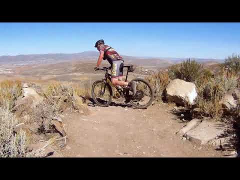
Oh Deer Flow trail with Sven and North Ross CreekThis page will cover three rides: A loop of 2.1 miles featuring the Oh Deer downhill flow trail,
an out-and-back to the top of Skyridge that's 6.2 miles with 900 vertical feet of climbing,
and a 5.5 mile loop ride of Milky Way and Big Dipper. All are intermediate-level rides and
can be quickly reached from a single trailhead on Jordanelle Blvd. The usual riding season
will be June through October.
For out-of-towners, I recommend the Skyridge trailhead on Jordanelle Blvd. But most local riders
pedal to the trails from the
Rail Trail
via the Park City and Jordanelle Parkway trails, from the Longview trailhead at
Ross
Creek
, or from Jordanelle State Park via the Jordanelle Parkway trail. (These alternate routes require
some explanation and are discussed below.)

The Jordanelle Parkway paved trail crosses the road to pass through the Skyridge trailhead parking area for Two Rocks and Milky Way. We're coming from the top of Oh Deer Flow trail.
Two Rocks and Milky Way
- as out and
back or route to Big Dipper

Entry to Two Rocks.
Two Rocks starts at the northern end of the Skyridge parking strip on Jordanelle Blvd. The
Two Rocks trail turns into the Milky Way trail in 1/2 mile at the point
where the Skyridge
hiking trail forks away. The total distance to the top of the peak is
3.1 miles, for an up-and-back
ride of 6.2 miles with 900 vertical feet of climbing.
Milky Way is also your route uphill to the Big Dipper trail, a bikes-only DH trail that forks
away from Milky Way just 1/10th mile below the summit of Skyridge Peak.
This ride is 5.9 miles;
6.1 if you do an out-and-back to the viewpoint at the top.
The starting elevation is 6450 feet. From the parking area, Two Rocks climbs gently for 1/2
mile, turning from northbound to southbound. This is a dry sage and grass
area with an occasional
bit of gambel oak.

Heading southwest after the turn on Two Rocks.

Granite boulders frame the entry to Milky Way where the hiking route forks away from Two Rocks.
The transition from Two Oaks to Milky Way is marked with a post as shown in the photo. So far,
you've climbed 100 vertical feet. Here the Skyridge hiking trail forks
away 160 degrees to
your right. Just keep straight.
Even though the foot trail has forked away, you'll still share the Milky Way trail with hikers.
Many prefer Milky Way, or will use it to stroll around a loop that includes
the hiking trail.
For the next 1.4 miles, Milky Way heads generally west in a steady climb. There will be a couple
of spots where you take a short jaunt back to the east to gain elevation.
The turns are banked
and smooth to ride uphill or down.

Looking west as increasing elevation brings tall bitterbrush and more substantial stands of gambel oak.

Looking southwest at the magma dike that forms the core of Skyridge Peak.

You'll cross the dike a couple of times. This will be at spots where it's low and flat.

Climbing back to the east on the final mile.
As you climb, there's more oak brush and tall bitterbrush. But except for a tiny stretch right
at the top of the hill, you're never riding in the shade.
There are constant views of Jordanelle to the south and east. You'll see the ski runs of Deer
Valley's Bald Mountain to the southwest. Take a minute to check out the
igneous intrusion dike.
This is the magma that brought the silver deposits to Park City.
When you reach the western side of the hill around mile 2.0 from parking, there's a trail fork.
The old trail-cut (to your left) descends to a dirt road. If you go north
on this road, it
will intersect the Park City trail then go out to the paved Richardson
Flats Road just east
of the Park and Ride. This offers a potential emergency bailout. Keep
right and uphill here
on the 2021 trail-cut.

On the western side, looking at Bald Mountain of Deer Valley. The pale areas below are road-cuts for US-40.

Looking down on Jordanelle and Jordanelle Blvd.
After the mile 2.0 trail fork, the pitch of the trail increases and the riding surface gets
slightly more techy. There's a bit of broken loose rock in some areas
-- not a problem on the
climb, but slippery on the downhill. You'll climb through a few turns
before heading back around
to the east side of the mountain.
At mile 2.9, Milky Way is joined by the hiking trail. At the trail fork, make a hard left turn
uphill. (Straight ahead is the Skyridge foot trail downhill -- closed
to bikes!) This hard
turn at the trail fork is the first of two hard-to-clean 180-degree turns.
After another 1/10th mile, you'll reach the Big Dipper trail fork. Keep left if you're doing
the up-and-back climb to the viewpoint on Skyridge Peak. You'll return
to this spot on the
way back.

Riding through the bitterbrush near the top of the hill.

The summit.
The trail ends at 7400 feet elevation at a viewpoint. In 2021 there was a rock-stacker shrine,
gone in 2022. Take a minute to enjoy the views. There's barely enough
room here to turn your
bike around, so it's not a spot for a big group of riders to stay and
party.
Seen enough beautiful views? Now hit your 3.1 miles and 900 vertical feet of downhill descending
Milky Way, or drop back 0.1 miles to the Big Dipper trail fork for the
loop ride!
Big Dipper
- bike-only downhill
trail

Like Milky Way, Big Dipper is surrounded by volcanic rock, but with only a couple of outcrops that you'll ride over. In 2022, 99% of the trail is pure dirt.
Big Dipper is a downhill-only, bikes-only trail that drops from Skyridge Peak to lower Milky
Way just above Two Rocks. It was completed in fall 2022. The top is 0.1
miles down from the
viewpoint atop the peak, and the bottom is 0.6 miles uphill from the Skyridge
trailhead. The
Big Dipper trail is 2.4 miles long with 600 vertical feet of elevation
loss.
The trail is rated intermediate in technical requirement. But determined beginners and early-intermediates
can easily ride the trail simply by controlling their speed.
As you climb Milky Way, the Big Dipper is one switchback uphill (around 1/10th mile) from the
trail fork where the hiking trail merges. There's a sign at the hiking
trail, but remember
the Big Dipper is further uphill. At the Big Dipper trail fork, you can
go left to do an out-and-back
to the viewpoint on Skyridge Peak, or keep right if you've been-there
done-that and just want
to start downhill.

Rolling east on Big Dipper.

Spotting Highway 248 from the trail.
The Big Dipper trail starts in oak forest, descends to bitterbrush, then hits a misture of
sage and low scrub oak on the lower slopes. Like Milky Way, it's almost
entirely sun-exposed.
There are two 100-yard sections where the gambel oak is tall enough to
be considered "forest."
Big Dipper will cross the Skyridge hiking trail after 1/2 mile of descending. Shouldn't be
confusing; just keep straight. But watch for foot traffic crossing Big
Dipper at this spot.

The Big Dipper trail is rated intermediate overall. The top 1/2 mile definitely earns that rating. The lower portions of the trail feature long traverses and less-demanding descending.

This trail can be done by experienced strong beginners or by early-intermediates.
In 2022, the trail is fresh and loose. It's easy to slide out on the turns. You won't be able
to rail the turns hard. Some of the turns on Big Dipper -- especially
lower down -- are fairly
flat. On these flatter hard reverses, you won't have gravity pulling you
into the upper half
of the turn. You'll start sliding long before your tires could contact
any berm on the lower
half of the turn. This will get better as the trail compacts.

Turns are mildly banked. The berms aren't tall enough to really slam through with speed, especially when the trail is loose.

A look at Jordanelle over the handlebars.
Like Milky Way, Big Dipper has a lot of nice views of Jordanelle and the surrounding mountains.
But you probably won't spend any time looking. It's a fairly fast and
furious downhill.
At the bottom, Big Dipper dumps onto Milky Way 1/10th mile uphill from Two Rocks. (You remember
that Two Rocks changes into Big Dipper at the point where the hiking trail
forks away.) The
trail fork is oriented to kick you back uphill for another lap. Or you
can turn hard left and
coast down to parking.

Hooking a 180 after completing the loop.
Oh Deer Flow trail and North Ross Creek
-
loop ride

Heading south on the Jordanelle Parkway trail to complete a lap. Note the trail just to the left of the bitterbrush. That's the combined Oh Deer Flow and the Tricky Loki hiking trail.
Oh Deer Flow TrailGo across the road from the Skyridge trailhead and turn left (north,
uphill). Pedal 0.2 miles. Now look for a big bitterbrush standing alone on
the right side of the parkway trail.
The trail drops away there but you might not spot it if you're riding
fast.
In 30 feet, the trail splits. Make a hard left turn for the Oh Deer
Flow trail. The right fork is the Tricky Loki hiking trail.
Go across the road from the Skyridge trailhead and turn left (north, uphill). Pedal 0.2 miles.
Now look for a big bitterbrush standing alone on the right side of the
parkway trail. The trail
drops away there but you might not spot it if you're riding fast.In 30
feet, the trail splits. Make a hard left turn for the Oh Deer Flow trail. The right fork
is the Tricky Loki hiking trail.

At the trail fork. Oh Deer turns 120 degrees left as Tricky Loki goes right.

Handlebar view of Jordanelle from the trail.
The ride downhill is easier-intermediate, with a smooth surface and banked turns with generous
radius. This trail could be done by your pre-teens or by an experienced
beginning rider.
There are two short alternate left-hand lines marked as expert. They're ride-overs that any
experienced intermediate rider should be able to do.

Well-marked official alternate line. The expert path to the left simply runs up and over a rock outcrop.

Typical banked turn.
The hillside is a mix of sage and gambel oak. There are nice views south over the Jordanelle
Reservoir.
At the bottom, Oh Deer rolls through a sloped sage meadow
before dropping to join the Sven trail.

Sage slope before the final drop to join the Sven trail.

On Sven as Oh Deer joins. We're at the loop's lowest point.
Sven TrailThe Sven trail, as of July 2021, is an incomplete route. You'll join it
for 0.1 miles to get up to the paved trail. Navigation is simple here.
Just keep straight until the trail turns uphill onto a paved spur.
FYI, Sven appears to be a future riding loop. But for now, except for the short stretch you'll
use to get out to the pavement, it will reach a dead end in either direction.
On the lower
side, it peters out in a damp sedge meadow. On the upper side, the right-hand
trail fork goes
to a fence at a property border. There's no reason for you to go exploring
at this time.

Looking down the Sven trail.

We've just crossed the street and are now heading northwest on the parkway trail.
Ross Creek ParkwayAt the top of Sven, take the paved spur out to the street and turn
right downhill on paved trail. In 100 yards, spot the paved trail across
the road and turn left to the climbing trail. Head uphill.
2021 route: When the paved trail descends alongside a cindered path, keep right and leave the
pavement. (The paved path will dead-end in a construction area shortly.
There was a dirt path
through, but it was blocked by construction equipment on my ride.) After
0.2 miles on the wide
cindered path, watch for a singletrack on your right. This is your climbing
route to the Jordanelle
Parkway trail, the North Ross Creek singletrack.

Keep right here, leaving the pavement. Then when the trail descends, watch for the singletrack on your right.

Cruising through aspen and brush.
North Ross Creek SingletrackFrom the Ross Creek Parkway, head uphill on the singletrack that runs
parallel to Highway 248. The North Ross Creek singletrack climbs just
under 200 vertical feet in 1/2 mile. It will quickly pass through several
types of terrain: riparian area near the stream, maple and aspen groves,
and dry scrub hillside.
The trail will gradually pull away from the highway and you'll see Jordanelle Blvd above you.

About half-way up, we're on a dry scrub hillside. The Jordanelle Parkway trail is along the road above.

A final grove of aspen before the trail ends on the paved parkway trail.
When the singletrack ends on the paved trail, turn left and pedal 0.4 miles to the top of Oh
Deer for another lap.
Connecting to the trails by bike!

Park City Trail. This is the old Kamas railroad path.
Park City Trail from the Rail TrailThe Park City Trail will deliver you to the Jordanelle Parkway Trail,
where you can pedal another 1.2 miles to the top of Oh Deer Flow trail,
plus another 0.2 miles to the Skyridge parking area. While pedaling east
on the Rail Trail, pass under US-40. Then just after the trail turns to
head north, turn 180 degrees south on the Park City Trail.
Ross Creek Parkway trail.
Ross Creek (Jordanelle State Park's Wada Way and Keetley
trails)Pay your state park fee and ride the trails in the state park. When
you're ready to move on to the Skyridge trails, backtrack along the entry
road on your bike. Keep straight at the road fork and get onto the paved
bike pathway on the south side of the road heading west. After the trail
changes from downhill to uphill, transfer to the trail on your right
across the street when you see it. When you reach
the spot where it ends (July 2021), continue on the gravel path (uphill
from the paved trail) 0.2 miles. Turn right onto the North Ross Creek
singletrack and climb up 1/2 mile to the Jordanelle Parkway trail. Turn
left and pedal 0.3 miles to the top of Oh Deer Flow trail, or another 0.2
to the Skyridge trailhead.

Jordanelle Parkway trail.
Jordanelle Parkway Trail From Jordanelle
State Park! Pedal out of the park toward US-40 then turn right on
Jordanelle Blvd just before the on-ramp. The trail starts alongside the
road. Follow the paved trail north 3-1/2 miles and turn into the Skyridge
trailhead parking to find the Two Rocks trail (which becomes Milky Way).
The top of Oh Deer Flow trail is another 0.2 miles up the Jordanelle
Parkway trail.
Alternate access:See below for the main Skyridge trailhead directions!
Jordanelle Blvd - Richardson Flat trailhead. Take Highway 248 to Jordanelle Blvd (see
below). Drive 150 yards, then turn left at Richardson Flat Road and
immediately left again into parking. The Jordanelle Parkway trail is
across the road from parking. (The Park City trail ends at this parking
lot.)
Park and Ride to Park City trail. As described above, turn onto Richardson Flat
Road, but do not turn into parking. Drive on Richardson Flat Road for 0.8 miles
and turn right into the Park and Ride. The Park City trail is right across
the street from the entry to the Park and Ride.

Wide area map to show connections from other riding areas.

Riding area
Getting there, Skyridge TH:
From Heber. When coming from the south on US-40, exit at Jordanelle State
Park (Mayflower). Turn right onto Cranmer, then immediately left on
Jordanelle Blvd. Drive around 3.5 miles north, then turn into a small
parking area on the left side of the road (there's a marked trail crossing
here, so it's hard to miss). Two Rocks starts at the north corner. To
reach Oh Deer Flow Trail, cross the road to the Jordanelle Parkway trail
and pedal north north 0.2 miles. Spot the singletrack trail on your right.
From Park City or I-80. When driving southbound on US-40, exit toward
Kamas on Highway 248 at Quinn's Junction. From Park City, simply continue
east on Kearns Blvd until you pass under US-40. Now drive 1.3 miles on 248
then turn right on Jordanelle Blvd (13970 North). Drive 1.6 miles and turn
right into the parking area.


