Looking at the red Navajo cliffs from the Red Reef East trail. Review and photos by Bruce on February 12, 2022.
Quail Creek to Tipple Trail Ride
includes Red Reef EastThe Quail Creek to Tipple loop ride is a popular option in the Red Cliffs recreation area west
of Harrisburg. There are many options for longer versions of this ride. I'll be describing
the shorter (4.9 mile) and most popular version. You can arrive at the loop from the White
Reef or Red Reef trailheads in the recreation area, or tie in from the Prospector trail, or
even ride to it on dirt roads from Wells Fargo in Silver Reef.
The Red Cliffs recreation area is maintained by the BLM. Trailheads have bathrooms and water,
and there are shaded picnic facilities at the Red Reef trailhead. There's
a fee for day use
($5 per car in 2022). For other trails in this area, see the
Red Cliffs
trailhead-area page
, the
Prospector Trail page
, and the
White Reef to Leeds Reef page
.
My description of the ride assumes you'll be starting from the White Reef trailhead just off
I-15. Note that the area near this trailhead was severely burned by a
fire in 2020, but the
western side of this loop ride was not affected.

Step-over exit from the White Reef trailhead, with map and fee station.
Starting from the White Reef trailhead, pedal west 0.2 miles
on White Reef and turn left on the
Adams trail. This is the second
option on your left, 0.2 miles from the trailhead, and just after passing
the entry to the
Leeds Reef trail on your right.
Cross the Cordura trail, then in 0.1 miles, cross the bridge over Quail
Creek and make a hard right onto the Prospector Trail Connector.

Southbound on the Adams trail, heading towards Quail Creek.

Looking west as the Quail Creek trail forks away from the Prospector Connector.
After 0.1 miles on the Prospector Connector (mile 0.3 from
the trailhead), turn right onto the Quail Creek trail. The first
half mile of this trail will be riparian habitat, but many mature trees
were killed by the fire in 2020. So it's a bit weird.
After heading west for about 0.4 miles, it's time to cross Quail Creek again. This time, there's
no bridge. But the creek is a bit smaller because we're now above the
confluence with Leeds
Creek. On my February ride, coasting through wet the lower half of both
shoes but nothing came
over the top to get inside.

Dropping down into Quail Creek and up the other side!

After dipping through the creek, you'll ride winding trail through a sage and juniper environment.
Now you'll follow the northern flank of the creek as you continue to the west toward the Red
Cliffs.
The Quail Creek trail climbs away from the creek at around mile 0.8 of the ride. Here the brush
has not burned, and you'll enjoy a ride through giant cactus, brittle
sage, mesquite, and the
occasional cedar.

Granite boulders and giant cactus and a Rocky Mountain bike.

Approaching the end of Quail Creek. For photos and detailed description of the Anasazi trail area, see the Red Cliffs page.
After one mile on Quail Creek (mile 1.3 of the loop), the
trail ends at a T intersection with the
Anasazi trail. Turn to the
right here, and we'll take Anasazi 0.1 miles to
Metate, which will
shortcut over to the Red Reef East trail in 0.1 miles. (See the main
Red
Cliffs page for close-up details of the trails near the Red Reef
trailhead.)
(If you need water or want a shaded table for lunch, you can fork left
and follow Anasazi to the campground loop and day-use area. But my
loop-ride recommendation is designed to keep you away from crowds of
hikers as much as possible.)
There's another connector between Anasazi and Red Reef East. This one is just 100 yards outside
the campground area, called Mano. This option would add around 0.4 miles
to the ride: Instead
of turning right on Anasazi from Quail Creek, turn left. As you approach
the campground, fork
right onto Mano and pedal up to the step-over gate for Red Reef East and
turn right to head
north.

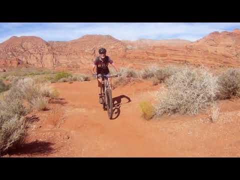
Northbound on Red Reef East. After a bit of cruising in the wash bottom, you'll climb out onto a low ridge of sage.

Yep. Them's footprints. Fer sure.
There's a dinosaur trackway just off Red Reef East. It's 0.2 miles from the campground and
marked by a tiny sign just off the trail. If you followed my advice to
take Metate over to
Red Reef East, you'll need to take a small detour to see them: instead
of turning right on
Red Reef East, keep straight and cross the wash. Just uphill is the path
to the tracks. Then
turn around to go back east on Red Reef East.
The broad old ATV path of Red Reef East narrows to new singletrack and winds through tall brush
generally eastbound. There will be a little gentle up-and-down, but the
riding is fairly flat
and non-technical. You'll be gradually gaining around 100 feet of elevation
as you proceed
east.

Twisting through the gooseberry bushes on Red Reef East.

As we gain elevation and ride further from the cliffs, the terrain changes to mesquite and brittle sage.
After 0.5 miles on Red Reef East (assuming you took the Metate cutoff instead of going to the
campground area), you'll reach a trail intersection. To your right is
the singletrack portion
of the Tipple Trail. Fork off Red Reef East to continue the loop.
Option: upper Silver Reef
Were you to continue on Red Reef East, it will turn northwest. The official singletrack trail
ends at a gate 1/4 mile later. The doubletrack dirt road that the singletrack
replaced continues
northwest for 2.5 miles and ends on paved roads in western (uphill) Silver
Reef.

Looking south on Red Reef East near the trail's end at the Silver Reef dirt road.

Entry to the Tipple Trail singletrack from Red Reef East. We're looking south.
From the Red Reef East trail, the Tipple Trail
initially turns to the south. Over 0.3 miles, you'll drop 100 vertical
feet before splashing through Leeds Creek. (Assuming there's enough water
there to splash.)
After crossing the creek, the Tipple trail begins climbing. The target is the top of White
Reef, where the Tipple trail will join an old mining road.

A dip through Leeds Creek.

Climbing away from Leeds Creek on the Tipple trail. We're heading for the ridge on the skyline.

The trail has meandered back southbound as it traverses a rock outcrop. It will turn north again.

Last bit of climbing. The carsonite post marks where the singletrack joins the old mine road.
From the creek crossing you'll climb 0.5 miles and 150 vertical feet to reach the old mine
road. The last 100 yards has the most pitch, but isn't too tough. At the
doubletrack, you'll
have spent 0.8 miles on Tipple, and you're at mile 3.1 of the loop ride.
Keep to the left and
northbound on the Tipple doubletrack.
(To the right, the old dirt road continues 1/10th mile to a saddle. This is a popular lunch
spot with spectacular views.)
The old doubletrack will descend along the top of the reef. You'll want to take a break to
look at the spectacular views!

Rolling along the top of the reef. You can see the tipple (the small dark spot mid-upper) ahead.

The tipple. So if you stop here and pull the beer out of your backpack, are you tippling on the tipple?
You'll pass the old tipple on your right once the slope flattens. If you Google "tipple" you'll
learn about drinking alcohol. But a tipple is a structure that brings
the mined material (in
this case silver-containing sandstone) up above ground level where it
can be dumped from ore-carts
into other vehicles (such as mule-drawn wagons) for transportation to
the nearby processing
facility.
At mile 1.0 of the Tipple Trail, the
Adit trail forks
away to the right (mile 3.3 of the loop). This singletrack descends 0.1
miles down to the northern end of the White Reef trail. (If you want to
descend Leeds Reef, stay on Adit to climb the other side of the shallow
valley, then turn right when Adit joins Leeds Reef.)
Another option is to continue on the Tipple Trail dirt road for another
half mile. As a second dirt road comes in from the right (mile 3.8 from
the trailhead), turn hard right 150 degrees. That doubletrack will become
the singletrack Leeds Reef.

Looking up at Adit from the junction with White Reef.

View downhill as we blaze south on White Reef to complete the loop.
If you took the Adit trail to White Reef, here's your
payoff. White Reef is a gentle smooth descent where you can fly.
You'll spend 1.4 miles descending 300 vertical feet. The loop is complete
at mile 4.9 as you arrive back at the White Reef trailhead.

Map of the recreation area trails
Getting there:
From St George, take the Hurricane (Highway 9) exit from I-15. At the
Telegraph Street (Highway 212) traffic light 1 mile later, turn left.
Drive 4 miles northeast on Old Highway 91. At Harrisburg, turn left to the
tunnel under the freeway and duck under both sides of I-15.
If southbound on I-15, exit at Leeds. Turn right under the freeway, then
right onto Old Highway 91 southbound through town. At Harrisburg 3.4 miles
later, turn to the right and go under the freeway on a narrow single-lane
road.
White Reef trailhead: After passing under I-15, turn right
at the T intersection. Follow the road as it turns left and enter the
parking area. Self-service fee envelopes are at
the step-over for the White Reef trail at the southwest corner of the parking area.
Red Reef trailhead: At the T intersection after passing under
I-15, go left. Cross Quail Creek
and follow the road towards the cliffs. Pay the entry fee at the station
(or self-serve if unoccupied). The Red Reef East trail and the Anasazi
trail have separate entrances on the northern side of the loop road and
are not directly accessed from the parking lot.
Both trailheads have a bathroom and water. Camping and picnic tables
are available at Red Reef. Note there is a $5 per car fee (2022 price) for
day use of the Red Cliffs recreation area.
For other trails in this area, see the
Red Cliffs
trailhead-area page
, the
White Reef to
Leeds Reef trail page, and the
Prospector Trail
page
.
Silver Reef: Take the Silver Reef I-15 exit and head west,
following the signs to Silver Reef. Find the parking area just south of
the Wells Fargo building. Work southwest on dirt roads until you arrive at
the fork between the Tipple trail and the Leeds Reef trail, both of which
are dirt roads at that point. The intersection is not marked. GPS
navigation is recommended.
Cottonwood Trailhead (for Prospector Trail): Take the UT-9 exit from I-15
(highway 9 goes to Hurricane, Zion Canyon, Grand Canyon) about 15 miles north of St.
George. Turn towards Hurricane and pass Coral Canyon. Instead, drive to
the traffic light in 0.7 miles. Turn left on Old Highway 91. Now go exactly 2
miles north. Watch on your left for a gravel road that enters a tiny single-lane
slot under the freeway, with a sign that says "Cottonwood Trailhead".
It will be between a beer warehouse labeled Winkel Distributing and a Rocky Mountain Power
office. Turn left and drive 0.25 miles under both lanes of the freeway to reach the
trailhead. Follow the Cottonwood Trail 0.5 miles then veer left at two forks
that are about 50 feet apart. The Prospector Trail will parallel the freeway
heading south 3 miles. If you want, turn left when it intersects the Church Rocks Loop and
ride the loop clockwise. The ride will be about 11 miles.
Grapevine Trailhead (for Prospector Trail): On I-15 just north of Washington, take
exit 13 for Washington Parkway. Turn north on Washington Parkway toward
the mountain (left if you're coming from St.G). The road will end
immediately after the northern off-ramp. Continue straight onto dirt
(note: will change as area develops). 100 yards later, pass through fence
and park. N37 08.981 W113 29.430. The ride starts on the dirt road that's
to your right as you go through the fence, heading northeast parallel to
the freeway. As the road turns west (left), find the singletrack trail
that continues north. Follow it to the top of the hill. Straight ahead is
a steep rocky plunge into the wash. If you go left 1/4 mile, there's an
alternate trail that's a calmer smoother ride. It will take you down
through the wash to the southwest corner of the Church Rocks Loop. To get
directly to Prospector, fork right.