
Across the valley, the single-track descends towards the Colorado River. Photo April 17, 1999
Porcupine Rim Trail
The Porcupine Rim Trail is the "other" famous classic ride at Moab. At 15.6 miles, requiring expert technical skills, this ride is for advanced bikers who are in good shape. It's one-way with a shuttle car, or a 34-mile loop for the truly insane (10 uphill miles from Moab to the trailhead, 8 flat miles from Jackass Canyon back to the middle of Moab).
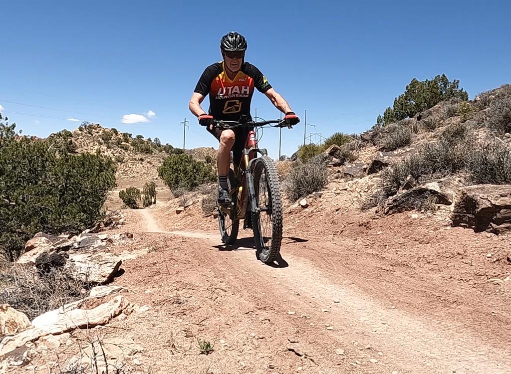
The ride begins with a 3 mile climb up rocky ledges on a wide-track trail. This is a moderately
strenuous climb, gaining 1000 feet to an altitude of 6,800 feet.

Gary Argyle grinds up the many rock ledges on the way to the top of Porcupine Rim. Photo Bruce Argyle, October 21, 2000.

While Dominic is at the hospital getting his broken wrist x-rayed, the Mad Scientist bikers pose on top of Porcupine Rim, in front of the grand vistas of Castle Valley. October 21, 2000. L to R: Chad Hunter, Matt Flygare, Mike Engberson, Gary Argyle, and Bruce Argyle.
Reaching Porcupine Rim, you'll find a mob of young buff bikers admiring the view of Castle
Valley to the north. The spires of Castle Valley are spikes of Wingate
sandstone sitting on
red mudstone beds of the Moenkope and Chinle formations. These strata
originated in Triassic
times (around 220 million years ago).
The real ride begins at the Rim. This is primo downhill advanced technical stuff, dropping
off a gazillion small rocky ledges, with the last 3 miles a hairy single-track
on the edge
of deadly cliffs. From the Rim, you'll drop 2,700 vertical feet to the
Colorado River over
11 unforgettable miles.

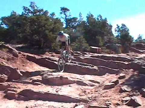
Rob K takes a ledge on the downhill flight. May 18, 2002.

Chad takes a hop off a "the Diving Board." October 21, 2000.
The downhill varies from smooth cruising to rocky technical stair-stepping. Especially on the
singletrack section at the end, all but the very best stunt-riders will
have to portage the
bike over a few obstacles.
The trail can be ridden with a hardbody or hardtail bike, but your body will pay the price.
There's a lot of slamming and banging on the way down. We recommend dual-suspension
for this
ride. Many bikers will soften the suspension at the summit, to let the
bike absorb the thousands
of impacts on the way down.

Matt and Mike drop down the rocky ledges. October 21, 2000.

Gary and Mike watch Chad fix his bike. October 21, 2000.
We rarely finish this ride with all of our bike parts. This ride temps you to bang down the
ledges with abandon -- which can be pretty rough on your steed. Be prepared
to replace a snakebit
tube, to straighten a bent rim, and to fix a broken chain. If your bike
is fairly new, schedule
a couple of stops to tighten all the bolts.
Getting there: The Porcupine Rim Trail begins on the Sand Flats Road, reached by turning left
off Moab's main drag onto 300 South, then right when the road ends, then
second left. From
the entry gate, drive 7 miles. The trailhead is on the left, near the
small cattle-watering
tanks. Leave your shuttle car in Moab, or at the Grandstaff Canyon parking
area on highway
128 north of Moab. (Known as Negro Bill Canyon prior to 2017, the canyon
is named after William
Grandstaff, a black cowboy who ran cattle in this area in the 1870s.)

V iew down Jackass Canyon on the way down towards the Colorado River. Behind the river, Moenkopi and Chinle formation slopes lead up to cliffs of Wingate sandstone. The cliff-top is Kayenta sandstone. Mounts of Navajo sandstone can be seen on the skyline. April 17, 1999 Bruce Argyle

Map of Porcupine Rim as a loop ride
Riding resources:
GPS track files (right-click and "Save as..."):
GPX
Topo map:
View
Hres
Lodging, camping, shops:
Links to Moab area resources