The Mill D North Fork trail is a tad on the technical side, with many roots and embedded rocks. It's also a fairly stiff rate of climb. So it's best for strong-intermediate or advanced riders. It's a great downhill, but a bit of a beast to climb up.
But the uphill is nice and has some fun riding options -- for example the little loop on the Big Cottonwood side of Dog Lake -- if you've got the leg for it.


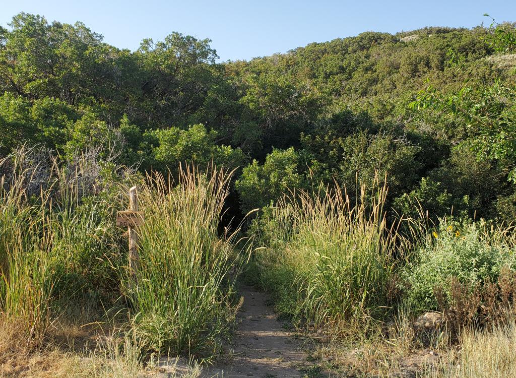
Mill D North Fork is very popular with hikers. On a Saturday, you'll need to be extra careful. Be considerate of other trail users.


Keep to the right to climb higher on Mill D.


The Dog Lake to Desolation Connector is 0.9 miles long with 100 feet of climbing. It can take you to the southeast corner of Dog Lake, where it joins to the Dog Lake to Mill D Connector trail.


Loop 1: Most bikers ride a loop by climbing the paved road from the trailhead. Turning left onto the Guardsman Road, they ride to the Wasatch Crest trailhead and climb Puke Hill. Just past the Desolation Lake overlook, the trail forks left to drop down past the lake. Keep left at the Dog Lake trail intersection. This gives 4 miles of kick-butt downhill. Total climbing is 2700 feet, distance 16.7 miles. To avoid the road ride and 1700 feet of climbing, you can leave a shuttle at the Mill D trailhead and drive up to the Wasatch Crest trailhead. [ GPX Track ]


NOTE: Upper Mill Creek trails are CLOSED to bikes on odd-numbered days.

0.0 From parking north up ST Mill D North
N40 38.672 W111 38.412
1.6 Stay R on Mill D North (L = Dog Lake)
N40 39.759 W111 37.791
3.9 Pass Desolation Lake
4.1 L on Wasatch Crest
N40 39.507 W111 35.794
6.5 Keep L, downhill on Mill Creek Trail
N40 41.224 W111 36.087
(R = to Midmountain Trail)
7.6 Keep L N40 40.975 W111 37.177
9.5 L uphill at 4-way (to Dog Lake)
N40 40.694 W111 38.514
10.4 Pass Dog Lake
11.0 R downhill on Mill D North
N40 39.759 W111 37.791
12.5 Back at parking

Getting there: Go to Big Cottonwood Canyon (Wasatch Blvd and 72nd South) and drive 8.8 miles up from the traffic light. Park near the trailhead on your left. GPS N 40° 38.976' W 111° 38.884'.
Guardsman Pass trailhead: Ride up the road past Solitude Resort (about 6.5 miles). Just before you reach Brighton, the road to Guardsman Pass turns off on your left. Exactly one mile later (1.8 miles from the fork in the road), you'll see a dirt road on the left. GPS N 40° 36.817' W 111° 33.532'. Park along the hairpin turn and bike up the road.
Single-page riding guide
GPS track files and route (right-click and "Save as..."):
Area multi-track file
High-res topo (printable): View map
Lodging, camping, shops:
Links to northern SLC resources
Links to southern SLC resources