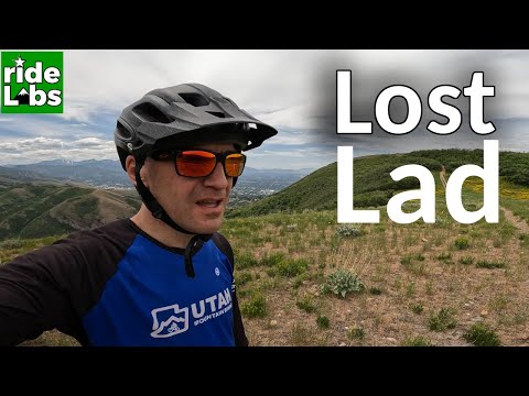
A rare bit of straight trail in the upper canyon on Lost Lad. Photos and trail review by Bruce on September 24, 2021.
Lost Lad
(Jones Canyon)Lost Lad is a downhill trail in Jones Canyon between northern Salt Lake City and Bountiful.
This ride is best reserved for expert or true upper-intermediate riders. There's steep climbing
to get there and moderately techy riding down the canyon. The expected riding season is late
May through November.
The Lost Lad trail itself is 1.4 miles long with 650 feet of elevation loss, starting from
a ridgeline at 6100 feet elevation. It drops west in the bottom of Jones
Canyon to end on the
Bountiful
Bonneville Shoreline trail (BST)
The upper portion is winding forest riding with multiple gap jumps. The final third of the
ride is a wild twisting plunge in the bottom of a ravine.

Looking south at the Salt Lake Valley just before plunging into Jones Canyon.

Looking south at the combined Tower Road and BST, at the fork where the cruel climbing begins (see route below).
Lost Lad can be reached in three ways. From the foothills of northern Salt Lake City, all the
possible starting points funnel into the
Tower
Road in Hell Canyon
, which climbs to the top of Jones Canyon from the southwest. From Bountiful, the
Bonneville
Shoreline Trail
takes you up to join the Tower Road. If you don't like gravel roads, you can climb up through
the
Wild
Rose
trail system and take either of the viewpoint trails to the ridgeline where you can drop down
to Lost Lad from the north. (See below for more details on the climbing
routes.)

Looking west from the top of Jones Canyon.
When approaching from the southwest, the gravel road will turn into a doubletrack at the ridgeline.
Keep to the right at a trail fork and descend a rough boulder-strewn slope.
At the bottom,
keep right again to go around a small hillock, then drop to the right
into the canyon.
From Wild Rose, turn right from the viewpoint trail onto doubletrack southbound. At the bottom
of a dip (the top of Jones Canyon), turn 150 degrees to the right downhill
on the Lost Lad
singletrack.
The trail will begin twisting through a forest of maple and oak. The track is narrow, with
a couple spots where a tree trunk can catch your handlebar if your aim
is off. (On my check-out
ride I made a wild tumble to avoid injury when I hooked my left handgrip
on a small tree and
continued airborne down the trail without my bike.)

Heading down the canyon. Slopes in the upper canyon are generally gentle with banked turns.

Set of two gap jumps in sequence, with a ride-around on either side.
The upper canyon has multiple gap jumps. All have ride-arounds, although there are a couple
that look like simple optional lines until the hole opens up in front
of you. The gaps usually
have an excavated area to deepen the hole between launch and landing.
(This is not an attempt
to make you "pay" for a botched jump. The hole forces novices to avoid
rolling through the
gap, so it preserves both the launching lip and the upper part of the
landing ramp.)
Most of the gap jumps are fairly low at around 18 inches of ramp height, with perhaps an extra
foot of depth added between launch and landing. Sight-lines coming into
the stunts are adequate
even for a first-timer. Between jumps the trail is fairly straightforward
cruising on narrow
dirt ribbon with a root or two.

Continuing downhill through variable forest.

Breaking out into the only meadow of the descent.
There's one meadow where you can take a quick look at the views to the west. Then head down
to the tallest gap of the trail toward the end of the meadow.

A wooden ramp leads up to a bigger gap jump in the meadow. A long straight approach lets you get speed.

One of the last gap jumps has some timber covering the hole, and some riders have been rolling through.
The slopes of the canyon become more steep as you approach the bottom. The trail settles into
the bottom of a ravine, hitting the sides as it twists down a high-speed
plunge. Here the pitch
of the trail increases the further down the ravine you go. There will
be some rock outcrops
to dodge.

Starting the twisty flight down the ravine.

Further down, there are steeper walls and rock outcrops. This area will have flowing water in the early spring.
At the bottom of Lost Lad, the trail pops up onto a water-control dike across Jones Canyon.
The BST is on top of this artificial ridge. Turn to the left to head back
to SLC or to climb
up for another round. A right turn on the BST takes you up the side of
Jones Canyon and then
down to Tunnel Springs Park. If you came from Wild Rose, that trailhead
is just down the street.
Getting to the top -- via Bountiful BST

Entry gate from the BST trailhead.
The southbound Bonneville Shoreline Trail starts at the end of Eagle Point Blvd. At the entry
to paved parking for Tunnel Springs Park, pedal south on the wide cindered
path above the gravel
road. Or you can park in the gravel parking spot just down that road and
catch the short connector
to the trailhead gate.
As you enter the Bonneville Shoreline Park, keep straight onto a wide road-like trail. (There's
a singletrack heading west immediately after the entry. It will curve
around southbound. If
you pedal that direction, there's a connector on the left uphill after
0.6 miles that rejoins
the broad BST just before it starts the climb up and around the hill.
Don't follow the singletrack
around the mountain. It gets less bike-friendly as it heads over to the
edge of Hell Canyon,
and to my knowledge, it doesn't connect through to where you want to go.)

Heading south on the BST. Enjoy the easy cruising while you can.

Looking south from the BST at the lower towers. When we reach the ridge there, we'll turn left uphill and head for the second towers.
At mile 0.6, the trail begins climbing. Counting the dip through Jones Canyon, there will be
a bit over 400 vertical feet of climbing in the 0.9 miles before you join
the Tower Road.
At mile 1.0, you'll drop through Jones Canyon, then at mile 1.5 from the trailhead, you'll
arrive at Tower Road. Turn left uphill here.
Now the climbing gets serious. The loose rocky surface of Tower Road is regularly torn up by
vehicles, so you'll be constantly watching for the best-grip, most boulder-free
line. There
will be 600 vertical feet of climbing over the next mile. Buckle up, little
camper.

Looking at the upper Tower Road. We'll pass these upper towers. The pitch here is around 12%.

We've passed the second set of towers and the pitch is mellow on this old doubletrack eastbound.
As you approach the ridgeline and see the mountains to the east, the road turns into doubletrack.
Keep to the left at a trail fork at mile 1.1 from the BST.
Now the doubletrack turns northbound. Descend a rough steepish section into the top of Jones
Canyon. Keep left now until you spot the singletrack heading into the
bottom of the canyon.
Getting to the top -- via Wild Rose

Wild Rose parking, looking east.
The Wild Rose trailhead is on Sky Crest Lane, just off Eagle Pointe Blvd around 1/4 mile downhill
from the BST trailhead. Find the singletrack at the back of the park.
About 1/10th mile uphill,
you'll need to decide which ridgeline viewpoint trail you'll take. The
right side is more direct,
but the left is more scenic and fun.
See the
Wild Rose page
for navigation details or follow Trailforks on your phone. Your goal is to get uphill to the
top of either the north or south ridgeline. See the map. Then you follow
that ridgeline to
the southeast and turn to the right onto a north-south doubletrack that
will take you to the
top of Jones Canyon.

We're at the highest point of the larger Wild Rose loop. The loop turns to the right. Straight ahead intersects the Woodbriar trail in 300 feet. Turn left there. I don't suggest attacking the trail that goes straight up the ridgeline.

The tough climbing is over, and it's a gentle grade as we pedal east toward the connector.
Southern Viewpoint route
Navigation isn't as hard as you might think. If you decide on the southern approach, take the
main Wild Rose trail uphill, then after 1/4 mile turn right on the Wild
Rose Overlook trail.
Crank up to the ridgeline and go southeast. Keep right as the gas line
forks away. There's
a singletrack forking right about 2 miles uphill. It ends in a nasty plunge
down to Lost Lad.
I suggest you keep straight here, then turn 90 degrees right when the
doubletrack connector
trail crosses.
From this trail crossing, Lost Lad is 0.2 miles downhill. (The singletrack eastbound -- the
continuation of the ridge viewpoint trail -- goes around 100 feet to a
viewpoint as an out-and-back.
It's worth the trip.)

At the viewpoint into City Creek Canyon.

Traversing the hillside on Rosebriar eastbound.
Northern Viewpoint (Rosebriar/Eagle Crest) route
For the fun "scenic route" keep on the Wild Rose loop clockwise. At mile 1.2, keep left and
take a short connector to Rosebriar, where you'll fork left. (You can
also hop on Rosebriar
from a bit further along on Wild Rose with a hard left turn.) Pedal on
Rosebriar 0.9 miles
until it hits the ridge trail Eagle Crest. Fork left (to the east). Now
go 0.6 miles and turn
right onto the southbound connector trail. Cross the southern ridge viewpoint
trail in 0.2
miles.
Now make the final 0.2 mile gentle descent to the top of Jones Canyon. In the dip, make a 150-degree
right turn onto the Lost Lad singletrack.

The little valley straight ahead is the top of Jones Canyon. We're on the last bit of the connector trail.
Getting to the top -- via Salt Lake trails to Tower Road

On the Columbus trail heading toward Hell Canyon. Columbus connects to Sandhurst near the homes in the photo, or you can take the challenging climb up the Hell Canyon trail.
Many SLC riders take city streets to the foothills. Options for a place to start include
Victory or
Columbus, Sandhurst Drive
, and the
BST at
City Creek
The routes in Hell Canyon will take you to the lower Tower Road, which you'll climb until the
northbound BST joins just before the upper Tower Road. The majority of
Lost Lad riders arrive
via the lower Tower Road from SLC.
The lower Tower Road is a continuation of Sandhurst Drive. You can get here via
Columbus or Hell Canyon
Or you can go to the park on Ensign Drive and take Dorcester Drive over to Sandhurst. Take
the gravel continuation of Sandhurst uphill for a mile, then turn left
as the BST joins. From
here, it's 1/10th mile before you'll turn right uphill on the continuing
Tower Road (while
the BST keeps straight).

The lower Tower Road, just uphill from where the Hell Canyon singletrack joins.

Heading east in City Creek Canyon on the BST.
To climb via the
City Creek BST
, start in the bottom of City Creek and pedal 3.4 miles. Stay on the main BST until you hit
the turn-off to the upper Tower Road on your right.

Map of the Lost Lad area
Getting there:Victory Road TH: Exit I-15 at the Salt Lake 600 North Exit, heading eastbound toward
Highway 89. At 89, turn left (north) for 3/4 mile, then turn hard right
onto Victory Road. Drive 3/4 mile southeast, watching for the parking area
on your left. The trailhead is designated with a kiosk-type sign. Do not
park in front of the gates. The singletrack trail is on the north side of
the parking area. No bathroom or water at trailhead.
Wild Rose Park: On I-15 northbound, take exit 312 (US-89). Just after the exit at the
first stop light, turn right on Eagle Ridge Drive. Keep on Eagle Ridge
(straight) at the roundabout. Climb the hill for about two miles. Watch
for Eaglepoint Drive on the right. (If you reach
the golf course, you just missed it.) Drive 0.2 miles on Eaglepoint and
turn left uphill on Sky Crest Lane. The parking lot is at the end of the
road. From parking, find the singletrack on the left just below the
bathroom. It connects to the uphill trail. Alternately, you can take
sidewalk up through the park and find the uphill trail at the top of the
grass, among several picnic-table spurs. Bathrooms here.
Bountiful BST: Get onto Eaglepoint as above, but continue
to the end of the road. Turn into Tunnel Park paved parking, or go on the
gravel road 100 yards to primitive parking. Pedal south to the BST.
Bathrooms here.
City Creek BST: From North Temple in Salt Lake
City, head north uphill on E Street (around 5th East). At 11th Avenue,
turn left and drive until 11th Avenue ends at the edge of City Creek
Canyon. Turn right on the one-way (no passing: the left lane is for bikers
and pedestrians). Park at the amphitheater and coast down to the lowest
point of Bonneville Blvd the City Creek road. There's also a few spots for
primitive parking there at the base of the 19th Avenue Trail. The trail starts across the
creek on the north side of
the paved City Creek road.