Photo looking towards Box Elder Peak. January 15, 1999 by Bruce
Lone Peak Trail
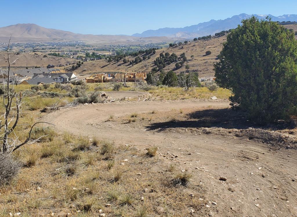
Old Hammagog Access Road
Old Hammagog Access Road
This road north of Alpine is a good workout during winter and early spring. Being on the south face of the foothills of Lone Peak, the trail is quickly cleared of deep snow by the February sunshine. The main trail is usually rideable again within a week after a heavy snowstorm. (The single-track is hit-and-miss during the winter.)Early mornings, you're riding on frozen dirt and hard-crust snow, with a few spots of sheet ice for fun. By afternoon, you can descend in a sloppy slippy sea of mud, if that's your "thing." (Try it, you'll like it.)
The road rises 1900 vertical feet in 3 miles. It's a real thigh workout. During the summer,
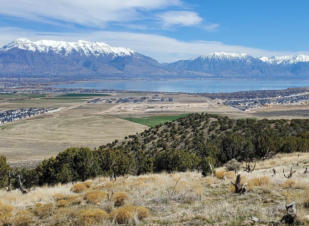
the surface gets a little loose.On a clear day, the views are great and
constantly there. During the winter inversion, you
can get above the soup into pristine air.View south, looking over Alpine.
Provo and Orem are somewhere in the soup. December 20, 1998.

iew south, looking over Alpine. Provo and Orem are somewhere in the soup. December 20, 1998.

Jackie plays on the granite boulders common to most Wasatch Front foothill
trails. December 20, 1998.
Let's be frank: this road isn't the greatest ride you've ever done. But it makes a nice combo
event -- put the day-pack on your back and fight your way up to the wilderness
border, then
take a long hike in the beautiful forest starting at the First Hammagog.The
road ends at the border of the Lone Peak Wilderness at a flat area called the First Hammagog.
From here, foot trails head towards Lake Hardy, the Second Hammagog, and
other local attractions.
You're not allowed to ride bicycles into the wilderness area, tempting
as that may be. Park
'em here and hike.

Lone Peak trail.
Getting there:
Drive into Alpine from the south. At the stop sign at 200 North, turn right (east) to 200 East. Turn left and drive about 2 miles until you reach a "T" in the road. Turn left. Follow the turn up the hill (ignoring the first road on your left), then turn left at the 4-way intersection. Turn right on Aspen Drive just before the paved road turns back south and down the hill. As the road turns left to cross the creek, go to the right and follow the gravel road to the trailhead. Find a place to park. Pedal your bike around the gate and head uphill.
Drive into Alpine from the south. At the stop sign at 200 North, turn right (east) to 200 East. Turn left and drive about 2 miles until you reach a "T" in the road. Turn left. Follow the turn up the hill (ignoring the first road on your left), then turn left at the 4-way intersection. Turn right on Aspen Drive just before the paved road turns back south and down the hill. As the road turns left to cross the creek, go to the right and follow the gravel road to the trailhead. Find a place to park. Pedal your bike around the gate and head uphill.