

The Little Canyon ST is 2.7 miles long with 350 feet of elevation change. The trail leaves the Gemini Bridges road at the Metal Masher intersection. As it descends it connects to Great Escape , then the Gold Bar ST , then turns north to the Gemini Bridges road at the bottom of Arth's trail. (Note 2020: the lower portion of Little Canyon that continues to the Gold Bar Rim 4x4 trail is now part of the Gold Bar Singletrack.)
At the bottom, there's no formal trailhead, but there's a flat area on open rock with space for a couple of cars about 200 feet downhill on the Gemini Bridges road just past the cattleguard. This may be useful if you're riding the trail with a shuttle.
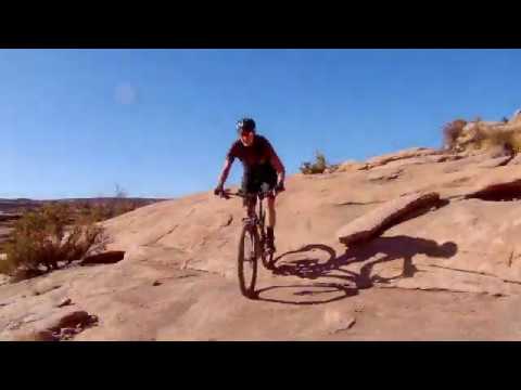
 section of Little Canyon. In upper middle...")

Again, note that the trail designations have changed with the construction of the Little Canyon extension in 2020. The portion east of the trail fork for the extension trail is now considered part of the Gold Bar Singletrack . Little Canyon now officially follows the newer trail to the Gemini Bridges Road across from the new Arth's downhill segment.


Another nice small loop is Arth's Corner to Little Canyon downhill, then Great Escape uphill. (Great Escape is a harder climb than Little Canyon, if that makes a difference to you.)


Nice ride, not highly technical. A nice out-and-back, loop ride, or piece of the Mag 7. Lots of options to construct your own route using pieces, or all, of Little Canyon.
From parking on side of Metal Masher,
go south to Gemini Bridges Road
0.0 Cross Gemini Rd, south on ST N38 35.773 W109 41.621
0.8 Cross DT N38 35.731 W109 41.006
1.6 Keep straight (R = Great Escape) N38 35.645 W109 40.540
1.8 L to stay on Little Canyon N38 35.552 W109 40.331
Mag 7: keep R to start Gold Bar ST
2.7 L uphill on Gemini Bridges road N38 35.965 W109 40.578
(Arth's preferred direction here is downhill)
3.9 Back at Metal Masher


Alternate from 191: Two miles south of the 191-313 junction, cross the railroad tracks to a dirt road. Climb a scary steep path over the skirts of the hill and follow the road 6 miles to Metal Masher.
Printable one-page ride summary
GPS track file (right-click and select "Save Target as..."):
Little Canyon ST only
Little Canyon Loop
Area trail tracks
GPX Mag 7 as single route
Topo maps for printing:
Low Res Mag 7
Little Canyon
Lodging, camping, shops: Link to Moab area resources


