Timpanogos Foothills
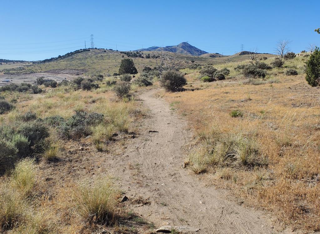
The Lazuli trail runs approximately north-south on the western edge of the Timpanogos Foothill bench area. As it climbs it gradually curves to the east, and reaches the Little Baldy Trail 33 just 200 feet above the trail intersections at The Altar. It can serve as a climbing or descending route. The trails here are intermediate in tech requirement but fairly strenuous due to sustained pitch.
1. Do not ride these trails during the winter ( December 1st to April 15th). Deer will not survive if frequently disturbed.
2. Unauthorized trail-building is strictly prohibited! Stay on-trail!
3. To reduce erosion and prevent "trenching" of trails, do not ride trails when muddy.
4. Avoid disturbing wildlife, keep your dog on a leash.
5. You must have a current Utah fishing or hunting license to enter the WMA!
This sample ride will start at the Orem Bonneville Shoreline Trail (BST) trailhead. All routes to this area must use part of the Orem Bench (BST) road, which has other connecting trails from downhill. So you can also get to this loop from Zorro (1560 East in Orem), the Race Loop (Canyon View Park), and the Dragon's Back (Canyon Glen or Nunn's Park).


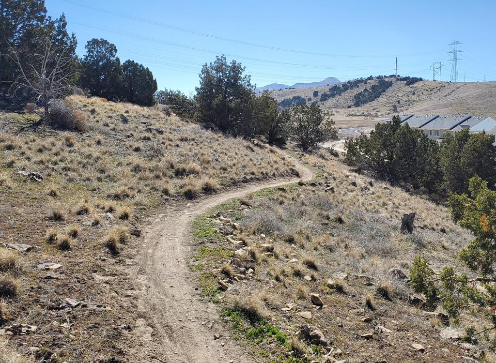
From the BST Orem trailhead, head east into the canyon. After passing the entry to Swift Ridge (historic Shooter) at mile 0.4 of the Bench Road, your next uphill connection (as of 2016) will be Lazuli at 0.8 miles. Turn left and settle into a climbing rhythm. The entry to Lazuli was re-routed in fall 2023, so it's now a nice climb and not push-a-bike!
Keep left and northbound at the first couple of trail forks, which will be a connector to Cottontail and a trail fork with the lower end of the Elk Crossing trail.
At mile 0.6 comes your first chance to connect over to a downhill route. A hard right here will take you east on Elk Crossing eastbound.
Elk Crossing climbs up to meet the middle of Gopher Snake at mile 0.5. Stay eastbound on Elk Crossing, then turn right when lower Gopher Snake forks away to the right.

If you turned down down Gopher Snake, in 100 yards you can fork to the right to descend on Cottontail. Or keep straight to descend Gopher Snake to Rattlesnake. Both good options.
If you stay on Lazuli past the connector trail, you'll quickly pass a connector from Swift Ridge (Shooter) on the left at 0.7, then another at 0.8 miles. Now Lazuli and Swift Ridge will be a combined trail for the next 100 feet.
Another 100 feet uphill, keep right as Swift Ridge forks off on the left. Keep climbing straight north uphill until the trail turns to the right onto a ridgeline trail fork at mile 1.1 from the Bench Road.

 trail, we look back sout...")


A connector from lower Lazuli will join on your left. When you hit the Bench Road (BST), head right to return to the Cascade trailhead, left to climb up Rattlesnake .
When climbing Lazuli, keep straight and northbound as you pass the fork to Gopher Snake. At mile 1.3 from the Bench Road, pass the first connector on the left. Then turn left on Wild Turkey.


Continue on Lazuli at the Wild Turkey trail fork. Lazuli will now descend through oak forest and cross a meadow to the Little Baldy trail, just 200 feet uphill from The Altar.


Or descend to The Altar and go down via Rattlesnake or Mouse or the GWT 33. Lots of ways to ride!

Orem Bench BST Trailhead: Exit I-15 on Orem's 800 North and drive straight towards the mountains. At 800 East, turn left and drive north about 1 mile. Immediately past the fence at the uphill end of the cemetery, turn right (east) on Cascade Drive. Drive 1/2 mile then fork uphill before you approach the water treatment plant. Take two switchbacks up, passing the lower overflow parking, to the paved parking area with the bathroom. Your trail is right across from where the road entered the parking lot.
Bathroom: Orem BST TH, Dry Canyon TH, Canyon View
Park, Canyon Glen Park, Nunn's Park
Water: Canyon View Park, Canyon Glen Park, Nunn's Park
Camping: Nunn's Park
Canyon Glen: Use this trailhead if you plan to ride counter-clockwise or out-and-back. Note that if you ride this direction there are some granny-gear climbs that are a bit loose. Exit I-15 on Orem's 800 North and drive straight towards the mountains. Keep left to enter Provo Canyon. About 3 miles later, you'll see the parking area for Canyon Glen on your left. Go across the bridge to the Parkway. Turn right, and find the GWT on your left about 200 feet later, forking uphill just before the paved parkway curves around a rock outcrop.
Nunn's Park: This makes the ride about a mile longer, but at the expense of a rather ugly short section of trail from Nunn's park up to the aqueduct. Going up-canyon, turn right 4 miles up the canyon, then left under 89. Go into Nunn's Park. On your bike, come back through the park entrance, then turn left on a broken-up roadway just before the road goes under 89. Turn left at the fence and follow the fence uphill. This section is a hike-a-bike uphill. As the singletrack reaches the top, go left (west).
Zorro (1560 East Trailhead): Take 800 North in Orem toward the mountains. Just as the road starts to descend into the canyon, turn left on 1560 East. Go to the end of the pavement and park on the right. The ugly jeep road switchbacks east of the trailhead take you uphill -- 0.4 miles with 200 vertical -- to the Zorro singletrack. Zorro will add another 300 vertical and 0.6 miles. (Don't fork onto the steeper Bramber DH. You'll know it as you pass it.) When Zorro hits doubletrack, head a bit further uphill to the Bench Road for uphill connections.
Canyon Mouth Provo River Parkway: There's a parking area on Orem's 800 North Street just before you enter Provo canyon. It's just east of the gas station. GPS N 40° 18.840' W 111° 39.472'. To get to the parkway, go east over the river and through the fence. Go uphill to the Canyon View Park, Canyon Glen, or Nunn's park for uphill singletrack connections to the Bench Road.
Single-page riding guide to above ride
GPS track files: (Right click and Save as...)
Lazuli
Multi-track area file (over 50 tracks)
Topographic maps for printing:
Orem Bench Zoom
Wider canyon mouth area
Lodging, camping, shops: Links to Provo area resources