
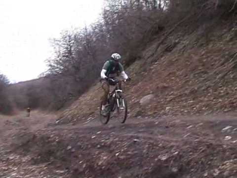
Chad, Mike, and Gary pause on Traverse Ridge on January 9, 2000, with Lone Peak (left) and Box Elder peak in the background.
Hog Hollow with Hog Hollow Creek and Porcupine TrailsHog Hollow is a bike route from Alpine and Highland to Traverse Ridge,
providing a link for Utah County bikers to ride directly into Draper's
Corner Canyon trail system
. The trails include the singletrack Hog Hollow
Creek trail, the former Hog Hollow dirt road (now a trail), and the
Porcupine trail at the upper end of Hog Hollow. Porcupine extends to the
Peak
View trail
, which will connect you to Draper's Peak View trailhead, or
to eastern Alpine via
Three Falls
to Fort
Canyon or
Bodily Harm and Forbidden
to Dry
Creek (
Lambert Park
area).
The Hog Hollow route will be a three or four mile climb, depending on where you start. The
altitude change is 1000 feet. The Hog Hollow Creek trail is upper-intermediate
in technical
requirement (see the trail info below), while old Hog Hollow and Porcupine
are easy but steeper.
Hog Hollow is also the location of the
Achtung
Baby
downhill flow trail (new in 2018). This trail is discussed on a
separate page. Hog Hollow is the climbing route for laps on Achtung Baby.

Bruce cranks up Hog Hollow in 2018.

While Draper has substantially improved the old Hog Hollow dirt road, you may encounter puddles and wash-outs in late winter, depending on the weather. To keep the track narrow, go straight at the puddle and hit it full throttle. Photo at the Frozen Hog race, Feb 1, 2003.
On the lower part of the route from Alpine into Highland, you have the option
of the singletrack Hog Hollow Creek trail or the wide easy Hog Hollow
trail. These two options rejoin at the mouth of the canyon near the
Angel's Gate (Spring Hollow) trailhead in Highland.
The usual riding season is April through November, but Hog Hollow has
long been a winter playground. At this time the trails have never been
closed due to weather. Upper Hog Hollow (above the gate) and Porcupine are within Draper City, so
if in doubt check the
OPEN vs CLOSED status on the Corner Canyon website.

View north from the singletrack connector at Angel's Gate. Lone Peak lies behind Traverse Mountain. October 27, 2017.
The Hog Hollow Creek Trail is a hand-built singletrack route that follows Hog Hollow Creek.
The official trail is a mile long, extending from Beacon Hill Park to
join Hog Hollow just
above the Angel's Gate trailhead. The climbing is steady but gentle, gaining
200 vertical feet
over one mile.
For a continuous uphill route from Westfield Road, a tiny piece of the Hog Hollow trail can
be added to the Disc Golf trail at Beacon Hill Park. After passing the
park, the Disc Golf
trail continues across the street as Hog Hollow Creek.
The singletrack Disc Golf trail is 1/4 mile long. It begins on your left 0.2 miles uphill from
Westfield Road (be sure to stay to the right when the Beacon Hill access
trail forks away from
Hog Hollow at mile 0.1). The trail runs northbound along Hog Hollow creek
east of Beacon Hill
Park before ending on the sidewalk right across the street from the bottom
of the Hog Hollow
Creek trail.
There are a lot of little branching trails as you pass through the Disc Golf course, both for
access to the Disc Golf goals, and for people chasing their errant discs.
If you keep northbound
and stay on what appears to be the main trail, the correct path is obvious.

Meandering through the Disc Golf course, a logical extension of Hog Hollow Creek, and I didn't see any "don't ride here" signs.

Looking south on the connector trail from the parking lot down to Deb's Ravine and the Hog Hollow Creek trail.
So that's the far south end of the trail. Now about the north end: For the tiny bit of Hog
Hollow Creek north of the trailhead, just drop from the Angel Gate trailhead
toward Hog Hollow.
As you dip through the (dry) creek, turn left onto the singletrack. It
will join the main Hog
Hollow trail in 100 yards.
The southbound Hog Hollow Creek trail can be reached via a connector
from the Angel Gate parking area. Go to the far south end of the gravel
parking lot near the
entry road. The trail is labeled as both "Deb's Ravine" and "Brandon's
Trail," new in 2022.
The connector trail will turn as it drops down into the ravine, then cross a small bridge to
the main trail. Just after the bridge, the left fork labeled "Horse" is
the route to the northern
end of Hog Hollow Creek. The right fork is the Hog Hollow Creek trail
downhill.

View north from the singletrack connector at Angel's Gate. Lone Peak lies behind Traverse Mountain. October 27, 2017.

Looking north from Beacon Hill Blvd as the Hog Hollow Creek trail snakes toward the oak brush.
Most riders who climb the trail will park at Beacon Hill Park. There's a large parking area
for the park on Beacon Hill Blvd. If you've parked there, head east (toward
the mountains)
from the parking lot, and spot the Hog Hollow Creek trail on the north
side of the road just
before the road goes over the creek. Begin pedaling north and uphill.
The trail will quickly enter a tall oak brush forest. Although homes line both sides of the
gully above Hog Hollow Creek, you won't be able to see those houses because
of the trees. So
the trail feels a lot more "wild and isolated" than you'd think from its
location within Alpine.

The trail lies in a dense grove of gambel oak that runs along the banks of the creek. Photo June 2018.

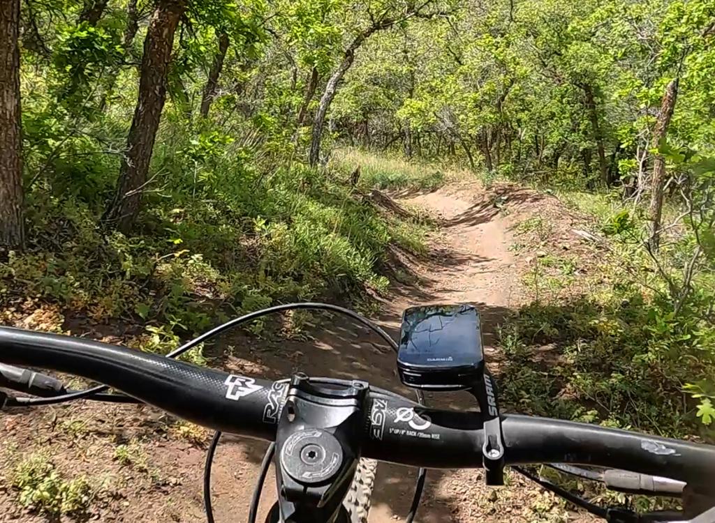
Handlebar view as we head north uphill.
As a hand-built route that began as a "social trail," Hog Hollow Creek is narrow and twisty,
with stout old oak trees close to your handlebars. There will be a couple
of dips through ravines
that will challenge less-skilled riders. So overall, the trail would rank
upper-intermediate
in skill requirement.
Gaining only 200 vertical feet in one mile, the trail is easy aerobically.

There are multiple connecting trails to homes and local streets. The public connectors tend to be more prominent, and are (in 2017) marked with small trailside signs. The westbound New London connector is shown above.

The main trail will continue northbound close to the creek, so the correct path is usually obvious. The above photo shows a bridge over the creek on the eastbound Wildflower connector, which ends on a paved path through a local park strip.
The tight fit between trees makes the trail ride better uphill, where you're riding slower
and more upright. When heading downhill and tilting through the tight
turns, you may find it
a challenge to avoid banging your superwide handlebar on a tree.

Looking south downhill. Lots of trees waiting to bang your fingers if your line isn't perfect.

Entry to the tunnel from the north. It's about 100 feet long.
The tunnel under Hidden Meadow Drive is a fun little adventure. Just bend a bit forward to
keep your helmet from scratching the top of the pipe and aim for the light
at the other end.
It will be even more fun in the spring when water is running through the
pipe. If you don't
want to get your feet wet, you can take the Hidden Meadow connector trail
up and cross the
road.
At the north end, the Hog Hollow Creek trail splits into two routes. At the trail fork just
before a bridge, the left fork (across the creek) climbs up to the southern
end of the Angel
Gate trailhead.
The right fork before the bridge is labeled "Horse" but is used by bikes as well. This trail
takes you up to the Hog Hollow gate area, were you can either hit the
doubletrack Hog Hollow
trail at the gate, or veer a bit left to catch the singletrack near the
creek. Of course, the
Angel Gate trailhead is across the creek and uphill.

Approaching the spot where the trail crosses the connector from Angel's Gate.
Hog Hollow Trail (old Hog Hollow road)

Hog Hollow was the former site of the Frozen Hog winter mountain bike race. A frigid festival for the fanatic. Photo February 6, 2004.
The old Hog Hollow road was smoothed and seeded in 2017, with a plan that it will narrow to
a broad singletrack trail. The Hog Hollow trail is 2.8 miles long -- when
ridden from Westfield
Road. If you're riding from the gate near the Angel's Gate trailhead,
it's 1.5 miles from the
canyon mouth up to the Porcupine trail.
At the Porcupine trail fork, the old Hog Hollow road continues uphill another 1/3 mile as the
Two Hollows trail, ending in the subdivision atop Traverse Ridge.
If starting from Westfield Road, keep right at the trail fork in 0.1 mile (the left fork runs
to the paved trail in Beacon Hill Park). After a mile of steady straight
riding northbound,
the trail veers left to a north-northwest heading as it reaches the foothills.
After a bit
of up-and-down, it drops into Hog Hollow and turns north again.
To start from Angel's Gate at the end of Lighthouse Drive, go north and downhill from the parking
area. In 2017, there's both a doubletrack and a singletrack. Cross through
the creek, then
turn left (north) and go through the gate.

Hog Hollow has gained new fans with the connections to Porcupine, Two Hollows, and Achtung Baby.

Kiosk and gate as the Hog Hollow trail enters Draper from Alpine, just across the creek from the Angle's Gate trailhead.
Hog Hollow will begin as a very gentle climb, then get gradually steeper as you hit the upper
mountain. The total climb in the 1.5 miles between the gate and Porcupine
is 550 vertical feet,
with most of that coming in the last 1/2 mile.
As you climb Hog Hollow, you'll find connections to
Fango
westbound (with connections to
Woods Hollow
)
and
Longview
and
Carpe
Diem
eastbound uphill to
Peakview
. These
trail forks are just below the bottom of the downhill trail
Achtung
Baby
. Porcupine (see below) and
Two Hollows
are further uphill.
Because Hog Hollow faces south, it picks up a lot of sun in the afternoon. So in summer, your
climb will be hot. And in winter, the snow will get sloppy and slippery,
with torrents of water
running over ice ledges.
As a descending route, Hog Hollow is straight and blazing fast.

Hog Hollow is a nice climbing route on summer mornings. Some riders even use this route as a commute to work and back on their bike. Photo 2005.

On Traverse Ridge looking north into Corner Canyon. Doc Argyle with "Banana Thunder." January 8, 2000.

These days, you'll want a fatbike for Hog Hollow in winter. Mike rolls down from the summit on January 15, 2000.

Hard to see in this photo, but Draper has covered the old eroded rocky road with dirt and mulch so it can re-vegetate. We're looking southeast toward Timpanogos. Behind me is Hog Hollow, I'm turning 180 degrees to Two Hollows.
As you begin to see the top of the mountain, Hog Hollow joins the
Two Hollows
trail to continue up the ravine. If you're headed for
Mercer Hollow,
Mercer Mountain
or
Eagle Crest
, turn and descend on Two Hollows to the Mercer Mountain trail. Next climb Mercer Mountain
to the top of Mercer Hollow and cross the road to
Eagle Crest
heading westbound.
If you're headed for the mountain top, continue uphill 200 yards.
To reach Peak View or Three Falls, fork right on the Porcupine trail.
To
reach the subdivision road -- or the top of
Achtung
Baby
-- keep straight on Two Hollows to the underpass.

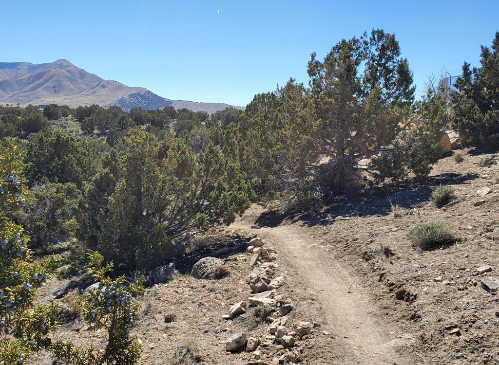
Bruce cruises the brand-new Porcupine trail in July 2017.
The final piece of the climb is either Two Hollows to the road at Canyon Pointe, or the singletrack
Porcupine trail up to the Peak View trail.
Porcupine is machine-cut singletrack, broad and easy to ride, with a gentle grade. From old
Hog Hollow, it's 0.9 miles and 200 vertical feet of climbing up to the
connection with the
Peak
View trail
The altitude of this junction is 6000 feet. (The Hog Hollow trail starts at 4920 feet elevation
at Westfield Road.)

Looking south at the junction between the Peak View trail and Porcupine.

As you descend the last bit of Porcupine, you're heading north. You'll reach Two Hollows uphill from the fork where Hog Hollow joins Two Hollows, as shown in the photo.
As a descending route, Porcupine is fast and flowy. When you hit the broad Two Hollows trail,
make a hard left. (A right turn uphill takes you into the middle of the
subdivision west of
the Peak View trailhead.) Descend Two Hollows 0.15 miles. Now fork left
to descend Hog Hollow,
or fork right to follow Two Hollows to the bottom of the Mercer Mountain
trail.
As a climbing route, Porcupine ascends the hill at a reasonable pace. There are no technical
challenges, so it's a relatively easy climb uphill.

View south toward Utah Lake as we climb uphill.

Drone view as Bruce rides Peak View, heading toward Porcupine.
From fork where the Porcupine trail ends on Peak View, the Peak View trail descends 0.7 miles
to the Peak View trailhead above Corner Canyon. Keep straight if that's
your destination.
Eastbound, the Peak View trail climbs to
Jacob's Ladder
and the
Three Falls trail
. If those trails are your
destination, make a hard right turn when you reach the Peak View.
Hog Hollow riding notes, from Burgess
Park:
0.0 Parking in Burgess Park
Head back (south) to Canyon
Crest
0.1 R on Canyon Crest
0.4 L on Long Drive
0.6 R on Ranch Drive
0.9 Cross Westfield Road onto DT
N40 26.924 W111 47.706
1.1 Fork R N40 27.017 W111 47.839
1.8 Straight then veer L uphill
N40 27.616 W111 47.866
2.2 Rejoin old HH Road, straight
N40 27.904 W111 48.241
4.0 R onto Porcupine
N40 28.929 W111 49.034
4.9 Top! Straight on Peak View
N40 29.295 W111 48.888
5.6 Peakview TH

Closeup map of Hog Hollow Creek area
Closeup map of Hog Hollow Creek areaGetting there, Westfield Road (lower Hog Hollow trail): If you're parking (or pedaling) on Westfield
Road, the trail is 0.7 miles west of the stop sign where Westfield ends on
200 North in Alpine. Spot the metal gate on the north side of the road near the
school crossing. The doubletrack that heads uphill through the gate is the
lower Hog Hollow trail.
Beacon Hill Park (bottom of Hog Hollow Creek): From
Westfield Road, turn north uphill on Beacon Hill Blvd. Drive 0.5 miles,
and just after the road turns to the east, turn right into the parking
area above Beacon Hill Park. The Hog Hollow Creek trail will be on the
north side of the road (across the street from, and just east of the
parking lot).
Angel Gate at Spring Hollow in Highland (upper Hog Hollow and top of Hog Hollow
Creek): On Westfield Road, turn uphill (north)
on Beacon Hill Blvd. Drive 0.5 miles, then as Beacon Hill turns to the
right (east), turn left on Lighthouse Drive to continue straight north
uphill. Lighthouse will become Angel Gate. Keep straight until you pass
the irrigation facility, then park. At the northeast corner of the fence,
a doubletrack descends east across the hollow. Immediately after crossing
the creek, turn left on Hog Hollow. The southbound Hog Hollow Creek trail
can be reached via the connector trail at the south end of the trailhead
parking.
Area map of Hog Hollow above Angel GateGetting there, traditional Hog Hollow Road access: Northbound on Main Street (Highway
74), turn left at 200 North in Alpine. Keep straight as the road turns
right uphill after 1/2 mile. Watch for Hog Hollow Road (paved) on your
left, just as you see a church uphill to the right. Turn left on Hog
Hollow. Now keep straight until the road turns 90 degrees left downhill.
Find a spot to park in the circle where the road turns. To get to the
trail, go west over the hump of dirt then veer right on the doubletrack
heading northwest.
Church "trailhead" (traditional access): Drive into Alpine from the south. At the
stop sign at 200 North, turn left (west) and drive 1/2 mile. Turn right up the hill. When
you see the big church, look for "Hog Hollow Road" on your left just before the
church. That's where you'll be going. Park near the church, then head
downhill and right onto Hog Hollow Road and ride 1/2 mile to the end of the
pavement. Climb the dirt, and veer slightly right onto a DT heading
northwest. (Note: this route may close with further subdivision
development. Let us know!) Once on the Hog Hollow Road, ignore
smaller diverging roads, unless you want to play on them.
From Peak View Trailhead in Draper: Take the
Peak View trail on the south side of the trailhead area. Ride uphill 0.7
miles, then take the right (downhill) fork to the Porcupine Trail, which
will descend to old Hog Hollow.
Water: None
Bathrooms: None

Area map of Hog Hollow above Angel Gate
Original review 2001, updated 2017.


