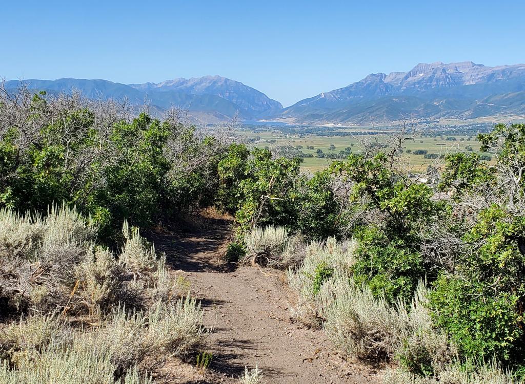
On Arcylon, here's a ramp dropping to a steep transition zone, going directly into banked turn. My bike is sitting alongside the intermediate ride-around. Photos and review by Bruce on July 18, 2015.
Gorgoza Park Trails
Gorgoza Park, Up Trail, Dead Reckoning, Arcylon,
Pale Green Dot, and A Toll New World
The Gorgoza Park downhill loops lie on the slope above I-80 just east of Parley's Summit. This
is the location of the classic Arcylon downhill flow trail, but with the new addition of an
easy and an expert-level downhill trail. Connected to the loops are nice XC trails to the east
and west: Gorgoza Park and A Toll New World.
These are free public trails located near the "pay-to-play" trails at the Woodward Park City
resort.
While riding these trails, you'll encounter connections to neighborhood trails to the south
and east. These are private trails for residents only. Also, do not attempt
to ride into the
Woodward Park City resort, which is a fee area. Follow the riding directions
and obey the signs
to be sure you're staying on public trails. If a branching trail appears
very narrow and is
unsigned, assume it's a connector to a trail you're NOT supposed to ride.

Looking downhill to the north. We're on the Gorgoza Park trail, just a bit west of the Woodward resort.

Descending the Gorgoza Park trail, where we'll either loop back on the Millenium trail, or climb back uphill on a down-and-back.
These trails start at a bottom elevation of 6350 feet, rising to 6700 at the top of A Toll
New World. This creates a riding season of June through October. Except
for Arcylon and Dead
Reckoning (which require expert skills), these trails are acceptable for
experienced beginners
and intermediates.

Looking west from the trailhead parking at Discovery Ridge. The connector trail is on the left.
The trailhead complex for the public trails is located on Discovery Way. There are three paved
parking spots with room for around 20 vehicles total. Drive 1.1 miles
east from the I-80 Summit
Park exit on Kirby Road. Turn right on Discovery Way and go 0.3 miles.
When you see overflow
parking, the main parking area with bathrooms and running water is just
to the right uphill
around the corner.
The connector trails from the upper and lower lots join and extend 1/10th mile uphill to the
flow trail loops. At the trail fork, you can take a hard left to the Up
trail to head to Gorgoza
Park or the downhill flow trails, or you can keep straight until you reach
the A Toll New World
trail.

Arriving at the trail fork for the Up trail, turning hard left in this photo.

Westbound on the Millenium Trail after dropping down Gorgoza Park.
You can also arrive at the area via the paved Millenium trail along Kirby Road. A paved spur
follows Discovery Drive up to the trailhead. This creates an option for
a loop ride with Gorgoza
Park downhill and a paved return. Another way to arrive here is to drop
down A Toll New World
from the
Road to WOS
area.
Note: Do NOT park in the neighborhoods above or east of the trail, and do NOT drive into these
neighborhoods to drop off shuttle riders. The trails in Sunridge are privately
owned and you
are only allowed on them if a resident accompanies you. Do NOT use the
Woodward resort parking
to reach these trails unless you're a paying customer!
Flow Trails at Discovery Ridge
Up Trail

Starting uphill on the Up trail.
The Up trail is the route to the top of all three downhill flow trails. It's also the route
to the top of the Gorgoza Park trail, which forks away in the middle of
the climb. The Up trail
is exactly one mile long, with a bit over 300 vertical feet of elevation
gain.
The Up trail begins 1/10th mile uphill from the Discovery Ridge trailhead with a hard left
turn. After you descend a flow trail, the return trail will route you
directly into the Up
trail.
The surface is non-technical and suitable for beginners. The climbing rate is pleasant even
for those who aren't in the best of shape.

The trail winds back and forth. Climbing turns are usually flat and easy for kids to cruise around.

Rolling through an aspen grove. Very pretty stuff.
At mile 0.5, the Gorgoza Park trail forks away to your left. Keep straight to continue the
climb on Up.
The terrain is a mix of aspen and maple with an occasional fir. The understory
is lush with shrubs and flowers. It's a very nice ride all by itself!
At mile 1.0 (1.1 from the trailhead), you'll reach the flow trails. While the climbing rate
on the Up Trail is mild, I'd hate to do it on a heavy DH bike. But if
that's how you got here,
there are a couple of resting benches waiting for you at the top.
For the easiest way down,
keep to the left for Pale Green Dot.

Almost to the top as we cruise through a flower-filled meadow.
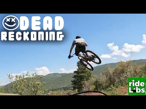
Dead Reckoning Expert Flow Trail

Here's the drop-in to Dead Reckoning. It's steeper than it looks. After a couple of wiggles as you bounce downhill over rocks and roots, the trail turns smooth for a while.
The first downhill option at the top of Up is Dead Reckoning. This is the most technical descent.
It not only has stunts that require expert skill, it also has stretches
of rock garden that
have no ride-around. Do NOT take a noob down this trail.
Dead Reckoning has a TON of gap jumps. These are of varying length. The longest I saw was around
12 feet. The bottom of the gaps is filled with brambles -- and the greenery
obscures your view
of the landing and the length of the gap as you roll toward it. I strongly
suggest a scouting
run first. Fortunately, the gap jumps all have ride-arounds.

Approaching a gap jump. The green stuff you see is growing in the gap. The ride-around is to the left.

A plunge down a rocky slope on Dead Reckoning. Fortunately it's only about 20 feet, so just hold on and aim the bike downhill.
As I mentioned, there's a bit of technical rock on Dead Reckoning. And there are no alternative
lines to go around them. Stopping to scramble down these spots is not
a good idea, as this
blocks the trail and other riders may hit you. If you're not sure of your
ability to hit this
stuff, don't ride this trail.
Between the raw rock sections, there's some high-speed cruising and banked turns. Just hold
your line on the rocky stuff and there will be smoother riding ahead.

Rolling into a banked turn.

Getting a bit closer to the bottom, and we've got some more tech rock to contend with.
Dead Reckoning is 0.6 miles long. It's considerably shorter and steeper than Arcylon, which
is your next DH flow option.
Arcylon Intermediate Flow Trail

Rock-plated rim of a gap jump, with a dirt jump to follow. Intermediates can roll these.
Arcylon is 0.8 miles long. The trail is posted as intermediate, but it's an expert-level ride
if you try to hit the stunts. The entry begins with a rock-garden rollover
designed to discourage
tourists. That's the trickiest thing you're forced to do, as all the remaining
tech spots have
ride-arounds. Like Dead Reckoning and Pale Green Dot, the Arcylon downhill
is closed to hikers,
dogs, and horses.
The preferred riding attire for Arcylon is, of course, your best roadie lycra. Extra points
for doing it on your cyclocross bike. And if you're wondering what bit
of Native American culture
or Utah Pioneer heritage is responsible for the name of the trail, spell
"Arcylon" backwards.

Sample of high-bermed quick turns on Arcylon.

About the midpoint of the descent. The signs warns that the wooden ramp leads to a deep gap jump. It's a good idea to read the signs on a first run where you take the intermediate lines.
If you need to stop or slow for any reason -- for example to snap a photo of a buddy -- swing
well off the riding path first. Bikes and riders who are stopped in the
trail may become roadkill.
The trail isn't particularly steep, but it moves along at high speed,
and sight lines are limited
around turns and below stunts.
Most turns have high berms to maintain speed. On straight sections, there will be frequent
bumps that form low gap jumps. These are flat enough that intermediates
can simply roll them.
Stunts are plainly marked, with the ride-around route obvious.

Another drop.

Jump with a wooden roll-out.
Most riders will want to take a test-run down the intermediate lines to scope the transition
zones below drops and jumps. For many of them, you can't see what you'll
be getting into from
uphill.
Most riders will, of course, keep heading back uphill to do multiple runs down the tech stuff.
The total loop is 1.8 miles, with 0.8 of it being the downhill.
Arcylon and Dead Reckoning merge at the bottom, then join the trail back toward the trailhead,
where you can catch Up for another go.

A particularly nasty-looking gap jump with a short-fall wheel-catcher. It leads into a second ramp. I didn't have the cajones to do this one.
Pale Green Dot Easy Flow Trail

The trail on the left is Pale Green Dot, while the rock-pile roll-over to the right is Arcylon.
Pale Green Dot is the easiest way downhill from the top of the Up trail. It has a mellow rate
of descent and wide easy turns. Older kids and experienced beginners should
be able to ride
it without terror. For this option, just keep to the left at the top of
Up, passing the entries
to Dead Reckoning and Arcylon on the right.
Pale Green Dot is 1.1 miles long. Comparing this to the 1.0 mile of climbing on Up should tell
you that this isn't a steep ride. The trail drops 300 vertical feet.

Rolling through maple forest, the trail offers a bunch of easy humps.

View west toward Parley's Summit.
There are occasional breaks in the trees that let you catch a view. The trail is a series of
gentle traverses back and forth across the hillside.

Turns are smooth and banked, and are also fairly flat. Here's a typical right-hand turn.

And here's a sample of a left-hand turn. It's easy for a kid to stay in control and ride confidently.
At the bottom, Pale Green Dot hits the A Toll New World Trail. Turn right for the traverse
back to the Up trail. You'll be joined by the combined Arcylon and Dead
Reckoning. After a
steepish but short climb, you'll hit the trailhead connector, where keeping
to the right will
take you back uphill for another lap.

Passing through a pretty aspen grove on the way back east to complete the loop.

Bottom of Gorgoza Park as the singletrack forks away from the paved Millenium Trail.
The classic Gorgoza Park Trail was on the property now occupied by the Woodward Park City resort.
It has been bulldozed. The new trail alignment is more exposed and has
a lot more bumpy rock,
but it's still a good ride.
Gorgoza Park connects the middle of the Up trail downhill to the paved Millenium Trail just
east of the pond. On the way, it will pass connectors to neighborhood
trails. (In 2022, I noted
that the arrow had worn off of a carsonite post, so I couldn't distinguish
"neighborhood access"
from "continuing trail.") When in doubt, keep to the left on the downhill,
to the right on
the uphill.
On the uphill end, the Gorgoza Park trail forks away from the Up trail at mile 0.5 (0.6 from
the Discovery Ridge trailhead). It begins with a long traverse near the
top of the ridge, then
drops down into the trees to skirt the top of the Woodward Park City resort
eastbound.

Looking up the Gorgoza Park trail where it joins the Up trail.

Trail marker where Gorgoza Park forks away from a broader ridgeline trail. If the trail markers are missing or damaged: on the downhill, keep left. If you're climbing up, keep right.
The trail is 1.7 miles long, with a bit over 400 feet of elevation change. If done by climbing
Up then making a loop with a return via the paved Millenium Trail and
the Discovery Way spur,
a lap will be 3.6 miles.
The upper half of the trail is fairly smooth. It's mostly maple and oak forest with occasional
meadows. This area tends to be an east-west traverse with minimal elevation
change.

Traversing through groves of gambel oak.

Descending through a field of mules ear flowers.
The lower half of Gorgoza Park (past Pinebrook Point) is more open, with exposed sandstone
occasionally making the trail rough. Because of this, the trail earns
an intermediate rating.
The pitch of the trail increases and the path winds back and forth across the hillside. Much
of the lower trail approaches the edge of the Woodward property repeatedly.

Rolling into one of many switchback turns.

Heading downhill into the valley on Gorgoza Park. Dryer and hotter, but still pretty.
And if you need another reminder: For local residents there are connections to Gambel Drive
(see map) just a bit to the east. The upper trail also connects to the
Sunridge Perimeter Trail,
as does a short connector on the ridgeline. The Sunridge Perimeter is
a private singletrack
that heads uphill to the southwest corner of Pinebrook and is for residents
only.

Typical trail. Smooth dirt in groves of aspen, maple, and fir.
A Toll New World starts at the bottom of the downhill flow loops. To reach it from the Discovery
Ridge trailhead, just keep to the right. Pass the entry to Up, the bottom
of Arcylon and Dead
Reckoning and Pale Green Dot, then also keep right as a hiking trail forks
away uphill. You'll
find it at 0.2 miles from the trailhead.
A Toll New World is 1.5 miles long, with an elevation gain of 400 vertical feet. It ends on
the gravel Toll Canyon Road -- where residents can connect uphill to Sunridge
Perimeter, and
the rest of us can descend and hit the
No Worries
trail up to Road to WOS.

Rolling into the conifer forest as we climb A Toll New World.

Hitting a meadow on the ridge before resuming the climbing into Toll Canyon.
The trail is mostly forested, with a couple of meadows where you can appreciate the views.
It's noticeably cooler here than the Gorgoza flow trails below.
A Toll New World also makes a nice out-and-back for strong beginners and intermediates who
want to add a few miles to their Arcylon laps.
If you're heading for
No Worries and Road to
WOS
, keep right and
downhill on the doubletrack when you reach Toll Canyon, Keep straight
when
it turns to pavement and follow it around the corner. Keep uphill at the
fork going to the outbuilding, then find No Worries on your left 0.5 miles
from A Toll New World.

Heading into Toll Canyon. Very nice.
The Gorgoza area trails are worth a visit. Located right off the freeway at the top of Parley's
Canyon, they're nearby and are ready to ride a bit earlier than the upper
Park City trails.
The flow trail loops are fun, but you'll probably want to add some extra
trails -- which this
area provides!

On the uphill on the A Toll New World trail.

Close-up view of the flow loops.
Getting there:
From Salt Lake City, take I-80 east up Parley's Canyon. After crossing the summit, take the
Jeremy Ranch exit. Turn right, then immediately right again to take Kirby
Road westbound. After
passing a small hill, you'll see a small gravel parking lot on the left
side of the road. It's
preferred that you save this little lot for hikers that are visiting the
pond. Go another 100
yards to the big paved Gorgoza Park lot. (If the big lot is closed --
as it was on the Saturday
I visited -- grab a spot in the little lot.) Head back out to the paved
Millenium Trail and
follow it east until it heads south uphill past the pond. Just above the
pond, the mountain
biking trail veers uphill as the Millenium trail turns sharply eastward.
(Keep to the left
of the two trails. The trail you see heading straight up the mountainside
meadow gets there,
but it's hike-a-bike steep.)
Do NOT park in the neighborhoods to the east of the trails, and do NOT
use the neighborhood roads to drop off shuttle riders above Arcylon! Note
that the Sunridge Perimeter Trail is a private trail for residents and
their guests only.
Also do NOT park in the Woodward Park City resort lot unless you're a
paying customer.

Wider area view.