Mike looks east from the Gold Bar Rim. Just above the highway, rusty Moenkopi sk...
Mike looks east from the Gold Bar Rim. Just above the highway, rusty Moenkopi skirts lie beneath brown and gray Chinle layers. The vertical cliffs are Wingate sandstone. Photos by Bruce, May 17, 2002.
Gold Bar 4x4 Trail

The classic Gold Bar Rim Trail is now called the Gold Bar 4x4. It takes you up ledges of Kayenta sandstone to a viewpoint on the cliffs high above the entrance to the Moab Valley. After leaving the Gemini Bridges road, the trail becomes advanced technical, with a strenuous aerobic climb. The Gold Bar 4x4 itself is an out-and-back to the overlook, 8.5 miles each way. Is this NOT what you were looking for? See our other pages for the Gold Bar Singletrack and the Gold Bar Rim Singletrack cliffside slickrock route .

Because better trails have been developed in the area, the Gold Bar 4x4 Trail is now rarely done as a stand-alone ride by mountain bikers. Pieces of the route can be part of the Rusty Nail , Gold Bar ST , and Gold Bar Rim rides. Gold Bar can also be one part of a long and brutal point-to-point with shuttle, using the Golden Spike Trail You descend to the Colorado on either Poison Spider (21.2 miles total) or the infamous Portal Trail (17.5 miles).
Matt takes air off a sandstone ledge, one of hundreds of similar stunt opportuni...
Matt takes air off a sandstone ledge, one of hundreds of similar stunt opportunities on this trail. Trees are mostly pinion pine, with a juniper at lower elevations.
Matt and Mike cruise the easy first section of the trail.
The first 4 miles are visually pretty, with cliffs closing in around the broad doubletrack of the Gemini Bridges road. Biking-wise, it's a bit of a yawner. The track is smooth and easy. Once you begin climbing the rock at mile 5, things get a lot more interesting.
Leaving the Gemini Bridges road in Little Canyon, the trail begins climbing up the Kayenta sandstone. Rounding the head of Gold Bar Canyon, it drops back down, then climbs to a viewpoint.
Looking uphill on a granny-gear grunt near Gold Bar Canyon.
Cogs to spare. Bruce takes advantage of a smoother trail section, reducing wear ...
Cogs to spare. Bruce takes advantage of a smoother trail section, reducing wear on his front tread.
Four wheeler traffic has excavated the trail surface. There will be sections of powder-and-chunks, and a couple of unrideable black tire-stained cliffs where you'll have to walk around.
From the viewpoint at the top, you can look north at the undulating Moenkopi and Chinle skirts at the base of the Wingate sandstone that forms the sheer cliffs along the Moab Fault. Looking west, you see the Colorado River emerge from the Navajo Sandstone below Slickrock. If you're riding the out-and-back, this is where you turn around. Stay and play a while on the broad slickrock areas, then enjoy the cruise back to the highway.

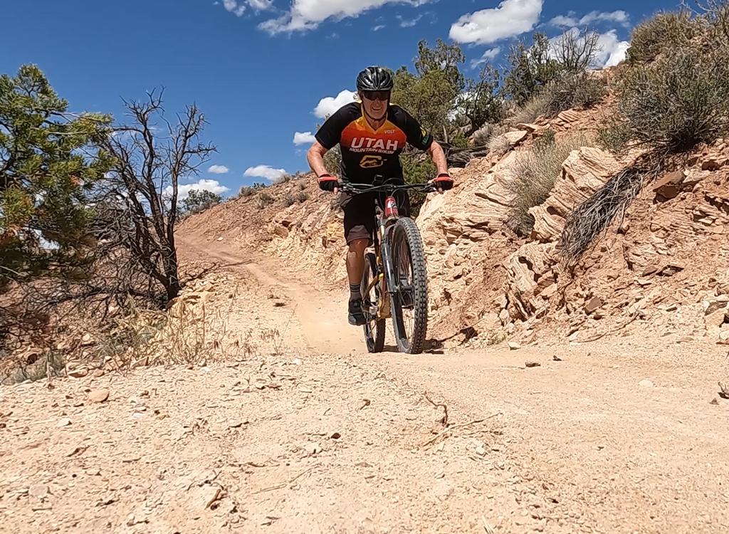
You'll find plenty of ledges, so practice your uphill attack and downhill ledge drops.

Just one of several nasty ledges, some of which are absolutely not rideable.
Bruce and Matt look into Gold Bar Canyon. The trail follows the tilted Kayenta l...
Bruce and Matt look into Gold Bar Canyon. The trail follows the tilted Kayenta layer up and around the canyon.
The point-to-point rides:

Consider carefully before you commit to either of the point-to-point options. These rides are NOT easy. After the first 5 miles, there's no cruising. Again and again, you face tough technical climbing followed by brakes-on, butt over the wheel technical descents. The Golden Spike Trail and the Gold Bar Rim will take everything you've got.

The reward for all this? Tons of ledges, jumps, and technical challenges. Fantastic views, again and again, as the trail comes back to the edge of the Wingate cliffs to the west of the Moab Valley.

On Poison Spider, you'll ride mounds of Navajo Sandstone as you cross the mesa, then drop down to the river on an advanced-technical ride.

Mike grunts up and over a ledge as he nears the top.
Matt rolls down from the viewpoint at the end of the Gold Bar Rim Trail. In the ...
Matt rolls down from the viewpoint at the end of the Gold Bar Rim Trail. In the background, the Colorado river slices through mounds of Navajo sandstone.
The Portal Trail presents two problems: (1) the deadly upper half is located exactly one endo away from high cliffs, and (2) the extremely technical lower half is more than ready to maim or kill you. Even very skilled technical riders walk much of the Portal Trail, and only the most idiotic (or suicidal) try to ride it all.
map
Gold Bar 4x4 road
Riding notes:
0.0  Head across the tracks and turn left (south)
4.3  Turn left (off the Gemini Bridges road) just before it climbs a hill
4.8   Gold Bar ST crosses N38 36.097 W109 39.346
5.3   Fork, keep L
5.8   Fork, keep L N38 36.097 W109 39.346
        (R = Rusty Nail) 
        Reaching open rock, follow "gold bars" painted on rock
8.3   Golden Spike joins, go L
8.5   At turn-around, overlook. End of trail for out-and-back
        For epic ride, backtrack 0.2, south (left) on Golden Spike
14.1 Trail to Portal forks L before fence (easy to miss)
        15.0 Portal singletrack goes R at cliffs
        GPS N 38° 35.033' W 109° 35.688'
        Back at road at mile 17.5
For Poison Spider, keep R at above fork
        Follow little "jeeps" painted on the rock
        Back at road at mile 21.2

Getting there: Drive south on US-191 for 16 miles south of I-70 (about 15 miles north of Moab). Spot the parking area on the west (right as you head toward Moab) side of the road. GPS N 38° 39.381' W 109° 40.672'. Park in front of the railroad tracks, and head out west on the road. (Note: this is private parking, and requires payment of a fee. Free parking is available across the highway at the Bar M trailhead.)

To leave a shuttle at the Poison Spider trailhead, go 6 miles down U-278 then right up a short dirt road with a sign that says "Dinosaur Tracks." GPS is N 38° 31.917' W 109° 36.473'.

Riding Resources for Gold Bar:
Topo map:   Low Res    High Res
Single-page riding guide for printing.
Lodging, camping, shops:      Links to Moab area resources
GPS track files (right-click and "Save as..."):
    GPX Gold Bar 4x4
    Gold Bar ST
    Golden Spike
    Gold Bar Rim cliffside ride
    Magnificent 7
    Area Tracks Master File