
Ghost Falls lies in Draper's Corner Canyon riding area . It was one of the first mountain bike routes in the canyon and is still a good ride. I love it. But there are newer and somewhat easier trails that run parallel to Ghost Falls and connect to it. So most riders do only pieces of the Ghost Falls trail, rather than riding the whole thing. This page will attempt to explain some of those connections and routes.
The Ghost Falls trail itself is 1.6 miles in length, running from the Canyon Hollow doubletrack (where it shares a bit of common trail with Gasline ) to the Ghost Falls trailhead on the Corner Canyon Road. It rises 700 vertical feet to a top altitude of around 5750.
 after turning off ...")

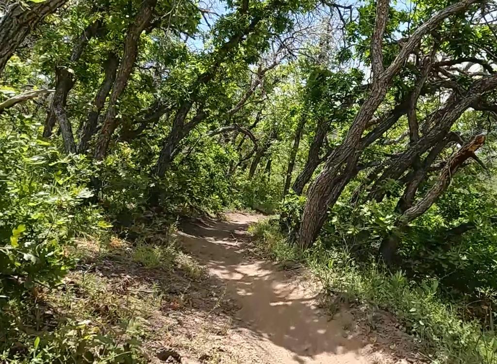
In November 2016, even the smoother areas in the trees were tougher here, with trenching of the trail and stiff (up to 15% grade) climbing. Most riders were bypassing this segment by riding Rattler to the falls instead of climbing lower Ghost Falls. In May 2017, the trail had been buffed up and was smoother to ride. In other words, conditions may vary.
The usual riding season is May through November. Unlike nearby trails such as Rattler , Gasline , and the Corner Canyon Bonneville Shoreline , this trail is NOT open year-round and will be closed when conditions are damp. See the Corner Canyon trail closure page for the current status.


The bottom of the Ghost Falls trail shares a common origin with Gasline . You can get to the south end of Gasline (and the bottom of Ghost Falls) via the Canyon Hollow doubletrack, or via Gasline itself. Ghost Falls begins on Gasline just before Gasline's southern end at the doubletrack. See the map.
If you're on the southbound Corner Canyon Bonneville Shoreline trail, take Gasline from the south end of Aqueduct (at this point Aqueduct is also the BST ). You can also get to the Aqueduct-BST-Gasline junction by climbing the eastbound BST from the four-way intersection at the top of the Corner Canyon trail.
An alternate route is to fork left on the BST at the top of the Corner Canyon doubletrack and climb uphill to Aqueduct . Make a hard right turn on Gasline when the BST joins Aqueduct and head south to the Ghost Falls trail.


(To visit the falls before continuing, keep straight at the trail fork after crossing the creek. Just after crossing the next bridge, the falls are to your right.)


As an uphill route, most riders do only the upper section of Ghost Falls, from the falls to the trailhead on the Corner Canyon Road. There are two options. (1) Take the BST to Rattler , joining Ghost Falls just downhill from the falls, or (2) climb Canyon Hollow to the upper connector to join Ghost Falls just above the falls (as described above -- see the map).

Many riders use Ghost Falls to continue downhill from Jacob's Ladder . But regardless of how they got on Ghost Falls as their downhill route, most riders transfer from Ghost Falls to Canyon Hollow at the upper connector -- avoiding the technical and steep rocky stuff -- then transfer to lower Rush about 0.2 miles further downhill.
However, rock-loving tech riders will stay on Ghost Falls.

The next exit is just past the falls, mile 0.8, as Rattler forks right uphill. In 2016, the 100 yards just past the Rattler fork is the most technical part of Ghost Falls. It's more do-able downhill than as a climb. Eyeball the slope and decide if you want to hit it. If so, take the left downhill fork.
At mile 1.1, there's another fork to Canyon Hollow on the left, then a fork to Rattler on the right.


When you hit Gasline at mile 1.5, go left if you're headed to Canyon Hollow or right if you're taking Gasline over to the BST or Aqueduct.

After climbing Corner Canyon from the Equestrian (Highland Drive) trailhead, veer right (west) on the BST and head for Clark's trail. At the Peak View trailhead, take the Corner Canyon Road (or the Brocks-Canyon Hollow-Road combo) to the upper end of the Ghost Falls trail and take it downhill to Gasline. Drop the doubletrack back to the Corner Canyon trail. Veer onto Creekview for the final descent. Altitude change by this route is 1200 feet, distance 6.7 miles.
0.0 L uphill on ST as it exits tunnel
0.4 Keep generally L uphill
0.6 ST joins DT, continue uphill
0.9 Keep slightly R (L= east BST)
1.0 Veer R on DT at fork (BST)
1.2 Join Canyon Hollow, go R
1.2 Fork L uphill on BST+Clark's
1.4 Fork L across bridge (Clark's)
2.7 L on Ann's
3.7 L onto ST Ghost Falls after gate
4.5 Fork R (L=to Canyon Hollow)
4.6 L (R=Rattler)
4.8 Keep R (L = to Canyon Hollow)
5.2 L on Gasline, cross Bridge
R downhill on DT
5.5 Keep straight onto Corner Canyon
5.6 Veer L on Creekview Connector
6.7 Back at tunnel

Single-page riding guides: Standard loop or Clarks Ghost
GPS track files (right-click and "Save as...") for:
Ghost Falls track only
Clarks-Ghost Loop as above
Loop w Ann's from Potato Hill
Ghost Falls lower loop (CC, CanHoll, lower Ghost, Gasline, BST)
Master file of Draper GPX tracks
Topo map (wider area) for printing: View
Lodging, camping, shops: Links to southern SLC resources
Corner Canyon area trail overview page

Coyote Hollow trailhead: Take the Bluffdale exit from I-15 and turn east towards the mountains. Climb the hill as above, but turn right at the light on Traverse Mountain Road. After one mile, turn into Mike Weir Drive on your left. Pass the Mike Weir trailhead 1/2 mile later and continue another half mile until the road veers left downhill. Take the next right turn, turn right again, then left. You should now be on Gray Fox Drive. Take the next right into Coyote Hollow Court. The parking is on the right at the end of the pavement.
Facilities: There's a toilet at the upper Ghost Falls trailhead (where it meets the Corner Canyon road) and at the Equestrian Center parking. There's also a toilet where the Bonneville Shoreline Trail hits the Corner Canyon Road. Water is available only at the Equestrian Center.