Bruce hits the saddle between Elevate and Black Ops. Trail photos and review on ...
Bruce hits the saddle between Elevate and Black Ops. Trail photos and review on November 10, 2019.
Elevate and Black Ops Loop Ride

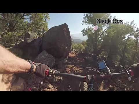
Elevate and Black Ops are trails in the Iron Hills system near Cedar City. They connect to the Turnpike trail near the Shurtz Canyon trailhead. Elevate is bi-directional. It's the climbing route to the top of Black Ops, which is downhill-only, and to the southern end of Lava Link .  Elevate is intermediate in tech requirement; Black Ops is upper-intermediate.

The base elevation of the trails is 6000 feet; 6450 at the top. The riding season is expected to be late May through mid-November.
Descending through a boulderfield.
Heading out toward the Elevate trail on Turnpike.
To reach Elevate, you'll need to pedal 0.9 miles north on Turnpike from the Shurtz Canyon trailhead. (You'll pass the exit from Black Ops at mile 0.5.)
From the Southview trailhead it's 3.4 miles to the base of Elevate. Turnpike is an easier-intermediate trail. It's suitable for strong experienced beginners -- but Elevate requires solid intermediate skills to ride due to rock challenges.
Elevate
Elevate is 1.4 miles in length. It starts on Turnpike at 6100 feet elevation (0.9 miles north of the Shurtz Canyon trailhead). Turnpike is gently uphill from the trailhead, gaining around 100 vertical feet.
Heading uphill.
Heading uphill.
A brief respite from climbing in this flat area.
Many stretches of Elevate are broad and plush. But there are tight banked climbing turns and some tricky rock rollovers and squeezes. So I'm giving it an upper-intermediate rating for tech requirement.
Elevate will gain around 350 vertical feet from Turnpike to the top of Black Ops and the south end of Lava Link The rate of climb is fairly steady, but with some short stretches of flat or barely-perceptible downhill as you climb.
Here and there are some tricky rock rollovers and squeezes. I found one of them ...
Here and there are some tricky rock rollovers and squeezes. I found one of them to be tougher to clean on the downhill than while climbing.
Almost to the top in this drone shot.
Elevate will wander back and forth across the hillside through nine tight almost-switchback climbing turns. Once it reaches and crosses a saddle running east-west, it will reach the top of Black Ops.
Elevate ends at a four-way intersection. Straight ahead is Black Ops. To your far left is Lava Link heading northbound. Bone Yard -- a DH-only trail -- ends here on the uphill side of the four-way.You can turn and descend Elevate, continue on to Lava Link, or try Black Ops. Elevate and Black Ops are equally fun as downhill routes, but non-experts may want to backtrack on Elevate instead of dropping Black Ops.
Arriving at the spot where Elevate turns into Black Ops.
Black Ops
Black Ops is a downhill-only trail that starts at the top of Elevate. It is 1.1 miles long, descending 400 vertical feet from an elevation of 6450. It is upper-intermediate in tech requirement overall, but almost any solid intermediate rider will manage.
Bruce rolls the downhill. The trail needs to firm up and pack before you can mai...
Bruce rolls the downhill. The trail needs to firm up and pack before you can maintain speed.
A mix of pinion, juniper, red dirt, and rocks.
Black Ops has a lot of jumps and ledge drops engineered into the ride. Most -- but not all -- will have ride-arounds. There are broad high-speed banked turns, but there are also quick moves in rock areas.
Compared to a descent on Elevate, Black Ops has a lot of embedded rock. So it will be a bit bumpy at high speed.
A plush high-speed section on Black Ops.
Exiting Black Ops onto Turnpike.
The terrain is a mix of pinion pine and juniper. Between the trees is almost exclusively dirt with occasional protruding boulders. There are some rare quick views of the valley here and there.

Lariat loop from the Shurtz Canyon trailhead...

[Back to video list ]
Bottom Line!

Very nice little loop. The 2021 addition of Lava Link , Tombstone and Bone Yard makes this area even more attractive. Shurtz Canyon will now compete with Southview as your trailhead of choice!

Climbing on the Elevate Trail.
map
Map of the riding area.
Getting there:
Shurtz Canyon Trailhead. Exit I-15 and head south on Old Highway 91 as above. At 2.4 miles, turn left on Tipple Road. After 0.6 miles, turn left on Shurtz Canyon Road (mislabeled "Shirts" on the road sign). Go 0.7 miles and turn left into the trailhead. The trail is on the east side of the parking area.
Southview Trailhead.
At the southern I-15 Cedar City exit (Exit 57 to Cross Hollow Road and Highway 130), turn east onto Highway 130. Immediately turn right (south) from 130 onto Old Highway 91. Drive 0.3 miles. Watch for the sign for Southview Trailhead and turn left on Shurtz Canyon Drive. Now stay on Shurtz Canyon Drive to the trailhead and find a spot to park. Start out on the paved Southview trail. After the bridge, go past the Turnpike trail and the one-way return trails from Lava Flow and Iron Giant. Turn right onto Lichen It at N37 38.699 W113 04.894.

Bathrooms:  Southview and Shurtz trailheads
Repair stand at Southview trailhead
Water:  Southview only, at sink in bathroom
Camping:  Campground at Shurtz Canyon

GPS track files (right-click and "Save as..."):
     GPX Elevate plus Black Ops
     Multi-track area files
Topo map for printing:   pending
Lodging, camping, shops:     Links to Cedar City area resources