View northeast from the ridgeline, with the tips of Mount Timpanogos (L) and Cas...
View northeast from the ridgeline, with the tips of Mount Timpanogos (L) and Cascade Mountain (R) hidden in clouds. Photos and ride review August 8, 2015 by Bruce. Updated April 2018.
Eagle Mountain Race Loop
Jackrabbit, Road Runner, and Deadwood trails
...with access route via Hidden Canyon and Cow Tracks trails

The Eagle Mountain race loop lies to the south of Eagle Mountain, making a circuit around the edge of Hidden Canyon. The loop can be reached directly by dirt road, or by singletrack on your mountain bike for a longer lariat ride. Many of these trails -- and connecting routes -- are also covered in detail on the Lake Mountain , Treadstone , and south Eagle Mountain pages . See the Overview Page for all area trails and links to riding areas.

The race loop itself is 5.6 miles in length, easier intermediate in tech requirement, with 600 vertical feet of climbing per lap. The altitude ranges from a low of 5100 feet to a high of 5425 feet. There are three segments of dirt road for a total of 1.6 miles of doubletrack. These DT sections join three trails (Road Runner, Jackrabbit, and Deadwood) that together yield 4 miles of singletrack trail. You can add to the classic race loop by taking singletrack options at a couple of points (Treadstone, Wile E Coyote).
View northwest as the bike rests near a limestone outcrop (on the way back down)...
View northwest as the bike rests near a limestone outcrop (on the way back down).
Outward bound on Hidden Canyon looking southeast. Well cross the doubletrack nea...
Outward bound on Hidden Canyon looking southeast. We'll cross the doubletrack near the saddle, then cross it again as we turn to the right.
The lariat ride is 9.1 miles with around 1000 vertical feet of climbing. It's a satisfying ride, but is significantly more strenuous and technical than riding just the race loop itself.

The lariat-loop mountain bike route starts on the Pony Express Parkway, right where the Hidden Canyon Road heads toward the loop. The Hidden Canyon trail forks off the paved bike path on the south side of the parkway (just east of the Hidden Canyon road). It climbs from 4950 feet elevation to 5150 before heading over to the hill above the Mountain Ranch Bike Park .

On Hidden Canyon, there will be a couple of man-made tech features to roll over (or roll around). The trail has a few rock outcrops, but overall it's intermediate in tech requirement. The grade on the initial climb is 200 vertical in 0.4 miles, which is very manageable by an intermediate rider.
After the initial climb, the trail undulates along the hill with nice views to the north and east.
View from Hidden Canyon as we pass above the homes of Eagle Mountain.
The entry bridge to Cow Tracks remind us that theres some slightly more tech rid...
The entry bridge to Cow Tracks remind us that there's some slightly more tech riding ahead -- especially if you decide to do a little lap around the Ridgeline Flow trail.
Shortly after crossing a doubletrack, take the right fork, then cross the doubletrack again, going over the wooden entry bridge. You're now on the Cow Tracks Trail, or maybe it's considered part of the Ridgeline Trail. Start climbing southbound.

Note that you can also reach Cow Tracks via the Mountain Ranch Bike Park . Follow the Access Trail uphill as it turns to rocky road and gets steep. As it turns to the left on the ridge, you'll see the singletrack entry bridge on your right.

The trail will get steep for a while, but it's still a very ride-able pitch. The rocks roll nicely, so a strong intermediate should have no problem grinding right up. At the trail fork, keep straight (right and south) as Ridgeline heads north uphill. The trail now levels out and rolls along the west face of the hill as you head south.
The steepest spot is the climb just before the Ridgeline trail fork. Theres both...
The steepest spot is the climb just before the Ridgeline trail fork. There's both embedded and loose rock, but it's very do-able.
Were passing through a juniper grove on Road Runner, temporarily northbound.
We're passing through a juniper grove on Road Runner, temporarily northbound.
The Cow Tracks trail dumps into the race loop staging area. Drop down to the middle of the valley. Here the southbound dirt road splits. Head for the right fork (on the far side of the narrow valley from the end of Cow Tracks) on the west shoulder of the valley and continue heading south. After 2/10 mile, the road splits. This is the race loop. Keep straight south another 1/4 mile until you see the singletrack Road Runner forking off on your left.
Note: The "no trespassing" signs on School Trust Lands apply to motorized vehicles. Not to you, noble biker.
Road Runner will turn back northbound as climbs gently. When it reaches doubletrack, turn right uphill. As you reach a wide treeless area on the ridgeline, you'll see the Jackrabbit trail turning back southbound to the right. Take a detour here to ride forward and enjoy the view, then backtrack a few feet to Jackrabbit.
Weve gone up to the ridgeline to take in the views. Were looking north, with Tra...
We've gone up to the ridgeline to take in the views. We're looking north, with Traverse Ridge standing in front of the mountains of the Cottonwood canyons east of the Salt Lake Valley in the center.
Finding our way through the junipers. The race-day markers wont be there when yo...
Finding our way through the junipers. The race-day markers won't be there when you ride, so just keep meandering south.
This first portion of Jackrabbit follows (approximately) the ridgeline ATV route southbound. It's a bit of a maze through the trees, as every clearing seems to have branching tracks. Just keep heading south on what appears to be the main path. The interweaving tracks should rejoin before you hit the singletrack.
You'll emerge from the trees to cross a doubletrack. Now you're on Jackrabbit proper, a narrow winding non-motorized singletrack.
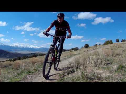
The scenery is inspiringly desolate and has its own ugly Great Basin type of empty beauty. There's plenty of very nice riding surrounded by a unique landscape.
Looking south as we enter Jackrabbit. The sign says no motorized vehicles.
Looking south as we enter Jackrabbit. The sign says "no motorized vehicles."
View back to the north at the Oquirrh Mountains.
At the southern end, 1.4 miles from the ridgeline, Jackrabbit drops rapidly through a series of smooth banked turns to the dirt road in the valley floor. Keep straight (left and southbound).
Jackrabbit will cross the Wile E Coyote singletrack shortly before joining a doubletrack on the edge of the valley. As you hit the doubletrack, keep heading south.
Wile E Coyote option...
To have a bit more fun (and a bit more work), you can divert to the Wile E Coyote singletrack as you approach the doubletrack.
Wile E Coyote begins near the bottom of Road Runner. You may have noticed it on the way up. It runs 0.9 miles from Road Runner to the corner where the doubletrack of the race loop turns northward to Deadwood. It crosses Jackrabbit on the way.
View back to the north at the Oquirrh Mountains as Bruce rides Wile E Coyote.
A bit of late spring snow persists under the cedars on Wile E Coyote.
Wile E Coyote is generally uphill, but has some up-and-down that make it a bit tougher. It's a much harder bit of riding than the doubletrack. While it gains only 150 feet in absolute altitude as you progress south, the rolling hillside makes it seem like more.
Whether you took the doubletrack or the alternate Wile E Coyote singletrack, it's now time to turn right, back to the north. Just 100 feet after the doubletrack turns around, find the Deadwood singletrack on the left.

At its south end Deadwood crosses, and joins, some newer trails (Fistful of Dollars and Eastwood). See the Eagle Mountain southern area page for details of these trails.

Deadwood climbs away from the road heading westbound. After it skirts the low hill at the southern end of Hidden Valley, it will drop down and cross a dirt road. It will climb a bit up the opposite hillside before turn north.
Traversing west on the first section of Deadwood.
Northbound downhill as the riding speeds up!
Deadwood now begins a steady descent as it heads northbound. The terrain here is grass and low scrub, with the trees having burned away in a recent fire. There are wide views of the valley area, extending north to the Oquirrh Mountains.
When Deadwood ends, keep straight across doubletrack and through a wash, then turn right (east) on the doubletrack on the far side of the wash. Keep straight as an ATV trail joins on the left. When you reach the next road fork, you're back where you entered the loop. Turn left to head back to the staging area.
An option to the doubletrack at the end of Deadwood is Treadstone , a singletrack that climbs and contours around the mountain (it's found straight across the DT from Deadwood). It also offers a longer return-to-town option, without backtracking on Cow Tracks. See the Treadstone (Prayer Flags hill) trail page .
If you arrived via Cow Tracks, find your singletrack and pedal north. The return trip via Cow Tracks and Hidden Canyon is hardly any work at all.
Passing through a scorched former juniper forest. Juniper inhibits undergrowth, ...
Passing through a scorched former juniper forest. Juniper inhibits undergrowth, so the formerly bare ground now shows grass and scrub.

Riding the race loop...

[Back to video list ]
Riding notes:  Lariat loop from Pony Express
0.0   From Hidden Canyon Rd, east on paved trail
        Veer right uphill on Hidden Canyon trail
        N40 21.344 W111 59.483
0.7   Cross DT N40 21.069 W111 59.065
        100 feet, then fork R (Cow Tracks)
        N40 21.049 W111 59.032
        50 feet, cross DT N40 21.038 W111 59.036
1.0   Keep R (L = Ridgeline ST)
        N40 20.943 W111 58.911
1.6   R on DT N40 20.597 W111 58.592
        100 ft across to far west side
        L (south) on DT
1.8   Keep straight and L (R = return)
        N40 20.428 W111 58.622
2.2   L on ST (Road Runner)
        N40 20.137 W111 58.484
2.9   R uphill on DT N40 20.529 W111 58.343
3.0   R on ATV at ridgeline
        N40 20.562 W111 58.263
3.3   Cross DT N40 20.338 W111 58.179
        Begin ST (Jackrabbit)
4.4   Join DT, keep L (south)
        N40 19.838 W111 58.094
4.8   Fork R on DT N40 19.568 W111 57.791
4.9   L on ST (Deadwood)
        N40 19.577 W111 57.839
5.4   Cross DT N40 19.469 W111 58.144
6.8   End ST, cross DT, straight through ravine
        N40 20.252 W111 59.209
        R on DT far side or ravine
        N40 20.292 W111 59.208
7.0   Keep straight (R) N40 20.296 W111 58.999
7.4   End loop, veer L (north) and retrace
        N40 20.406 W111 58.636
7.7   Back at Cow Tracks
9.1   Back at Pony Express
map
Map of the race loop
Getting there:
Take the I-15 Lehi Main Street exit and turn west. Continue west on SR-73, crossing Redwood Road (11600 West). Continue westbound uphill. Just after climbing the hill, turn left at the stop light onto The Ranches Parkway. At Pony Express Parkway, turn right. The road will veer a bit south (left), then back west (right). Now immediately turn left to the Hidden Canyon road, 1.1 miles from Ranches Parkway. (Note 2020: construction may block your access through this area.) Find a place to park to take the singletrack lariat. If you're driving to the loop, keep generally left and heading southeast at all road forks, staying just below the slope of the hill on your left. When you reach the broad valley and see a bunch of competing road forks at mile 1.3 from Pony Express Parkway, you're there.
To start from the bike park, stay on Ranches Parkway as it narrows and begins to wind around. When you come to a T intersection at the end of The Ranches Parkway, turn right on Golden Eagle Road. Drive about 1/3 mile and watch for the trail kiosk on your left. Park by the trail kiosk and begin your ride by climbing up the trail heading south.
Riding resources for this trail:
Single-page riding guide
GPS track files and route (right-click and "Save as..."):
    Race Loop alone
    Lollipop ride as above
    Multi-track GPX area file
High-res area topo map for printing:   View topo
Lodging, camping, shops:    Links to Provo area resources
Bathrooms: None. Porta-Potty at the Mountain Ranch Bike Park.
Water: None.
Camping: No developed or designated campgrounds. Flat spots can be found in the race staging area.
Bike services: UtahMountainBiking store in Lehi.