View of the pinnacle where the ride turns around, with Ogden in the background. ...
View of the pinnacle where the ride turns around, with Ogden in the background. Photos and ride description by Bruce October 12, 2010. Updated July 23, 2018.
Ogden Canyon Overlook Trail
(Coldwater Canyon Overlook)

This is a nice 2.7-mile climb near Snowbasin. The out-and-back is 5.4 miles with 900 vertical feet of climbing. It's easy-intermediate technical and only moderately strenuous. My sample ride below includes the Sardine Peak loop .
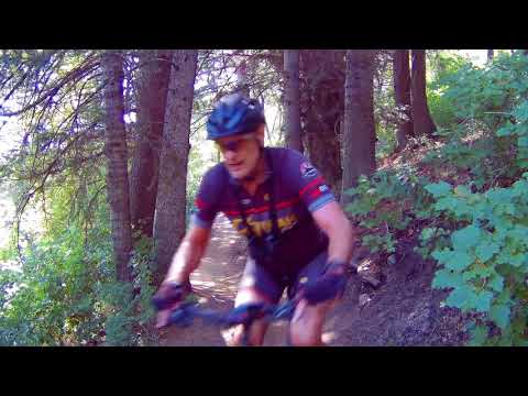
My ride description starts at Snowbasin. That's about the right distance and climbing for a typical rider. You can make the ride longer by picking an alternate trailhead. It's pretty simple to turn this ride into a 15 mile fun-fest. (See alternate trailheads below.)
At the official beginning of the trail. But you cant drive here. You have to ped...
At the "official" beginning of the trail. But you can't drive here. You have to pedal another trail to arrive at this point. The quickest way is via a 0.7-mile dirt road from Snowbasin.
Getting started on the singletrack.
The top altitude is 7200 feet at the overlook. Because the lower portion of the riding is shaded and the upper portion sits on the north side of a steep slope, during most years this trail won't be clear of snow and ready to ride until July.
To ride the Overlook trail out-and-back from Snowbasin, start at the overflow parking. That's on the far northeast corner, past the lodge area. Ride around the metal gate and head gently downhill on gravel doubletrack. Shortly after the track turns uphill, keep straight as you pass the Maples singletrack on your right. That's your return path.
Further up the hill (past the Sardine Peak fork) we encounter huge fir trees.
Most of the ride is in dense forest. As we climb toward the ridgeline, we begin ...
Most of the ride is in dense forest. As we climb toward the ridgeline, we begin to see some views back to the south.
A short bit later, singletrack veers off the doubletrack in a meadow. Take either one. They both wind up at the same place, which is a gate with a trail sign. Go through the gate and climb through the forest.
At mile 2.1, you'll reach a fork at the top of the ridgeline. To your right is the Sardine Peak trail. For now, go left and head toward the overlook. The trail will cross briefly to the north side of the ridgeline, where you'll pass through a grove of large conifers.
This is your trail fork. Left to the overlook, right to Sardine Peak.
Riding in maple and oak scrub as we approach the viewpoint.
After getting back to a scrub forest of maple and oak, the trail will climb to a small bench on an outcrop. It's 0.6 miles, and another 250 vertical feet of climbing from the trail fork.
Take a minute.

Oooh, aaaah.

Good spot for your picnic.
Looking west from the overlook.
Heading back downhill.
Now head back downhill. Keep your speed in control, as you'll certainly encounter hikers and other riders on this popular trail.

A nice option is to divert onto the Sardine Peak trail and ride a loop back to Snowbasin. This will add about 500 vertical feet of climbing and 5 miles.

A summer ride up to the overlook...

[Back to video list ]
map
Area map of Sardine Peak Loop and Ogden Overlook trail.
Riding notes from Snowbasin, with a return via Sardine Peak:
Start at gate, far northeast parking
0.0  Pass gate, enter doubletrack heading north
       N41 13.114 W111 51.792
0.6  Keep straight uphill (ST on R is return path)
       N41 13.538 W111 51.817
0.7  ST or DT, doesn't matter
0.8  Go through gate  N41 13.605 W111 51.894
2.1  Fork L for Ogden / Coldwater Canyon overlook
       N41 14.066 W111 52.531
2.7  At overlook N41 14.034 W111 52.801
3.3  Back at fork, keep L N41 14.066 W111 52.531
4.3  Trail in on L, keep straight
       N41 14.464 W111 52.071
4.6  Keep R and east, trail in from L
5.0  Cross ridge and begin descent
7.6  Fork R on Maples Trail
       N41 13.827 W111 51.510
8.1  Back at DT, fork L
8.7  Back at gate
Getting there, Snowbasin trailhead:
From US-89 or I-15 in Ogden, head east on I-84. A few miles up Weber Canyon, take the Mountain Green exit. As you exit, turn left under the freeway, then right. Drive a couple of miles through Mountain Green, then turn L on the scenic byway, U-167. At the top of the hill, turn left and drive to the main Snowbasin entrance. As you approach the lodges, keep right and descend to the overflow parking. The trailhead is the gate at the far northeast corner.
Alternate, Green Pond:  After turning left off U-167, drive 1.3 miles to a large parking area on the right. Good ride: down Middle Fork to Maples, up to the loop (in a figure 8) and back via the Green Pond trail. 16.4 miles, 2000 vertical.

Alternate, Art Nord: Head up Ogden Canyon on U-39. 2.7 miles after the dam, turn R on U-226. Go another 3.6 miles and turn R into the Art Nord trailhead parking N 41° 14.017' W 111° 49.224'. Recommend big loop ride with East Fork, Green Pond, Sardine Loop, down Maples. 14 miles, 2500 vertical. Lariat up Maples and around loop, 10.3 miles w 1700 vertical.

Alternate, Middle Fork: About 1.5 miles up the road from Art Nord, there's a large parking spot on the right. Head north on Middle Fork to Maples. Lariat or loop as per Green Pond or Art Nord.

Alternate, Wheeler: Heading up Ogden Canyon on U-39, drop R just before the dam. Follow Wheeler to Maples. Lariat ride or big loop. Big loop = East Fork to Green Pond to Sardine to Maples, 17.7 miles, 2800 vertical.

map
Wider area view around Snow Basin
Riding resources for this trail:
Single-page riding guide
GPS track files (right-click, "Save as..."):
   GPX multi-track file
      (includes Green Pond, Maples, Middle Fork, etc)
High-res area topo map for printing:   View map
Lodging, camping, shops:    Links to Ogden area resources
Bathrooms: Art Nord, Snowbasin
Water: Art Nord, Snowbasin
Camping: Pineview Reservoir