

Includes Brock's Point Trail
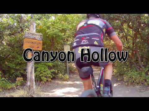
Canyon Hollow is a multi-user trail in Corner Canyon. The trail extends from the Silica Pit area to the Corner Canyon Road. The upper end is about 1/2 mile downhill from Clark's Trail , 1/2 mile uphill from the top of Ghost Falls . The trail itself is only 2.3 miles long, but the shortest loop ride would be 4.6 miles.

 was cut in 2013. Were lo...")
From the trail's beginning just off the Coyote Hollow trailhead there's 800 vertical feet of climbing. From the Equestrian Center parking via the Corner Canyon Trail it's 1100. Top altitude is 5250 feet.
You also can reach the bottom of Canyon Hollow from the Bonneville Shoreline Trail via any of its trailheads.


You can also go to the old entry to Canyon Hollow. For example, let's say you started at the Equestrian Center parking lot. After you can pedal up the Corner Canyon trail and take the doubletrack to the wide trail intersection, continue straight south on doubletrack. After 1/4 mile, fork to the right on a singletrack that takes you 1/10th mile up to Canyon Hollow.


Most riders will want to do the trail as a loop. The trail rides both ways. I've created loop options for a downhill with the climb via Clarks Trail from Coyote Hollow, and an uphill version from Corner Canyon with the downhill via Ghost Falls . There are a lot of other possibilities. The trail forks on Canyon Hollow are well-marked with trail signs.


0.0 From parking, west, down through tunnel
0.1 On exit from tunnel, L up, sidewalk, then R
N40 30.322 W111 50.731
0.3 Keep L uphill N40 30.234 W111 50.636
0.5 Keep straight
0.6 Keep R (L=to street) N40 30.098 W111 50.394
0.7 R on DT N40 30.041 W111 50.316
1.0 Stay on DT, veer L at DT fork
N40 29.764 W111 50.118
Find optional ST along R side of DT
1.1 If on DT, pass Ghost Falls ST N40 29.767 W111 50.023
1.3 ST rejoins DT, continue uphill N40 29.750 W111 49.890
1.4 Follow ST L around gate
Fork R on Canyon Hollow N40 29.774 W111 49.809
1.7 Rejoin Pipeline, keep R as Ghost Falls forks L
N40 29.758 W111 49.646
Fork R N40 29.752 W111 49.615 (L=to Ghost Falls)
Keep R next two forks
2.0 Keep R on Canyon Hollow N40 29.736 W111 49.416
2.9 Brocks Point trail comes in on right, keep straight
3.1 Top of Canyon Hollow, L on DT
N40 29.525 W111 48.866
3.4 Pass Jacobs Ladder trail, stay on DT
3.5 L onto ST, Upper Ghost Falls
N40 29.666 W111 49.037
4.2 R to Ghost Falls (Ghost Falls North)
N40 29.740 W111 49.304
4.5 Fork R (start retrace Ghost Falls trail)
N40 29.766 W111 49.621
5.2 Back at DT, continue downhill
5.4 Veer L to Rush Limelight N40 29.751 W111 50.124
6.5 Parking
0.0 Enter trail downhill, immediate R uphill
N40 29.617 W111 50.311
0.1 Fork L and cross bridge
N40 29.561 W111 50.234
1.6 Top of Clarks, fork L on DT
or follow Brocks Trail east from fenced TH
N40 29.308 W111 49.204
(Option: add Jacobs Ladder, up along pipeline)
2.1 L on ST (start Canyon Hollow)
N40 29.525 W111 48.866
(if riding from Brocks, take hard L on Canyon Hollow)
3.2 Keep L at all Ghost Falls connectors
N40 29.736 W111 49.416
L = to Rush one-way trail
3.6 Stay L on Canyon Hollow
N40 29.766 W111 49.621
3.8 Keep straight (L = down to DT)
N40 29.755 W111 49.792
4.0 Keep straight (cross Rush)
N40 29.713 W111 49.925
4.4 Keep L N40 29.632 W111 50.286
Go 50 feet, keep straight (L = back up Clarks)
4.5 back at trailhead

Lower Corner Canyon Trailhead: Take the Bluffdale exit from I-15 and turn east towards the mountains. Continue on Highland Drive until you reach the ballpark parking lot. Directly across the street from the parking, the Lower Corner Canyon trail heads uphill (GPS N 40° 30.351' W 111° 50.721'). To reach the trailhead from the north (Sandy area), take 13th East southward until it ends at the stop sign just past the underpass. Turn left and drive 1/4 mile.
Single page riding guide via:
Ghost Falls (climb Canyon Hollow)
Clarks (descend Canyon Hollow)
GPS track files (right-click and "Save as..."):
Canyon Hollow only
Corner Canyon area multi-trail file
Wider-area topo of trail system (1200 KB), includes Jacobs Ladder: View
Corner Canyon area trail overview page
Lodging, camping, shops:
Links to southern SLC resources


