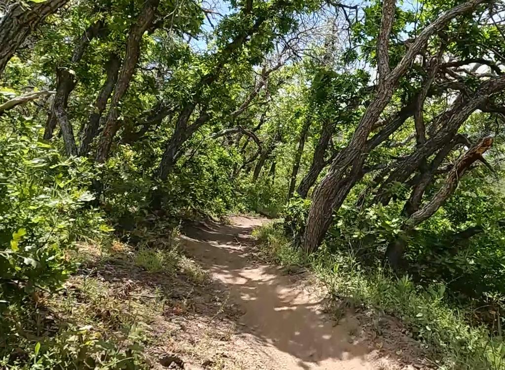
A rider heads uphill on Rattlesnake. The terrain is a mix of grass and stands of gambel oak. Initial photos, GPS track, and ride description by Bruce based on rides July 10-14, 2016 -- with update August 2021.
Rattlesnake Trail (historical Betty)
The Rattlesnake Trail (historically called "Betty" by local
riders) is a popular access route into the
Timpanogos Foothill
trails
. It's
1.2 miles long, rising 500 vertical feet from the Orem Bench Road (BST)
to
a trail junction called The Altar. It's a stiff climb but 100% ride-able,
with an intermediate technical rating. It's the climbing route for a lot
of different rides, for example the
Dry Canyon 51
Loop (Kris' Loop)
.
Note! These trails are on Utah Division of Wildlife Resources
land, purchased with sportsmen dollars and set aside as the Orem Bench
Wildlife Management Area specifically to protect Utah's native animals.
Mountain Biking is allowed, but only insofar as it is not harmful to
wildlife. To insure continued access please be respectful to the
landowner by following proper trail etiquette and obeying all posted
rules. Specifically:
1. Do not ride these trails during the winter (December 1st to April 15th). Deer will not
survive if frequently disturbed.
2. Unauthorized trail-building is strictly prohibited! Stay
on-trail!
3. To reduce erosion and prevent "trenching" of trails,
do not ride trails when muddy.
4. Avoid disturbing wildlife, keep your dog on a leash.
5. You must have a current Utah fishing or hunting license to enter
the WMA!
Rattlesnake can be reached from several trailheads, but they all have to hit the Orem Bench
Road (
North Provo Canyon Bonneville
Shoreline
) first. Many riders start from the Orem BST trailhead off 800 East.
Our route will be more direct, starting from Timpanogos Park in Provo
Canyon. We'll
pass through the
Race Loop
on our way to the BST. Then we'll use
Rattlesnake as
a climbing route within a double figure-8, introducing you to other trails
near Rattlesnake. The ride will be 7.4 miles with 1400 vertical feet of
climbing.

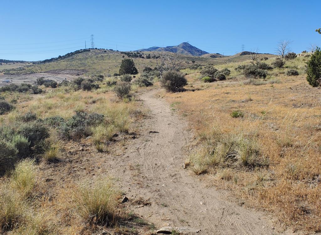
Climbing north on the Race Loop. We're doing the shorter west side of the loop, because it's less complicated.
 and the Bee L...")
Bench Road as we approach Rattlesnake between Aquila (Cliff trail) and the Bee Line race course access trail. Rattlesnake starts just after the road turns from northbound to east. That's Little Baldy straight ahead. Rattlesnake climbs up the dip in mid-right under Timpanogos.
Starting from
Timpanogos Park, climb the
gravel road.
Keep left at the fork at 0.3 miles, then veer right onto the
Lower
Access singletrack at mile 0.4. When you hit the
Race Loop, do
a 180 left and climb.
Keep straight as Aquila (Cliff) hits on the left (0.8). At the loop's highest
point (mile 1.1) turn left uphill and climb the Bee Line trail to the
Bench Road. Rattlesnake should be to the right (east) about 50 feet
on the BST on the uphill side. If you don't see
it, you probably took an alternate trail -- try the other direction.
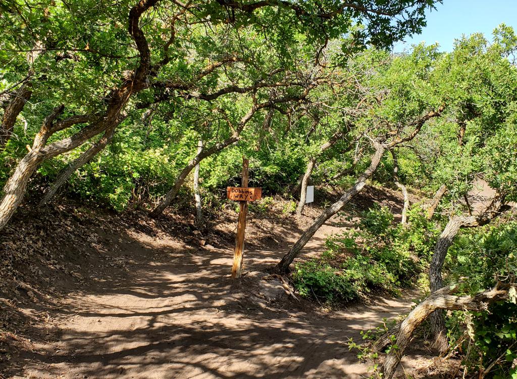
Just 150 yards up
Rattlesnake, you'll reach a trail fork.
Rattlesnake is to the right. We'll be descending the other trail, lower
Gopher Snake.
Rattlesnake will climb at a tough but tolerable rate. Pass Elk Crossing
as it crosses at mile 2 -- 0.4 miles from
Rattlesnake's start. (Gopher Snake is just 100 feet west on Elk Crossing;
Mouse is about 1/2 mile uphill to the right on Elk Crossing.)

We're standing on Rattlesnake. To the left is the downhill section of Rattlesnake and straight ahead is Gophersnake.

Looking back downhill on Rattlesnake as we approach The Altar.
Now crank on uphill without interruption. At mile 1.2 from the origin of Rattlesnake, mile
2.8 from Canyon View, you'll reach a large stone pile in a huge meadow.
You'll notice a few
trails forking away. This is The Altar.
The trail straight ahead uphill is
Little Baldy
33
, a mean climbing route to Black Bear Trail 51 (and the hiking trails Ruffy and Moose Back).
The first trail on your right is Mouse, which descends down to Elk Crossing.
Further right
is "Frank," officially still the Little Baldy Trail -- Great Western Trail,
Forest Trail 033
-- which descends to the Bench Road.
About 200 feet straight ahead on Little Baldy is the top of Lazuli, joining on your left.

My Rocky Mountain leans on The Altar as viewed from Rattlesnake, looking north toward Timpanogos.

Nice shady section of Lazuli just west of the Altar.
From here, you can make a loop ride using a bit of Little Baldy uphill, a short bit of Black
Bear (trail 51) westbound, all of Wild Turkey to Lazuli, and Lazuli eastbound
back to just
above the Altar. See the map.
There are a couple of nice meadows full of Mules Ear blossoms, if you hit the ride during early
to mid June.

Rattlesnake passes through a couple of meadows like this one.
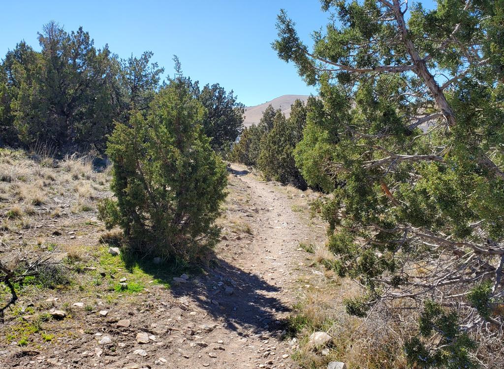
 fork, facing southeast.")
Descending on Wild Turkey after the Lament (trail 51) fork, facing southeast.
It's best to have a navigation app such as Trailforks here. In late summer 2021, most trail
forks are marked only by posts. Many have burned away. Those signposts
that do have trail names
have the old traditional names. (Trail markers with names are scheduled
for placement. But
given the complexity of the system, a navigation app is almost a necessity!)
After Wild Turkey ends on Lazuli, turn left. Lazuli will meander down a slope of grass, sage,
and low scrub oak.
 is a fun little trail, winding through grove...")
Northern Lazuli (historical Buckle) is a fun little trail, winding through groves of oak.

As we approach the meadow eastbound on Buckle, the trees get bigger.
When you reach a big
meadow, you're almost back to The Altar. Turn left as you hit the Little
Baldy Trail and coast downhill 100 feet to The Altar.
From The Altar, you could simply backtrack on Rattlesnake. But
we're here to taste different trails. So we'll take
Mouse for
the first half of your downhill from The Altar.
As your bike rolls to The Altar from uphill, the second trail from the
left is Mouse. (Leftmost is Frank 33; straight ahead is Rattlesnake.)

Back at The Altar. This time, I'm standing at the entry to Mouse to snap this photo (looking northwest).

Heading downhill on Mouse. Nice riding, occasionally a bit tight on the handlebar clearance.
Mouse is also a nice alternate climbing route, but we'll be doing it downhill. At mile 0.7
from The Altar, there's a trail fork. We'll be joining the Elk Crossing
trail. Turn right.
When you reach Rattlesnake, go straight across and pedal 100
feet. Now turn left at the trail fork. You're now on lower
Gopher Snake.
The trail
heads south parallel to Rattlesnake as you
descend.
This trail is narrow and fairly smooth. For your next ride, you may actually
prefer to climb this route instead of Rattlesnake.

At the trail fork between Gopher Snake and Elk Crossing, I'm looking back to the north uphill. (The "social trail" between the oak scrub has been closed off.)

Rolling south downhill on Gopher Snake.
The next trail fork comes in around 1/10th mile. Keep left
to stay on Gopher Snake. The trail on the right is Cottontail (an
alternate descending route to the bench road (BST).
Now head downhill and merge with Rattlesnake. Dump onto the Bench Road.
Now you could simply backtrack through the Race Loop. But instead,
we're heading south on the Bench Road so we can play on the Aquila (Cliff) Trail.
Go 1/2 mile south on the Bench Road. As the road turns to
the west, spot the doubletrack dropping off by the tower-whatever-thing.
Veer left to take the northbound singletrack trail that follows the top of
the cliffs. That's the Aquila Trail. (Don't continue south from the
doubletrack -- that's the Zorro Trail, and it will drop you to a
neighborhood in Orem near the canyon mouth. Or hey, maybe that's what you
want. Just pedal out to 800 North and descend to the Provo River Parkway
and pedal back to Canyon View.)
 Trail toward the Race Loop.")
Rolling downhill on the Aquila (Cliff) Trail toward the Race Loop.

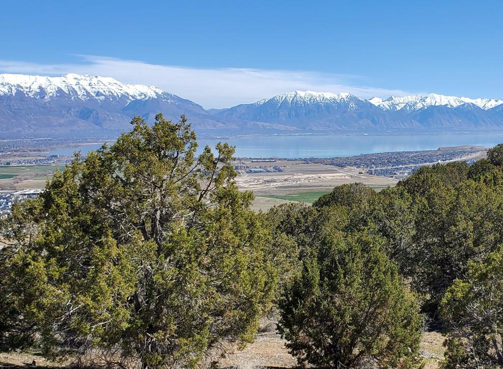
View west at the mouth of Provo Canyon from the Race Loop.
At mile 0.5 of the Aquila Trail, it will drop to the Race Loop. The quickest way down is to
your right. For a longer trip, consider forking left and doing the mile
of the
Race Loop
that you missed on the way up.
Bottom Line!
Rattlesnake is a key access trail to the
Timp
Foothills
. It's decent riding but
a tough climb, recommended for tough intermediates and above.
NOTE! This is an area maintained for the benefit of wildlife. Bicycling is ONLY allowed when
it does not impact animals. These trails are closed from December 1st
through April 15th for
the benefit of the winter deer herd.

Map of the trails in the Wildlife Management Area.
Getting there, Timpanogos Park: Exit I-15 on Orem's 800 North and drive straight towards the mountains.
Keep left to enter Provo Canyon. After 1 mile, you'll pass the entrance to
Canyon View Park on your left. About 100 yards later, there's a diversion
dam, then a bridge over the river to Timpanogos Park. (The parks are on
opposite sides of the Provo River.) Drive over the bridge and park in the
lot. Ride to the northwest corner of the parking area. Begin your ride by pedaling up the gravel
road. Keep straight at the road fork at mile 0.3 if you're heading
for the Bottom Access trail (recommended), or fork R uphill for the Ravine
or East Access trails. Ride through the race loop and take the Upper
Access trail to the BST to connect to uphill trails.
Orem Bench BST Trailhead: Exit I-15 on Orem's 800 North
and drive straight towards the mountains. At 800 East, turn left and drive north about 1
mile. Immediately past the fence at the uphill end of the cemetery, turn right (east) on Cascade Drive.
Drive 1/2 mile then fork uphill before you approach the water treatment plant.
Take two switchbacks up, passing the lower overflow parking, to the paved
parking area with the bathroom. Your trail is right across from where the
road entered the parking lot.
Bathroom: Orem BST TH, Dry Canyon TH, Canyon View
Park, Canyon Glen Park, Nunn's Park
Water: Canyon View Park, Canyon Glen Park, Nunn's Park
Camping: Nunn's Park
Dry Canyon Trailhead: Turn
east off State Street (Highway 89) at 200 South in Lindon, which also
happens to be 2000 North for Orem. Keep straight as you approach the
mountains. When the road begins to turn right (south), turn left onto Dry
Canyon Drive heading northeast. Now keep straight uphill until the road
turns into the trailhead. To reach the Shooter uphill route, go south on
the BST to the Orem trailhead.
Canyon Glen: Use this trailhead if you plan to ride
counter-clockwise or out-and-back. Note that if you ride this direction
there are some granny-gear climbs that are a bit loose. Exit I-15 on
Orem's 800 North and drive straight towards the mountains. Keep left to
enter Provo Canyon. About 3 miles later, you'll see the parking area for
Canyon Glen on your left. Go across the bridge to the Parkway. Turn right,
and find the GWT on your left about 200 feet later, forking uphill just
before the paved parkway curves around a rock outcrop.
Nunn's Park: This makes the ride about a mile longer, but at the
expense of a rather ugly short section of trail from Nunn's park up to the
aqueduct. Going up-canyon, turn right 4 miles up the canyon, then left
under 89. Go into Nunn's Park. On your bike, come back through the park
entrance, then turn left on a broken-up roadway just before the road goes
under 89. Turn left at the fence and follow the fence uphill. This section
is a hike-a-bike uphill. As the singletrack reaches the top, go left (west).
Zorro (1560 East Trailhead): Take 800 North in Orem
toward the mountains. Just as the road starts to descend into the canyon,
turn left on 1560 East. Go to the end of the pavement and park on the
right. The ugly jeep road switchbacks east of the trailhead take you
uphill -- 0.4 miles with 200 vertical -- to the Zorro singletrack. Zorro
will add another 300 vertical and 0.6 miles. (Don't fork onto the steeper
Bramber DH. You'll know it as you pass it.) When Zorro hits doubletrack,
head a bit further uphill to the Bench Road for uphill connections.
Canyon Mouth Provo River Parkway: There's a parking area on
Orem's 800 North Street just before you enter Provo canyon. It's just east
of the gas station. GPS N 40° 18.840' W 111° 39.472'. To get to
the parkway, go east over the river and through the fence. Go uphill to
the Canyon View Park, Canyon Glen, or Nunn's park for uphill singletrack
connections to the Bench Road.
Latest update August 2021.


 and the Bee L...")


 fork, facing southeast.")
 is a fun little trail, winding through grove...")


 Trail toward the Race Loop.")