Dominc Bria climbs through shoulder-high ferns among the aspens as he ascends the Ben Lomond Trail. Photo by Bruce, August 28, 2008.
Ben Lomond Trail
This is a six-mile climb (or descent) up the east side of Ben Lomond, rising 3000 feet. That's about a 10% average rate of climb, folks. Add the narrowness of the trail, some areas with loose rock, and a bit of brush overgrowth, and you've got a ride that's only for strong skilled bikers. It's a beautiful ride with great views. It can be done as an out-and-back, or as part of a shuttled ride or loop ride that includes the Northern Skyline trail. An alternative ride that reaches the top of Ben Lomond Peak (and connects to this trail) is Willard Peak .
As an out-and-back, it's 12.2 miles round trip. In 2008, protruding snowberry and currant bushes
slashed our legs until our shins were a mass of red sores. Check with
the local bike shop for
current trail-grooming conditions, but you might consider shin guards
if you value beautiful
legs. There are also a few spots of overgrown chokecherry where horses
have burst out the trail.
These areas are short, but until the trail sees some loving care, plan
to hike through these
spots.

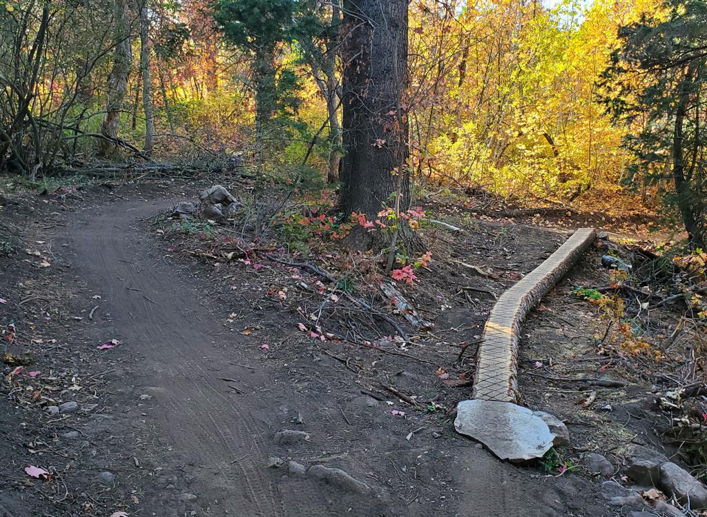
Dom climbs through the forest of maple and aspen early in the ride.

Two miles into the climb, Dom cranks away from a switchback overlooking the rock outcrop.
Climbing from the bottom, keep straight (right) at the first fork. The first two miles are
so-so riding, with a fairly stiff grade and frequent stretches of churned
loose rock courtesy
of horses.
In the second two miles, the bushes close in and begin to attack your shins. Watch for twigs in the derailleur and in your spokes. A few spots with shrubby small trees require you to dismount, put your head down, and push the bike through dense branches. These spots also tend to have trail-bursts as horses have flailed through.
In the second two miles, the bushes close in and begin to attack your shins. Watch for twigs in the derailleur and in your spokes. A few spots with shrubby small trees require you to dismount, put your head down, and push the bike through dense branches. These spots also tend to have trail-bursts as horses have flailed through.

The ugly middle section of the ride. Soft fluff with holes excavated by horse-hooves, overgrown elderberry and choke cherry. Fortunately, these spots are short.

Blackeyed Susans give way to snowberry sticking out into the trail. There's about 8-12 inches of space to ride here, and it's a bit scratchy!
As you reach the upper two miles, the trail opens up. This is very beautiful alpine scenery.
The climbing grade also lessens in the top two miles, so you can pedal
along in the thin air
and enjoy looking around.
About a mile from the top (mile 5.1), you'll reach the Cutler Spring trail. Turn left here. The Cutler Spring trail goes straight ahead, around the ravine to the opposite side, and it looks nice, but it turns ugly and it won't get you where you need to go. At the ridge top, you reach the Northern Skyline trail. Right will take you toward Inspiration Point or up the final switchbacks on the upper slope of Ben Lomond Peak. Left takes you down the Northern Skyline to the North Ogden Divide.
About a mile from the top (mile 5.1), you'll reach the Cutler Spring trail. Turn left here. The Cutler Spring trail goes straight ahead, around the ravine to the opposite side, and it looks nice, but it turns ugly and it won't get you where you need to go. At the ridge top, you reach the Northern Skyline trail. Right will take you toward Inspiration Point or up the final switchbacks on the upper slope of Ben Lomond Peak. Left takes you down the Northern Skyline to the North Ogden Divide.

The final two miles are the best, as the trail gets less steep and the scenery is awesome.

Dom arrives at top as the Ben Lomond trail joins the Northern Skyline.
Most riders doing a point-to-point or loop ride will climb the
Northern Skyline
and descend Ben Lomond. The Northern Skyline climb is a highway compared to Ben Lomond. From
the North Ogden Divide, it's 2500 vertical up the Northern Skyline, then
3000 feet descent
to North Fork Park, with a total distance of 12.6 miles.
For a loop ride, you'll have some climbing on the road in either direction. So pick your trailhead depending on whether you want the road-climb at the end, or at the start of your ride. And decide whether you want more of your climbing on the road, or less. And on whether you want the harder singletrack on the uphill or the downhill.
For a loop ride, you'll have some climbing on the road in either direction. So pick your trailhead depending on whether you want the road-climb at the end, or at the start of your ride. And decide whether you want more of your climbing on the road, or less. And on whether you want the harder singletrack on the uphill or the downhill.
The loop ride is 19.3 miles: 6.1 for Ben Lomond, 6.5 Northern Skyline, and 6.7 on the road.
Total vertical is 3500, with the low point on the paved road at 5200 feet
elevation. Clockwise,
there's 1000 feet of paved-road climbing, then 2500 up the Northern Skyline.
Counterclockwise,
you only suffer 500 feet of paved-road climbing, then 3000 on singletrack.
The descent on the
counterclockwise loop is blistering. I hit 24 mph on the singletrack and
49 mph on pavement
coming down from the North Ogden Divide.

View west up Ben Lomond from the intersection of the Northern Skyline and Ben Lomond trails.

Getting there, Ben Lomond trailhead:
Go up Ogden Canyon. (From the north on I-15, take the 12th South Ogden exit and head east on Highway 39. From the south, exit I-15 on US 89. Pass I-84 and climb up the hill, then turn right on Harrison Blvd. Continue on Harrison until you hit U-39 and turn R toward Ogden Canyon.) Turn left across the dam at Pineview Reservoir. At the stop sign in Eden, turn left. Turn left at the stop sign in Liberty. After about 1/4 mile, take the next right. Turn left toward North Fork Park just after you cross the river. Turn left again at the North Fork Park sign. Turn left toward the stables, then keep generally straight until you see parking and a metal horse corral on your right. Park just north of the horse corral, and you'll see the trailhead directly west.
Getting there, for loop starting at North Ogden Divide:
From the Ogden 12th Street exit, drive east (towards the mountains). At 400 East (Washington), turn left (north) and drive 5 miles. After the street narrows, veers slightly east, and enters a residential area, turn right (east) at 3100 North. Drive 4.1 miles to the parking area on your right, at the highest spot of the North Ogden Divide. The trail begins right across the road from the turn-in to the parking area. Alternate, via Ogden Valley: Drive straight into Ogden Canyon from the 12th Street exit. At Pineview Reservoir, turn left across the dam. At the stop sign in Eden (shopping center and gas station), turn left. Turn left again at the stop sign in Liberty, then go straight west until the road begins climbing up to the Divide.
Riding resources for this trail:
Single-page riding guide
GPS track files and route (right-click and "Save as..."):
GPX
High-res topo map (900 KB): View
Lodging, camping, shops: Links to Ogden area resources
Single-page riding guide
GPS track files and route (right-click and "Save as..."):
GPX
High-res topo map (900 KB): View
Lodging, camping, shops: Links to Ogden area resources