View east toward Park City about 3 miles into the ride. Photos and description A...
View east toward Park City about 3 miles into the ride. Photos and description August 30, 2011 by Bruce.
Armstrong Trail

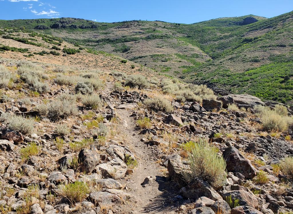
The Armstrong Trail shares a trailhead with Spiro , just north of Park City Mountain Resort (PCMR). This is an uphill-only trail. Commit to the full ride, or don't start uphill. The climbing is sustained but not steep -- most riders won't need the granny gear. It's pretty easy by Park City standards, suitable for strong advanced-beginners or conditioned intermediates.

The Armstrong Trail is 4 miles long, with 1300 vertical feet elevation change. Top altitude is 8150 feet at the Midmountain Trail just below Iron Mountain. Because Armstrong is one-way, you need to add some trails and some additional climbing to complete a ride. (Note: If you're doing a southbound ride past Spiro, be sure to have a GPS track or a current Park City trails map. The complex trail system can be confusing.)
Starting out from the trail fork with Spiro. Bushes and grass quickly give way t...
Starting out from the trail fork with Spiro. Bushes and grass quickly give way to oak, then maple.
Mining ruins along the trail as we begin the climb.
The Armstrong Trail has a gentler grade than Spiro. It also has more twists and turns, and is generally a more-interesting trail to ride. For riders intending to go northbound on Midmountain, it will cut a mile off the distance.
For southbound Midmountain riders, the climb via Armstrong adds three miles when compared to Spiro, and will add about 200 extra vertical.
The shortest ride using the Armstrong Trail is a loop that drops away on HAM to descend Spiro. This loop is 6 miles, with 1100 vertical feet of climbing. A larger loop climbs to the top of Armstrong, adds two miles of southbound Midmountain Trail, descends on the Spiro Trail. This is our featured ride.
Watch out for hikers and dogs. You'll see plenty of these on Armstrong and Spiro, even on weekdays.
Like Spiro, the trail quickly becomes shaded by deep conifer forest alternating ...
Like Spiro, the trail quickly becomes shaded by deep conifer forest alternating with aspen and maple.
Looking southwest at the ski lift as we cross Thaynes Canyon.
Armstrong to Spiro Loop (10 miles):
From the PCMR parking lot, this ride is exactly 10 miles long with just over 1600 total feet of climbing. Start at the parking lot on the north side of PCMR. Exit the north end of the parking lot, and angle across Silver King Drive northbound to continue north on Three Kings Drive. Take the next left and climb Crescent Drive. Just as the road veers left, turn right into a gravel road and spot the singletrack trail on your left.
Begin climbing on the combined Spiro/Armstrong trail. About 200 yards up the hill, the trail will split. Keep straight (right) for the Armstrong Trail. There will be NO trail forks now (at least, as of 2011) until you reach the Midmountain Trail.
Typical climbing turn as we switchback our way up the slopes of Iron Mountain.
The trail has short up-and-downs and twists, which helps it shed water. In its f...
The trail has short up-and-downs and twists, which helps it shed water. In its first year, the surface is already nicely packed and buff.
At mile 1.8, the trail will cross the meadow in the bottom of Thaynes Canyon, just downhill from the ski lift. It will now begin a series of switchback climbs as it ascends the mountain.
The corners are more "climbing turns" than switchbacks. It's pretty easy to power up and around. No tricky stuff. At mile 3.7, keep right as HAM forks left to descend to Spiro. (Bail on HAM if you need the shorter 6-mile ride.)
As you reach Midmountain at mile 4.5, fork left. (Right will take you up and over Iron Canyon Pass. It will be 7 miles from the fork before the next opportunity to descend.)
After two miles on Midmountain, keep left and downhill as Spiro forks away. There will be some intersecting trails as you descend. Just follow the signs. Stay left at the forks except for HAM, where you'll stay right. You'll arrive back at the Spiro/Armstrong fork at mile 9.4 and drop down to the pavement.
At the apex of a turn, we break out of the forest to see views of the Park City ...
At the apex of a turn, we break out of the forest to see views of the Park City Mountain Resort ski slopes to the south.
Higher up, as aspens temporarily replace the fir trees.
Option: Loop through Park City Mountain Resort (Johns), 15.7 miles (includes 2.6 mile road return), 1800 vertical  Armstrong-Johns-Gravedigger ride track

4.5   L on Midmountain
6.4   L, immediate R on Midmountain at Spiro Fork
9.3   Keep downhill (L), leave Midmountain
        Cross open area east to Johns at 9.5
        (Just to R of crest of ridge)
11.2 Keep R to Gravedigger
11.7 Cross Johns99, southbound on Gravedigger
12.2 Stay L downhill
13.1 L downhill on Daley Canyon Rd into town

Option: Loop through Park City Mountain Resort (Johns99)
13.2 miles (includes 1.4 mile road return), 1750 vertical
Armstrong-Johns99 track

4.5   L on Midmountain
6.4   L, immediate R on Midmountain at Spiro Fork
9.3   Keep downhill (L), leave Midmountain
        Cross open area then R on DT at 9.5
        Join Johns99 at 9.6
10.0 Stay L, veer to west then back northeast
10.8 Cross Gravedigger, head northeast
11.8 Hit pavement, turn L head north to parking

Weve reached the Midmountain Trail at 8150 feet. This is the view to the east.
We've reached the Midmountain Trail at 8150 feet. This is the view to the east.
Heading south and gently downhill on Midmountain. Well meet Spiro as the trail r...
Heading south and gently downhill on Midmountain. We'll meet Spiro as the trail reaches the valley.
Option:  Loop through Deer Valley Resort
19.2 miles (includes 2.0 mile road return), 2100 vertical
Armstrong to Deer Valley Track

4.5    L on Midmountain
6.4    L, immediate R on Midmountain at Spiro Fork
9.3    L downhill then R 150 degrees on Midmountain
10.2  Stay R uphill on MM
10.8  Straight on MM at Link
11.7  Stay on MM at TG, pass around lift
12.4  Straight (L) and downhill at Tour de Suds
12.8  Straight (L) and down at Team Big Bear
13.2  Stay R uphill
14.0  Lift area, keep L
17.2  Descend to DV road, north into city

Option: Loop to Tour de Suds, Deer Camp, Naildriver, and Deer Crest
23.7 miles (includes 2.6 mile road return), 3000 vertical
Track File for this ride

4.5    L on Midmountain
6.4    L, immediate R on Midmountain at Spiro Fork
9.3    L downhill then R 150 degrees on Midmountain
10.2  Stay R uphill on MM
10.8  Straight on MM at Link
11.7  Stay on MM at TG, pass around lift
12.4  R uphill onto Tour de Suds
13.2  L on gravel road
13.7  L again

Heading east from the Spiro-Midmountain junction.
On Midmountain heading toward Park City Mountain Resort, we pass a bench overloo...
On Midmountain heading toward Park City Mountain Resort, we pass a bench overlooking the city.
(continued...)
13.8  Find ST (Team Big Bear) L side of road, eastbound
14.1  R on Flagstaff
15.2  Keep toward Bald Mtn on Deer Camp
15.6  Stay R, aim for Bald Mtn
15.9  L on Nail Driver, descend
17.9  At lift, head to DT south (R) of buildings
18.1  Cross paved road, climb up to ST
         Follow Four Point NE to Deer Crest
19.9  Stay R uphill
20.1  L downhill
20.5  Straight and down
21.1  Descend to pavement, follow streets back
Option: Loop northbound through The Canyons Resort (Holly's)
19.1 miles (includes 4.3-mile pavement return), 2200 vertical
Armstrong-Holly's Track File

4.5    R (north) on Midmountain
6.8    L uphill on MM (2010 bypass)
7.7    L westbound on MM
11.5  R on DT, L on DT down, find ST on L
14.8  Into resort roads, head downhill
15.9  R, find Olympic paved trail for return

Further along the trail, we begin to see the slopes and buildings of Deer Valley...
Further along the trail, we begin to see the slopes and buildings of Deer Valley Resort to the south.
After climbing Tour de Suds on the BIG loop, were heading southeast on Deer Camp...
After climbing Tour de Suds on the BIG loop, we're heading southeast on Deer Camp at 9000 feet.
Option: Loop northbound to Robs Trail
22.2 miles (includes 5.2-mile pavement return), 2400 vertical
Armstrong-Rob's Track

4.5    R (north) on Midmountain
6.8    L uphill on MM (2010 bypass)
7.7    L westbound on MM
11.5  Cross DT to find MM ST
13.4  Keep R on MM at Crest connector
14.6  R downhill on Robs at Hunter
14.9  L on Robs at Ambush
16.2  L downhill
17.0  R on pavement, follow streets / Olympic paved trail

Small Loop down Spiro
10 miles with 1600 vertical
Track file, loop w Spiro

0.0   Leave parking to N, cross to Three Kings Dr
0.3   L uphill on Crescent
0.4   R to gravel area, L onto ST
0.5   R on Armstrong
4.5   L on Midmountain
6.4   L downhill, keep L onto Spiro
7.7   Keep R (L = HAM)
        Now keep L at Eagle and Silver Spur
9.4   Back at Armstrong fork, R
10.0 Parking

On the big loop, Ive descended Naildriver and rolled onto Deer Crest. Were looki...
On the big loop, I've descended Naildriver and rolled onto Deer Crest. We're looking north. We'll be descending toward the parking lot just above the ridge on the right.
Armstrong area map
Armstrong area map
Getting there:  In Park City, follow the signs to Park City Mountain Resort. As you see the first parking area, turn in and park there. Now ride your bike back out onto Silver King Drive, heading west (uphill, toward the mountain, and the way you were heading when you first saw the parking lot). Turn right onto Three Kings. The next left will be Crescent Drive. The trail is the singletrack next to the gravel road where Crescent Drive turns left. N 40° 39.390' W 111° 30.895'

Parking:  Not at trailhead! Use north Park City Resort lot.
Water:  None at trailhead.
Bathrooms: None.
Bike services: Multiple in Park City, includes rentals
Camping: Hailstone on US 40

Riding resources:
One-page trail guide to Armstrong-Spiro Loop
GPX Track Files  (Right-click and "Save as...")
      Armstrong only
      Loop w Spiro
      Armstrong-Holly's
      Armstrong-Rob's
      Armstrong-Johns-Gravedigger
      Armstrong-Johns99
      Armstrong to Deer Valley
      Armstrong to Tour-de-Suds / Deer Camp / Naildriver / Deer Crest
      GPX grab bag including intersecting area rides (36 tracks!)
Topo map of Spiro Loop for printing:   View
Lodging, camping, shops:     Links to Park City area resources