

North of the Santa Clara River, separated from the popular southern trails of the Santa Clara River Preserve , are some lesser-known trails. The highlight is a trail that runs the length of the preserve from east to west, called Tempi'po'op, Piute for "Rock Writing". This central trail connects to other trail options. So your ride can be a quick hit-the-highlights (from one end to the other and back is 8 miles), or you can easily run up 12 to 18 miles exploring the side trails. I'll break this trail description into two parts, because the western side of the Preserve has a very different character than the eastern.
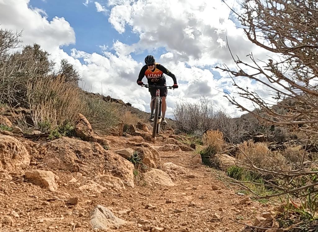
The eastern side of Tempi'po'op is more hard-core. The less-known Tukupetsi trailhead on the east side of the Preserve takes you directly to the fun stuff. There's a mile of very fun semi-technical riding. The pitch is more steep, and there's a bit of "bumpiness" as the trail follows the break of the cliffs above the Santa Clara River gorge.


To the north are red cliffs and eroded skirted mesas, with the Pine Valley Mountains visible as we ride higher. Views to the south include colorful eroded badlands, mesas, and the Santa Clara River gorge. This ride is big on visuals.
From the farmstead, continue up the trail. At the top of the improved trail (at least, as of 4/09), walk south from the end of the trail and find the rough hiking trail that descends slightly below the cliff edge.


Most riders will now head back downhill, making the ride a 2.6-mile out-and-back. Adventuresome bikers can continue eastbound (and a bit uphill) to reach the technical rock of the eastern Tempo'po'op trail.

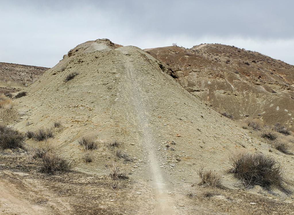
The Tukupetsi Trailhead (sometimes incorrectly called the Graveyard Wash trailhead) is at 2800 feet elevation, just on the outskirts of Santa Clara. There's a complex of easy trails here (once you make the short climb onto the mesa) for beginning riders. For the hardcore, the Tempi'po'op trail climbs to 3350 elevation along the Santa Clara River gorge.
As you recall, Tempi'po'op (Rock Writing) is the east-to-west route from the Tukupetsi to the Anasazi trailheads. It's an over-the-hump and back-down ride each direction. If I were guiding another rider on this trail I'd start at the Tukupetsi (eastern) trailhead, because that puts the techy climbing early in the ride. Climb up and over to the petroglyphs, hit the easy eastern trail (and maybe visit the bathroom) then turn around and do the up-and-over back to the eastern trailhead.


A more interesting ride is to turn 90 degrees left, southbound, on Een'oog (Old Ones). This singletrack turns parallel to Rock Writing, but right along the cliff. It will rejoin Rock Writing in 0.3 miles. (At mile 0.1 of Een'oog, note the trail coming in from the left. The U'waiv trail comes up from the Enepitsi trail along the river. On the way back, you'll keep left and uphill to avoid descending to the river.)


At mile 2.4, keep straight as the Tava'atsi forks to the right downhill. Now keep northwest to reach the petroglyph area 0.1 miles later. The glyphs are found along the rim, and on boulders below the rim, for the next 1/10th mile.


At mile 4.0 from the eastern trailhead, you'll reach the Anasazi Valley trailhead. There's a toilet here.
Fishhook Trail
Fishhook is a short smooth singletrack that branches off the middle of Upper Graveyard and meanders downhill to a step-over just across the road from a parking corral.


Upper Graveyard is a short bit of singletrack. It has its own primitive trailhead on the south wide of Graveyard Wash. Lower Graveyard is old jeep road. After a mile, it ends by joining the middle of the DT (jeep road) Cholla Trail. Cholla branches off the main DT and heads northwest to end at the border of the Preserve. There's a step-over gate and a continuing dirt road, but also a "private property no trespassing" sign facing you. So I'm not sure if this will become a real trailhead in the future.
Singletrack connecting Rock Writing to Lower Graveyard.
Tava'atsi doubletrack
The Tava'atsi doubletrack descends north from the petroglyph area (away from the cliffs). It has some slickrock but not much scenery. It meanders down to a fence at the Preserve border. There's a step-over gate there, but (Jan 2008) no vehicle access, as a subdivision is being bulldozed into existence. Not a high-voltage option; more of a future access point.


The trail briefly touches some private property, and may or may not be fenced off at around mile 2. You be able to pedal all the way around to the Anasazi trailhead. If you need more exploring, there's a fork around mile 1.5 that crosses to the south side of the river to additional doubletrack.
0.0 Trail starts at break in fence by RV parking
N37 09.749 W113 42.364
0.8 Anasazi farmstead
N37 09.434 W113 42.333
Continue up improved trail
1.3 Arrive at rock art area
N37 09.255 W113 42.258
Explore on foot
L uphill when finished
1.35 R on ST along cliff edge
1.5 Rejoins DT
N37 09.119 W113 42.148
1.6 Keep straight
N37 09.062 W113 42.105
2.1 Highest point of ride
2.3 ST starts on R along cliffs
N37 08.558 W113 41.725
N37 08.228 W113 41.159
3.4 Fork L = main DT
N37 08.278 W113 40.896
(R=DT that joins ST along cliff)
3.5 Fork straight = main DT
N37 08.286 W113 40.791
(Cholla forks L)
3.7 Fork straight = main DT
N37 08.249 W113 40.631
(Hard L = Lower Graveyard DT)
(L = Upper Graveyard ST)
(R = new ST)
3.9 End of Preserve
N37 08.122 W113 40.512
( R next to gate for River DT)
Go play on other trails!

Tukupetsi Trailhead: In St. George, head north on Bluff Street and turn left on Sunset Blvd. Drive 3 miles west on Sunset through Santa Clara. As you leave Santa Clara and begin climbing the hill, look for a road on the left. It will turn to gravel. Pass the first step-over trail access on your right (just after dipping through Graveyard Wash) and drive a little further. Parking is contained inside a wooden rail fence on your left (N37 08.125 W113 40.317). Directly across the road is a step-over to the Fishhook Trail and Tempi'po'op.
Anasazi Valley Trailhead: Drive all the way through Santa Clara and continue on 191 past Ivins. Just after a gentle descent, watch for the Anasazi Valley Trailhead sign. Turn left into the dirt road where the stone thingy is holding an iron gate. Drive 0.4 miles and turn into the parking area surrounded by a wooden fence (N37 09.748 W113 42.379). There's a bathroom at this trailhead. The trail starts at the break in the fence at the northeast corner.
Riding resources for this trail:
Single-page riding guide
GPS track files (right-click and "Save as..."):
GPX area multi-trail file
High-res topo for printing (500 KB):
View
Lodging, camping, shops:
Links to St.
George area resources